Die Kalte Buche
Oberhalb von Weißbach befindet sich gleich in der Nähe der so genannten Jungviehweide ein wenig beachtetes geologisches Relikt aus der Entstehungsgeschichte der Rhön; Die Kalte Buche.
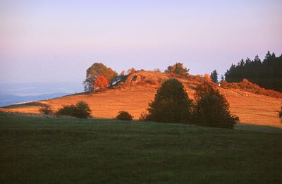
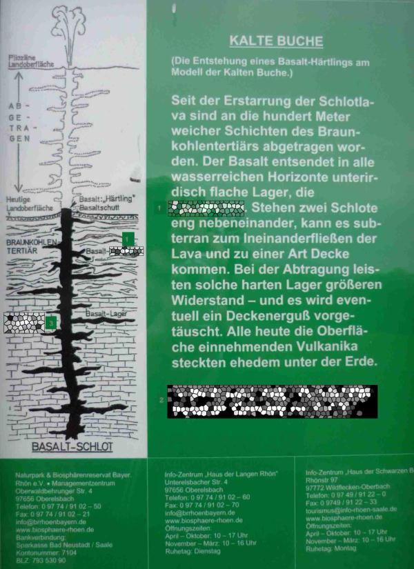
Bei der Kalten Buche handelt es sich nicht um einen abgestorbenen Baum sondern um einen Basalthärtling und damit um den erstarrten Schlot eines Vulkanes. Seit der Erstarrung der Schlotlava vor ca. 40 Mio. Jahren wurden durch Erosion an die 100 m der den Schlot umgebenden und bedeckenden weicheren Schichten des Braukohltertiärs abgetragen. Aufgrund seiner größeren Härte, verwittert der Basalt deutlich langsamer als das ihn umgebende Gestein, wodurch er über sein Umfeld hinausragt.
Wie groß die vulkanische Aktivität in der Rhön im mittleren Tertiär war lässt sich auch daran erkennen, dass inzwischen an die 500 der für die Rhön typischen vertikalen Magmadurchbrüche gezählt wurden.
Von der 723 m hohen Kuppe aus bietet sich ein reizvoller Ausblick über die Höhen der süd-östlichen Vorrhön bis nach Thüringen hinein 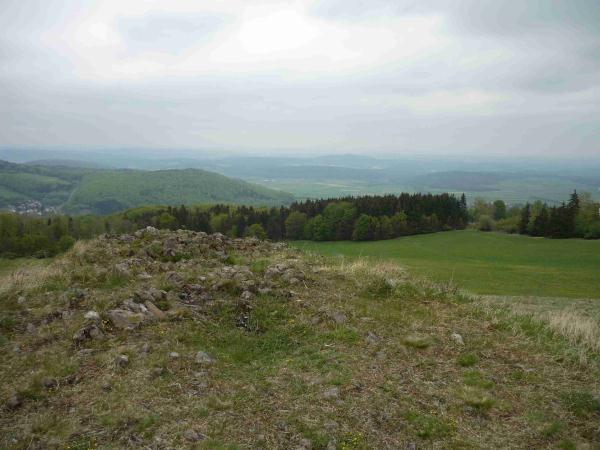
Anfahrt:
Von der Verbindungsstraße zwischen Weißbach und Ginolfs, kurz nach der Weißbacher Grundschule, führt ein Flurweg links den Berg hinauf. Diesem Weg ca. 2 km folgen. Rechterhand liegt schließlich die Jungviehweide mit dem dazugehörigen Gebäude und Grillplatz. Hinter dem Hofgebäude ist eine Parkmöglichkeit vorhanden. Von dort aus ist die ca. 300m entfernte Basaltkuppe schon gut zu erkennen. Ein Wiesenweg führt direkt bis zur kalten Buche.
Die Infotafel welche bis vor kurzem am Fuße des Basaltkegels stand ist inzwischen leider verschwunden aber eine Bank läd auch weiterhin zum Verweilen ein.
Und hier die Frage, welche für das Loggen des Earth Caches zu beantworten ist:
Wie hoch (geschätzt oder mit dem GPS ermittelt) erhebt sich die Basaltkuppe über ihre direkte Umgebung? (Angabe in Metern)
Mache ein Bild der Kalten Buche mit dir oder deinem GPS darauf (optional).
Sende die Antwort als GC- Nachricht (Mail) an den Cache- Owner (DieHyperspeedhasen). Das optionale Bild bitte beim Loggen mit einstellen.
Bei diesem Cache unbedingt beachten, dass er sich in einem Naturschutzgebiet befindet. Deshalb bitte die offiziellen Wege nicht verlassen.
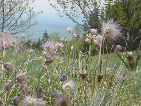
Impressionen der Frühlingsflora auf der Kalten Buche
Basaltformationen auf der Kalten Buche 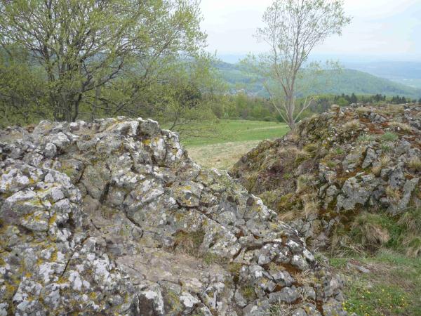
Die Kalte Buche
(The Cold Beech Tree)
Above Weißbach, (Bavarian Rhoen) near the so called Jungviehweide (young cattle meadow) you can find a not so well known geological relict of the volcanic history of the Rhoen: “Die Kalte Buche”.
The German name “Die Kalte Buche” leads to the assumption that a big dead tree can be found there. But this misleads. It is a basalt monadnock; a vent of an extinct volcano.
Since the volcano rose up, about 40 Million years ago, nearly 100 m of the earth layers vanished from the hill top by erosion. Caused by the hardness of the basalt and its higher resistance against erosion, a part of the former volcanic vent remains and towers over its surrounding now.
The extent of the volcanic activity in the middle tertiary can be read out of nearly 500 vents that where counted in the Rhoen.
From the 723m high (above zero level) top you have an interesting view over the south east of the Vorrhoen and parts of Thuringia (Thueringen)
Driving directions:
Driving from Weißbach to Ginolfs, 100 m from Weißbach, on the left, a small road leads up to the Hill. Following this road for nearly 2 km (1.4 miles) you will reach the Jungviehweide. The building and BBQ area are on the right side of the road. There is a parking area right behind the Building. From this point you can see the basalt top amid the meadows in south east direction. A footpath leads to the top. (Distance nearly 300m) A bench is placed at the foot of the basalt formation.
Questions: (The answer is necessary for logging the cache.)
-
The height of the basalt top compared to its surrounding (estimated or measured with the GPS device, in meters)
-
In addition: Make a photo of you, or your GPS device, in front of the basalt top or the information board. (optional, but nice) ;-)
Transmit the answer by a Geocache message to the cache owner (DieHyperspeedhasen). Add the photo when you log the cache. (Optional)
Please notice, that the cache is placed in a nature reserve. So please don´t leave the official tracks.
Spring impressions from the Kalten Buche