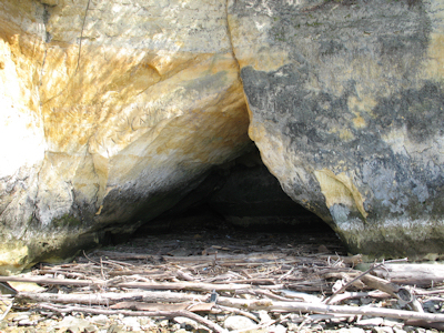
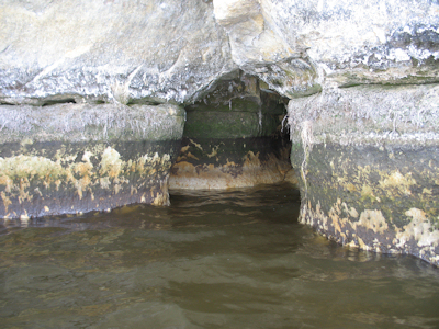
Most people from this area don't realize that there are sea caves within the Cannon River watershed. A sea cave is also known as a littoral cave. Littoral caves are formed primarily by wave or flow action along a body of water and take place within the littoral zone. A littoral zone is defined as the space between the highest water mark to just below the waterline along the shoreline. While this is just a definition, the littoral zone can often vary depending on the body of water in question. The formation of caves created by the flow of water within this zone is often referred to as littoral erosion.
When thinking of erosion along a river bank, one would generally imagine smooth layers of rock eroding away creating cliffs and slopes. While this is correct in thinking, the erosion process can be expedited when there are fissures (or fractures) along the littoral zone. These fissures can be both vertical and horizontal in nature. It is also thought that in our climate, the continuous contraction and expansion during seasonal changes may also accelerate the littoral erosion through heaving and ice movement.
If you observe the sea caves along Byllesby Lake, you will notice that in most every case above or around the cave opening there exists fracture. Once a water current hits this fracture, littoral erosion accelerates and over the course of time, the fracture evolves into what becomes a sea cave.
Samples of littoral erosion..
Sources:
http://en.wikipedia.org/wiki/Sea_cave
http://en.wikipedia.org/wiki/Littoral_zone
http://www.showcaves.com/english/explain/Speleology
In order to log this Earthcache as a Found It, you must complete the following tasks and email the answers to me:
1. Estimate the height of the littoral zone near GZ?
2. Choose one littoral cave near GZ and describe what you see.
3. For the littoral cave that you've chosen, estimate it's height, width and lateral depth to rear of cave.
4. REQUIRED to log your find, and a bonus to me, post a picture of yourself at the opening of the littoral cave that you've chosen.
5. CARVING YOUR NAME INTO THE SANDSTONE IS A MISDEMEANOR. If you're dumb enough to do it, please don't brag about it in your log. If you do your log will be deleted instantly.