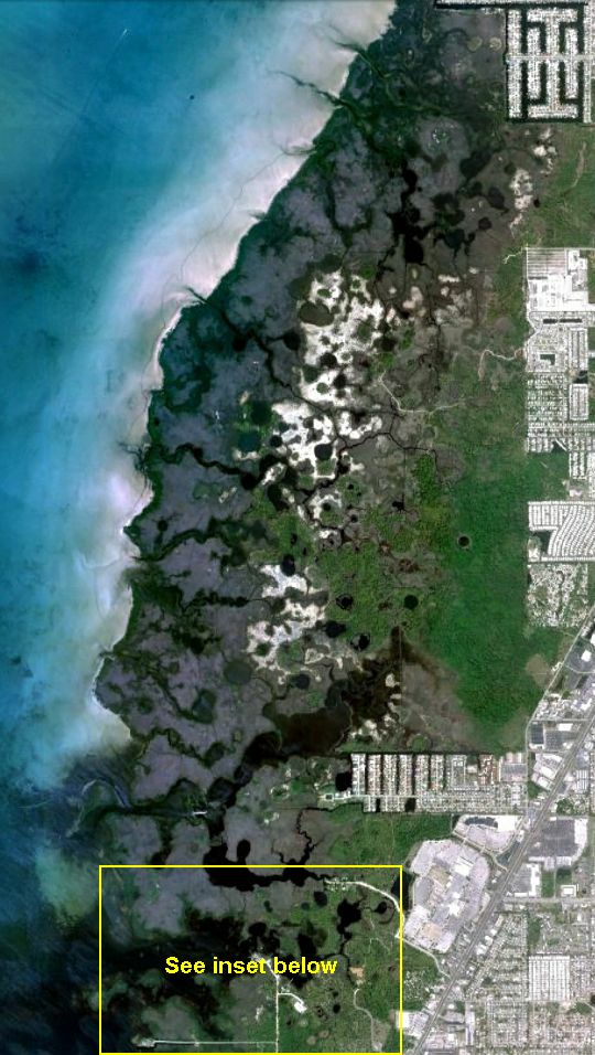
Welcome to Werner-Boyce Salt Springs State Park - Florida's
newest state park - located along the west coast of Pasco County.
Only a small section of the park is open for landside access, with
an entrance off Scenic Drive. However, the park is open for
exploration by kayak or canoe. With over four miles of frontage on
the Gulf of Mexico, natural springs, and twelve navigable streams
to explore, it is truly a kayaker's dream come true. For more
information about the park, visit the official park service webpage
at http://www.floridastateparks.org/wernerboyce/default.cfm.
For a detailed history of the Salt Springs going back before the
Civil War, see http://pascocemeteries.org/salt_springs.html.
And for information about how you can volunteer to help in the
development of Werner-Boyce Salt Springs State Park, see http://www.saltspringsalliance.com.
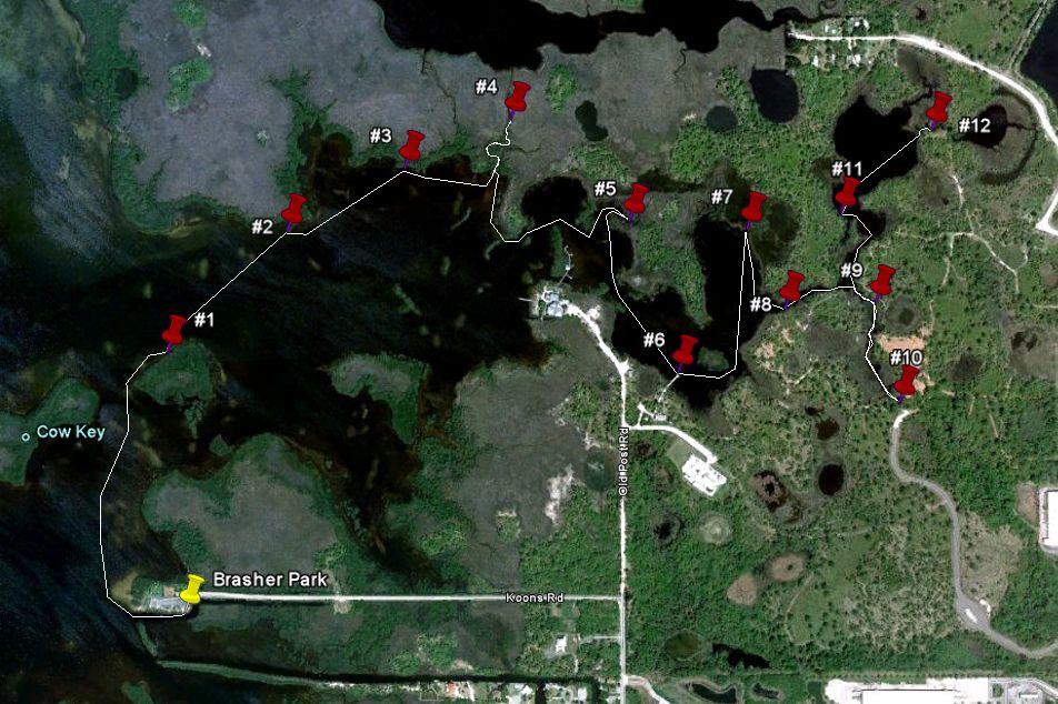
Currently, there are no kayak launch points within the park.
Once the main entrance to the park (on the west side of U.S. 19
just north of Ridge Road) is opened, a kayak launch facility is
planned. But for now, the nearest launch point for access to the
southern part of the Park is at Brasher Park at the end of Koons
Road in Port Richey - illustrated by a yellow pushpin in the map
below.
Note: the north extension of Old Post Road leads to the Pasco
County Energy Marine Center (owned by Pasco County Schools) and the
State Park headquarters, and is not a public road. There are no
publicly accessible kayak/canoe launch sites in this area.
This Salt Springs Run kayak series takes you on a two and a half
mile tour of the southernmost creek in the park with its source at
Salt Spring and its mouth at the Gulf just north of Brasher Park at
Cow Key. The round trip will be just over five miles. There are
twelve caches in the series - illustrated by red pushpins in the
map below. All are match holders that should be accessible any time
except low tide. If you want to find all twelve caches in one trip,
you should plan to make a day of it. Bring enough water, snacks and
sunscreen to last for 4 to 5 hours. I have not personally found
insect repellent necessary, but it always pays to be prepared.
There are some areas along the route that have strong tidal
currents, so you may want to plan your trip so that you leave the
Brasher Park launch point about 2 to 3 hours before a high tide so
that you can paddle up stream with an incoming tide, and return
with an outgoing tide.
Note: All of the geocaches in this series may be accessed
without leaving your boat. In fact, there are very few places in
the wetlands area where land access is convenient. While kayak and
canoe access to the park is welcomed, please respect the natural
habitats and nesting areas by refraining from hiking and exploring
on foot in the wetlands area.
For information about the suggested kayak launch point and
parking, see the waypoint listing for Salt Springs Run kayak
series #1 (GC2K487).
Cache #2 in the series is tethered to a dead mangrove.
You'll find most of the caches in this series to be along the north
side of Salt Springs Run since the property along the south bank
from the mouth up to the Energy Marine Center is privately
owned.
Geocaches were placed with permission of Larry Steed, park
manager.
Congratulations to swampmuck for the
FTF!