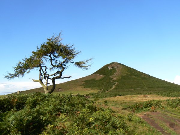
This distinctive shaped hill has a long history of providing
inspiration to those who visit it. When the Vikings invaded and
came to the area they believed that the hill was sacred and
dedicated it to their god Odin. The modern name of Roseberry is in
fact a corruption of the Norse name Odin’s Berg.
As a boy, the famous explorer Captain James Cook lived with his
family at Airey Holme Farm, which can be seen to the south of the
summit. When he had time off from working as a farm hand, the young
James is said to have got his first taste of exploration and
adventure by climbing to the top of Roseberry.
There are many other fascinating facts and stories associated
with Roseberry Topping many of which you’ll discover in
completing this multicache. The final cache contains ‘The
Terrible Tale of Prince Oswy’ – the hill’s most
horrifying legend. Be sure to read it before you sign the log.
This cache along with
National Trust Trail – Newton Wood and
National Trust Trail – Cliff Ridge Wood & Quarry
contain the coordinates for the bonus cache
National Trust Trail – Newton Moor. The numbers are
marked on both the box and the front of the log book.
The National Trust is a charity that protects special places in
England, Wales and Northern Ireland, for ever, for everyone
Car parking is available in Newton Under Roseberry at N
54°30.450' W 001°07.250'
Question One: N 54°30.174' W 001°06.601'
Despite what is says on the plate there is considerable
disagreement about when and by whom this folly was built.
It’s also more likely that it was intended to be a summer
house where Victorian visitors could rest before continuing the
climb to the summit, than a shooting box. At least we can be
certain of the year in which it was restored. When was this?
Answer = 19AB
Question Two: N 54°30.325' W 001°06.438'
Triangulations pillars were erected by the Ordnance Survey from
1935 on prominent hills across Great Britain. On a clear day it was
possible to see at least two other triangulation pillars at every
point. By carefully measuring the angles between each pillar the
Ordnance Survey were able to accurately map the whole of the
country. Every triangulation pillar has a unique reference number.
What is the number of this pillar?
Answer = S4CDE
Question Three: N 54°30.349' W 001°06.281'
The Cleveland Way is a long distance footpath that runs from
Helmsley to Filey and visits Roseberry Topping. How far would you
have to walk from here to reach Filey?
Answer = FG
Goal: N 54 30.(B)(E)(F-G) W 001 06.(B)(A+D)(C-G)
The area is extremely popular with visitors so stealth will be
required at all times.