You can get credit for this cache from all over, but this is the closest and best place to see the cliffs. This cache will take about an hour of walking to get all the needed information, but really if you drive to these places you can do it in ten minutes. If you are going to try this be sure to give yourself plenty of time to complete this cache.
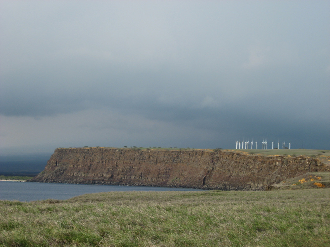
Here is a snapshot of what you will see when you arrive!
Also please read these rules for the open space park and respect them so that others that come in the future may enjoy the South Point Complex as much as you did. 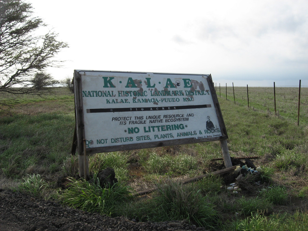
Just take the main road down from Route 11 and follow all the signs to South Point Complex. 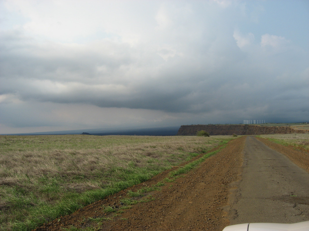
Aloha and welcome to the Big Island of Hawaii and the southern-most geocache in the United States! I've been to the Big Island two times and this is my first time to the South Point Complex and thought it would be a great place for an earthcache.
"The name for the southern tip of the island of Hawaii comes from Ka Lae in the Hawaiian language which means 'the point'. It is often spelled as one word, Kalae, or called South Point or South Cape. A confluence of ocean currents just offshore makes this spot one of Hawaii's most popular fishing spots." The cliffs were helpful for to the United States its wide range of lookouts over the Pacific ocean.
Millions of years ago these cliffs were not here. In fact they used to run into the ocean but a much more south. The reason for this is called erosion. Erosion is the process by which the surface of the earth is worn away by the action of water, glaciers, winds, etc. In this case it is caused by the oceanic water (Halaea Current) and wind. The listed coordinates used to be much farther inland. The cliffs have a drop off zone of about 50 feet. If you walk over to the nearby South Point Cache you will see how the cliffs get smaller. One of the questions will have to do with the creation of the cliffs.
Wind Erosion: Wind erosion is caused when wind is blowing in a specific area and a specific speed until it is blocked by something like rocks and over millions of years that rock is broken into smaller rocks like sand and carried away by gravity. The sand will eventually turn into sediment. There are many windmills about three miles north of here on the cliffs. The many windmills serve as a major power house for much of the island. As you walk around the South Point Complex, be sure to look at the plants. They are bent in the direction of the wind. A good example of this is at the Anza Borrego State Park in Southern California. Picture can be seen below.
Wind Erosion Diagram 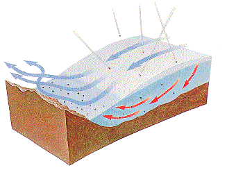
This picture shows the Anza Borrego Wind Caves in Southern California. This is what happens when wind is the main cause for erosion. 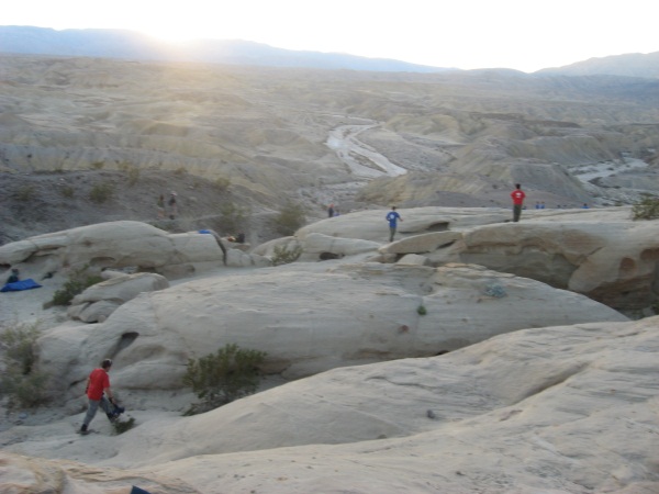
Water Erosion: Water Erosion is caused when water is costanly washing against something like rocks and carries the washed away sediment down stream or into the ocean. The sediment that you can see on the cliffs have different layers of rocks. Look at the cave for questions 2-4, you can see water inside of it. Every few seconds, you can see the waves crassing on the walls of the cave. This is water erosion happing right before your eyes! Fast forward 100 milion years and this place would be underwater and the most southern place in the United States will be to the east becuse of the volcanic ativity on the eastern side of the island I don't recommend swimming without a lifejacket due to the current "Halaea Current" named after a chief who was carried off to his death. If you walk along the cliffs at a very safe distance, the coast line here is very hard to get to without a built in ladder. The best example of this is probably the Grand Canyon in Northen Arizona. Picture can be seen below.
Water Erosion Diagram 
This picture shows the Grand Canyon in Northern Arizona. This is what happens when water is the main cause for erosion. 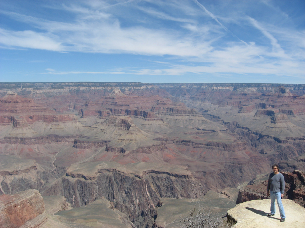
As you can see, there is a distinct difference from both the water erosion of the Anza Borrego Wind Caves and the water erosion Grand Canyon. The Anza Borrego Wind Caves are more scatters and rugged terrain with ups and downs all over as the wind hits it from all different angles depending on the weather conditions. The Grand Canyon is also rugged, but with mostly down patterns due to the Colorado River. Here at the South Point Complex cliffs both amazing forces of erosion are the cause of these cliffs.
There is a lot of trash here left mainly by the fisherman and it is hurting the wildlife so if you see trash please pick it up and throw it away. The Hawaiian beaches are used by the native Hawaiian Monk Seals and hatchling Hawksbill turtles, both endangered species. Organizations are in the process of the clean up and are funded by the Hawaiian Wildlife Fund and NOAA. The location of the South Point Complex is in a public area and is open 24/7, but I recommend you come during the daytime so you can see the cliffs.
TO LOG A FIND ON THIS CACHE YOU MUST GIVE ME THE CORECT ANSWERS BEFORE YOU LOG A FIND. YOU CAN CONTACT ME THROUGH MY EMAIL OR THE GEOCACHING MESSAGE CENTER. ANY INCORRECT ANSWERS WILL RESULT IN A DELETED LOG
1. Go to the tower at the above coordinates. Look north at the cliffs. (Opposite of where the target looks at) With all of the evidence around you, what factor do you think had more of an effect on the creation of the south point cliffs. Support your answer with examples from your observations, online sources, books, articles, or simply this cache page and the surrounding area of the coordinates.
FOR 2-4 USE THESE COORDINATES: N 18° 54.878 W 155° 40.951
2. About how deep is the cave to the top all the way to the bottom in feet?
3. From your own observations, how do you think the cave was formed (Water, Wind, Earthquakes, Volcanic Activity, ect.) and explain your answer while using examples from your observations, online sources, books, articles, or simply this cache page.
4. Look inside the cave. What visible differences can you spot from the top layer to the bottom layer of soil? Describe the texture of the cave walls and your explanation as to how this came to be.
FOR 5-6 USE THESE COORDINATES: N 18° 55.370 W 155° 40.881
5. When was the South Point Complex registered as a historic landmark? (Month, Day, Year)
6. Why was the South Point Complex registered as a National Historic Landmark?
* NOTE - You will likely not receive an email back from me, unless I need clarification on your answers. Please, don't wait for me to tell you you have it correct or not. I do review you emails within 12 hours of getting them in my inbox and with other of my earthcaches, it has become too hard to do. As soon as you send the email, you can log this earthcache.
All photos (except for the diagrams) are photos I have personally taken while here or at the example sites. Souses are cited here and the info can be found at any of these websites. http://en.wikipedia.org/wiki/Ka_Lae
http://geobytesgcse.blogspot.com/2007/08/coastal-erosion-landforms-features-and.html
See where others around the world have visited this cache webpage!