So if you stood at this point and had amazing
vision, World Heritage Site Gough Island is some 2 700 km away - due West.
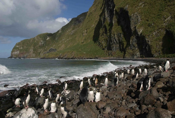
Gough Island is the least-disturbed major cool temperate island
ecosystem in the South Atlantic, and one of the most important seabird colonies in the
world. The island is scenically beautiful with spectacular sea
cliffs round much of the coastline. Two endemic landbirds are
found: the Gough moorhen and the Gough finch. Gough is in
the Tristan da Cunha Priority One Endemic Bird Area, as defined by BirdLife
International. Its undisturbed nature makes it particularly
valuable for biological research, which, with weather monitoring,
is the only other activity permitted on the
island.
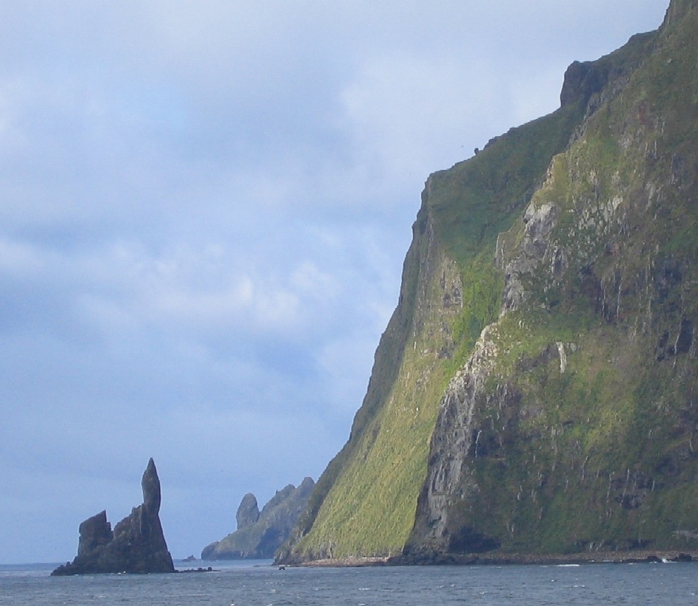
Gough Island rises to heights of over 900 m or above sea level. Its area
is 91 km2 according to the South African Antarctic
Programme.
The Topographic features include the
highest Peak, Edinburgh Peak, Hags Tooth, Mount Rowett, Sea Elephant Bay, Quest Bay, and Hawkins Bay.
It includes small satellite islands and rocks such
as Southwest Island, Saddle Island on South, Tristiana Rock, Isolda Rock West,
Round Island, Cone Island, Lot's Wife, Church Rock or
North, Penguin Island on Northeast, and The Admirals on East. It is a remote and
lonely place, about 400 kilometres southeast of the other islands
in the Tristan da Cunha group, 2,700 kilometres from Cape Town, and over 3,200 kilometres from the nearest point of South
America.
Wikipedia gives much information on the Island and its wildlife.
http://en.wikipedia.org/wiki/Gough_Island
Since I cannot have the pleasure of placing a cache
on Gough Island I decided to place one at the nearest applicable point
which is here.
Looking at the steepness of the mountains rising from the
sea which forms Gough Island, I am not sure that our terrain rating possibility of 5
stars is sufficient!
FTF congratulations go to
adilawson