Chilliwack: the "Heart of the Valley" is made up of 14 Villages - In this series of 14 caches we will introduce you to each of those Villages. When you have solved the puzzle for all 14 of the caches your smiley faces will produce the shape of a heart in the Eastern portion of Chilliwack. In each of the 14 caches you will find information which you must record in order to find the Final cache in this series, the "Heart of Hearts" cache.
We hope you enjoy your trip around the area and the cache locations we have selected for this series. Have fun and if possible involve the whole family in solving the puzzles and finding the caches, they are meant to be "family friendly".
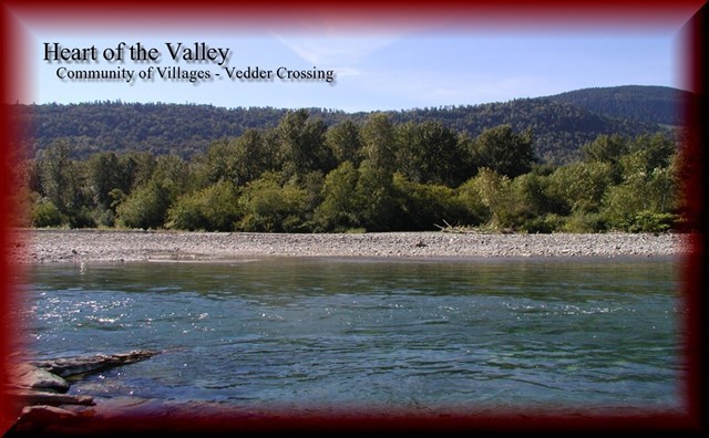
The community of Vedder Crossing straddles Vedder Road between Promontory Road and the south side of the Vedder Crossing Bridge.
Before 1941, the main centre of activity for the community was at the Vedder Crossing bridge. At various times, a hotel, general store, dance hall and store were located adjacent to the bridge. The success of these businesses was probably connected to their strategic location on Vedder Road. Before 1926, Vedder Road served as the main route to Vancouver. All highway traffic passed by Vedder Crossing.
This route to the coast was first used beginning about 1891 when a bridge was built across the river. The route to Vancouver changed again when Sumas Lake was drained in 1924 and a bridge across the Vedder Canal was built in the late 1920s. Vedder Road through Vedder Crossing ceased to be the main highway link to Vancouver.
Vedder Crossing remained largely rural until the 1940s. Gordon Watson remembers, “I remember the day when there were only two houses from the Promontory Road to the Vedder Bridge on the east side of the road.” (Denman, Ron, 50 Years of Military Presence in the Fraser Valley, Chilliwack Museum and Historical Society, 1992. P.17).
All of that changed when the federal government established a military training base at the corner of Keith Wilson and Vedder Road in 1941. Camp Chilliwack became a major Canadian training facility. Renamed Canadian Forces Base Chilliwack it was closed in the 1990s as part of military restructuring. The Canada Lands Company assumed the role of redeveloping the base lands shortly after. A new residential neighbourhood and an education park are now situated on the base lands.
Information was obtained from the Chilliwack Museum and Archives Website- Visit them ""Here"
In order to find this cache you are going to have to solve this easy puzzle:
FQABPRFARGGBQEHBSLGSVSGFRJRABLGARJGQRE
QAHURABRREUGLGUTVRYVAGBQARIRFBERMRAVA
EHBSUGEBAGNQAHBSROANPRTNYYVIFVUG
Because this cache continues to go missing please use (BLUE 41) to find the location of the FINAL.
