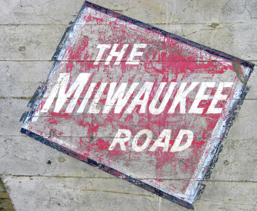
The Milwaukee Road, officially the Chicago, Milwaukee, St. Paul and Pacific Railroad (CMStP&P RR) (reporting mark MILW), was a Class I railroad that operated in the Midwest and Northwest of the United States from 1847 until its merger into the Soo Line Railroad on January 1, 1986. The company went through several official names and faced bankruptcy several times in that period. While the railroad does not exist as a separate entity anymore, it is still commemorated in buildings like the historic Milwaukee Road Depot in Minneapolis, Minnesota and in railroad hardware still maintained by railfans, such as the Milwaukee Road 261 steam locomotive.
The Milwaukee Road appeared as the Milwaukee and Waukesha Railroad when incorporated in 1847, but soon changed its name to Milwaukee and Mississippi. After three years, the first train ran from Milwaukee to Wauwatosa, Wisconsin, and the first passenger train ran on February 25, 1851. As a result of the financial panic of 1857, the M&M went into receivership in 1859, and was purchased by the Milwaukee and Prairie du Chien in 1861. In 1867, Alexander Mitchell combined the M&PdC with the Milwaukee and St. Paul (formerly the LaCrosse and Milwaukee) under the name Milwaukee and St. Paul. Critical to the development and financing of the railroad was the acquisition of significant land grants. Prominent individual investors in the line included Alexander Mitchell, Russell Sage, Jeremiah Milbank and William Rockefeller. In 1874, the name was changed to Chicago, Milwaukee, and St. Paul.
While the first railroad to reach La Crosse arrived in 1858, it wasn’t until 1876 when Congress approved the first railroad bridge to cross the Mississippi River at La Crosse for the Milwaukee & St. Paul Railroad (later called the Milwaukee Road).
Ten years after the railroad bridge was constructed across the Mississippi River, a railroad boom literally hit La Crosse. Each line built their own track, embankments, trestles and blocked parts of the La Crosse River. By the end of the nineteenth century, La Crosse was serviced by four major transcontinental railroad lines handling both freight and passengers. All of these lines crossed the La Crosse River and some traversed through the marsh to get to downtown La Crosse.
In 1873 the Green Bay and North Western formed a contract to use each other’s tracks so the Green Bay could get into Winona and the North Western could get into La Crosse, using a place called Winona Junction where the town of Medary is today. The Milwaukee line did not object to a branch line of a smaller railroad such as the Green Bay from crossing its track. Thus, Grand Crossing on the North side of La Crosse was born.
The same year the railroad bridge over the Mississippi was constructed, the Green Bay & Minnesota, later called the Green Bay & Western, wanted to get into La Crosse. The railroad entered the city in 1876 on trestles and fills through the La Crosse River Valley marsh along what was then the eastern edge of the city where East Ave. is today. The GB & W quit business in La Crosse in 1922.
The GB & W leased its La Crosse land holdings to the Chicago, Burlington & Quincy railroad. The line from Grand Crossing traversed over trestles through the La Crosse River Valley marsh across the La Crosse River into the south side of La Crosse passing by the city's water pumping station on East Ave. North, splitting Oak Grove Cemetery into two sections. This section of track north of the university and up to Grand Crossing was condemned as the engines were too heavy to operate on it and the trestles and fill expensive to maintain. The CB & Q bought out the GB & W land holdings in July 1936 and the coal traffic to the university continued for 23 years.
Sometime between 1878-1883, the Chicago, Milwaukee & St. Paul railroad constructed a round house at 300 Milwaukee Street in an area between Gould and Car street. The area was filled which affected the drainage pattern of the northern La Crosse River channel in a major way. The development blocked the Black River outlet of the northern channel of the La Crosse River. As a result, the water backed up and created additional wetland east of Milwaukee Street and south of present day Monitor Street.
In 1885, the Chicago, Burlington & Northern extended tracks across the marsh so a downtown depot could be built at Second and Pearl streets. To cross the La Crosse River only once, the CB&N dammed the northern channel with their tracks so that only one channel existed. The added flowage had an immediate affect on the river’s drainage pattern. By 1887 the mouth of the main or former southern channel of the river shifted northward. The river now flowed from Copeland Avenue due west to the Mississippi River rather than past Front Street.
The last major railroad to enter La Crosse was the Chicago, Burlington & Quincy Railroad (called the Burlington). In 1886 this line began operating through La Crosse. Because of La Crosse’s location and the availability of land, La Crosse was chosen to be the headquarters for the division with offices and large repair shops. This was a big boon to employment and added another major railroad for added competition to help keep freight and other costs to the consumer lower.
Also in 1886, the North Western and Milwaukee lines reached an agreement so that the North Western could cross the Milwaukee tracks and enter downtown La Crosse. This set the basic pattern of railroads in La Crosse. Grand Crossing was completed in 1886 and remained basically the same until the 1960s when most passenger travel ceased and most local freight traffic shifted to truck transportation.

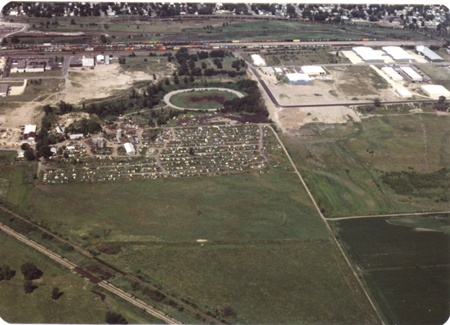
Looking west toward the Shiftar Brothers salvage yard and Campbell Cemetery. The La Crosse industrial park is to the right; photo taken by Kurt Brownell on July 18, 1979. The bike trail is in the lower right hand corner.
The container is a regular. The bike trail is very busy place so stealth is required. This cache can be found from the bike trail, there is no need to go bushwhacking to get the cache. Please take your time and plan well. Most of all, have fun and be safe.
The Geocache Notification Form has been submitted to Jordan Weeks of the Wisconsin DNR. Geocaches placed on Wisconsin Department of Natural Resource managed lands require permission by means of a notification form. Please print out a paper copy of the notification form, fill in all required information, then submit it to the land manager. The DNR Notification form and land manager information can be obtained at: (visit link)