Tsunamites EarthCache
-
Difficulty:
-

-
Terrain:
-

Size:  (other)
Related Web Page
Please note Use of geocaching.com services is subject to the terms and conditions
in our disclaimer.

The second largest meteor crater basin on planet earth is found in
Sudbury, ON. The crater (60 km long, 30 km wide and 15 km deep) was
created when a comet thought to be 10 km wide pounded the earth.
The comet is calculated to have been travelling about 143,232
kilometers per hour when it hit.

The large crater filled with magma containing nickel, copper,
platinum, palladium, gold and other metals. As a result of these
metal deposits, the Greater Sudbury area is one of the world's
major mining communities. The region is one of the world's largest
suppliers of nickel and copper ores. Most of these mineral deposits
are found on the outer rim of the basin. Visit the "Related Web
Page" link to see a short video from Science North about the
impact.
The size of the comet and the speed when it hit was such that it
caused a tsunami. It is thought the tsunami carried the debris
(ejecta) as far as 875 km from the point of impact.
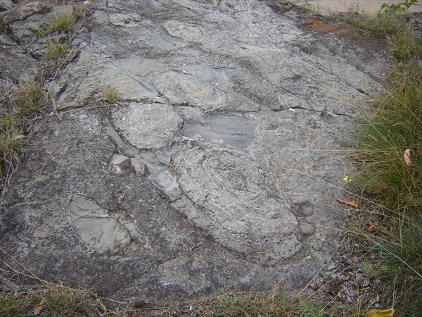
When the small pieces of hot molten debris (tsunamites) made
contact with existing rocks, it melted the existing rocks and
created a ripple effect in them when they cooled. The tsunamites
are not a particular type of rock, but a "potpourri" of molten
debris that impacted the earth - shocked quartz and feldspar
grains.

At the posted coordinates you will come to the edge of a resident's
personal property. The owner and tenant are aware of the formation
and that cachers may be going to the site. Approaching from the
street, you must go over the ridge and look down to see the
evidence of the tsunamite impacts with the rock. You will see
circular ripples and tear-drop shaped impressions in the rock. At
the centre you will find the tsunamites. The concentric ripples in
the rocks are a result of the impact.
To log this geocache, you must e-mail the cache owner the answer
these three questions.
1. Give an approximate size for the tsunamites. The tsunamites are
the part just at the centre of the circle, not the surrounding
ripples.
2. Give an approximate size for the largest circles that surround
the tsunamites.
3. Project a waypoint to the location of the Earthcache near
Sudbury Crater Basin. N 46° 35.270 W 081° 22.840. What is the
distance from your location?
Though not required to log the cache, I would encourage you to get
your picture taken with the tsunamites and to post it with your
log.
Additional Hints
(No hints available.)