(I) (tradotto da www.abacho.de - si prega di
errori scusa)
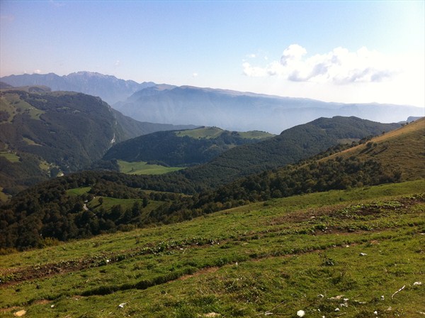
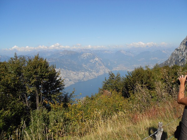
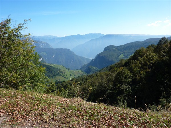
La Finestre di erosione
Il Monte Baldo è costituito principalmente da strati di rocce
sedimentarie, che sono inclinati verso ovest. Le più antiche
formazioni sono fatte di dolomia, una roccia bianca e rosa composta
di calcio e magnesio e contiene trace di fossili rari. Rocce
dolomitiche si trovano nella cresta del Monte Baldo, Vetta Buse
fino a Cima Valdritta vetta, dove anche fare alcune punte
acuminate. Poi le formazioni calcaree grigio si trovano in Lias
nella roccia dolomitica. Essi formano la parte più alta del
vertice, che si estende da Costa Bella fino a Altissimo. Tra cui, a
San Vigilio Oolite calcare si trova, che è costituito da grani
arrotondati, e, infine, una formazione di rosso pietra di Ammonite
costituito da carbonato di calcio e Ferrooxid.
La catena del Monte Baldo iniziata nell\'Oligocene ad emergere dal
mare, o circa 30 milioni di anni fa. La catena del Monte Baldo è
stato solo negli ultimi 5 milioni di anni fa per le caratteristiche
morfologiche di oggi. Nel corso degli ultimi milioni di anni fa,
durante la Era glaciale di Quaternario questo bacino è stato
riempito da un enorme ghiacciaio, che si muoveva molto lentamente,
le rocce levigate e modellate, e morene formate diverse.
Dalle vette più alte della gamma del Monte Baldo, in questo periodo
è anche aumentato lingue piccolo ghiacciaio giù nel bacino di
utenza, che nasceva da sette cerchi glaciale. I loro pozzi sono
ancora oggi visibili. Alle coordinate ai piedi delle cime più alte
della zona est Telegrafo del sud e Sascaga trono del nord.
Per accedere questa cache, la cache ora essere in grado di
completare le seguenti frasi e rispondere alle seguenti domande.
Non è necessario aspettare il mio Rilascio e può accedere
direttamente al tuo indirizzo e-mail di risposta. Se ci sono grandi
differenze con le vostre risposte, io sarò con voi. Le risposte si
possono trovare a livello locale.
1. La "Scharte" è un xxxxxxxxxxxxxxx, ed è .....
2. Un "Kar" è una valle con un profilo tondo che un ghiacciaio
xxxxxxxxxxxxxxxxxxx
3. Per testimoniare il periodo quaternario, che è alla ghiacciaio
di “Kar” del Monte Baldo?
4. Quanti sono molto grandi "pietre" sono sulla seconda
coordinata?
5. Sarebbe bello se si allega una tua foto o il vostro GPS sarebbe
il registro.
Buon divertimento e, soprattutto, una vista fantastica!
(D)
Erosionsfenster im Monte Baldo
Das Gebiet des Monte Baldo besteht überwiegend aus Schichten von
Sedimentärgesteinen, die westwärts geneigt liegen. Die ältesten
Formationen sind aus Dolomit, ein weiß-rosa Gestein, das aus
Kalzium- und Magnesiumkarbonat besteht und seltene
Lamellibranchenfossilien enthält. Dolomitgesteine finden sich in
dem Kamm des Monte Baldo, von Vetta delle Buse bis zu Cima
Valdritta, wo sie auch einige scharfe Spitzen bilden. Dann finden
sich Formationen aus grauem Kalkstein in Lias unter den
Dolomitgesteinen. Sie bilden den höchsten Teil der Gipfel, die sich
von Costabella bis zu Altissimo erstrecken. Darunter, in San
Vigilio, findet sich oolitischer Kalkstein, der aus rundlichen
Körnchen besteht, und schließlich eine Formation aus roten
Ammonitgesteinen, die aus Kalziumkarbonat und Ferrooxid
besteht.
Die Kette des Monte Baldo begann im Oligozän aus dem Meer
aufzutauchen, also ungefähr vor 30 Millionen Jahren. Die Kette des
Monte Baldo nahm erst in den letzten 5 Millionen Jahren die
heutigen morphologischen Merkmale an. In den letzten Million Jahren
während der Quartäreiszeit wurde dieses Einzugsgebiet von einem
riesigen Gletscher gefüllt, der sich sehr langsam fortbewegte, die
Gesteine glättete und formte, und mehrere Moränen bildete.
Von den höchsten Gipfeln in der Kette des Monte Baldo stiegen in
dieser Zeit auch kleine Gletscherzungen in das Einzugsgebiet
herunter, die aus sieben Gletscherkreisen entsprangen. Deren Senken
sind noch heute sichtbar.
An den Koordinaten am Fuße der höchsten Zone der Ostseite thronen
die Gipfel Sascaga im Süden und Telegrafo im Norden.
Nun zum Cache
Um diesen Cache loggen zu können, ergänze folgende Sätze bzw.
beantworte folgende Fragen. Du brauchst nicht auf meine Logfreigabe
zu warten und kannst direkt nach Deiner Antwortmail loggen. Sollte
es mit Deinen Antworten grosse Abweichungen geben, melde ich mich
bei Dir. Die Antworten sind vor Ort zu finden.
1. Die "Scharte" ist ein xxxxxxxxxxxxxxx, und befindet
sich.....
2. Ein "Kar" ist ein Tal mit rundem Profil, das das
xxxxxxxxxxxxxxxxxxx eines Gletschers....
3. Um Zeugen welches Zeitraumes der Quartärzeit handelt es sich bei
den Kargletschern des Monte-Baldo?
4. Wieviele sehr grosse "Steine" liegen an den zweiten
Koordinaten?
5. Es wäre schön, wenn Du ein Foto von Dir bzw. Deinem GPS Deinem
Log anhängen würdest.
Viel Spaß und vor allen Dingen eine phantastische Aussicht !
(E)
Window of erosion
The Monte Baldo consists mainly of layers of sedimentary rocks,
which are tilted westward. The oldest formations are made of
dolomite, a white and pink rock composed of calcium and magnesium
and contains rare fossiles. Dolomite rocks are found in the ridge
of Monte Baldo, Vetta Buse of up to Cima Valdritta peak, where they
also make some sharp points. Then the gray limestone formations
found in Lias in the dolomite rock. They form the highest part of
the summit, extending from Costa Bella up to altissimo. Including,
in San Vigilio Oolite limestone is found, which consists of rounded
grains, and finally a formation of red Ammonitestones consisting of
calcium carbonate and Ferrooxid.
The chain of Monte Baldo started in the Oligocene to emerge from
the sea, or about 30 million years ago. The chain of Monte Baldo
was only in the last 5 million years ago to today's morphological
features. Over the last million years age during the ice age this
basin was filled by a huge glacier, which moved very slowly away,
the rocks smoothed and shaped, and formed several moraines. From
the highest peaks in the range of Monte Baldo in this period also
rose small glacier tongues down into the catchment area, which
sprang from seven glacial circles. Their sinks are still visible
today. At the coordinates at the foot of the highest peaks east of
the zone in the south Telegrafo and Sascaga enthroned in the
north.
Now to the cache:
To log this cache please complete the following sentences and
answer the following questions. You do not need to wait for my
permission and can login directly to your e-mail reply. If there
are big differences with your answers, I will be with you, the
answers can be found locally.
1. The "notch" is an xxxxxxxxxxxxxxx, and is .....
2. A "Kar" is a valley with a round profile that a glacier
xxxxxxxxxxxxxxxxxxx
3. In which period are the „Kargletscher“ of the Monte
Baldo?
4. How many very large "stones" are on the second
coordinates?
5. It would be nice if you attach a picture of yourself or your GPS
to your log.
Have fun and above all a fantastic view!