From 1964 to 1968, Highway 101 cut straight through the UCSD campus, on a route that is formed today by Ridge Walk (on the north side of campus) and lower Gilman Drive (on the south). The given coordinates will take you to a monument to Louis Rose, which marked the spot where Highway 101 began its descent into Rose Canyon. When it was placed, the monument was on the dividing strip between the north and southbound lanes of Highway 101. It hasn't moved, but the UCSD campus has grown up around it.
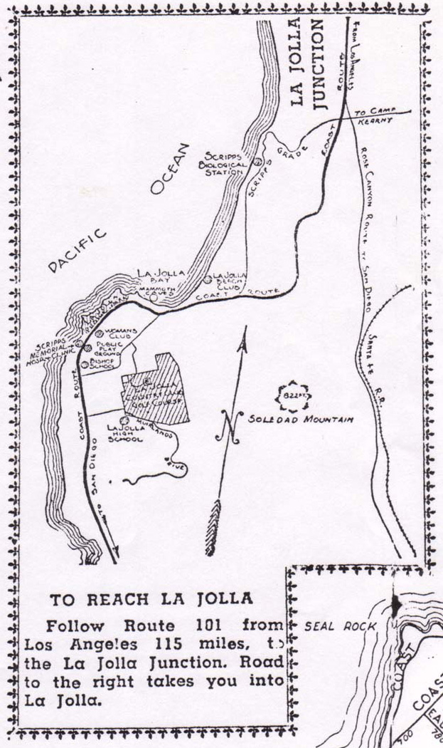
Just to the south, where Mandeville Auditorium stands today, was La Jolla Junction, a major intersection where Highway 101 met Miramar Road (today's Voigt Drive, in part) and Highway 101 split into eastern and western routes. A 1948 map shows an overview:

West 101, sometimes called the Coast Route, went down what is now South Torrey Pines Road and meandered through La Jolla; East 101, known as the Rose Canyon Route (now lower Gilman Drive and I-5) took a more direct route toward San Diego. The 101 East/West split was only briefly represented on maps; the Rose Canyon Route quickly dominated, and when the UCSD campus began construction in the early 1960s, Revelle College was built on top of part of the old Coast Route.
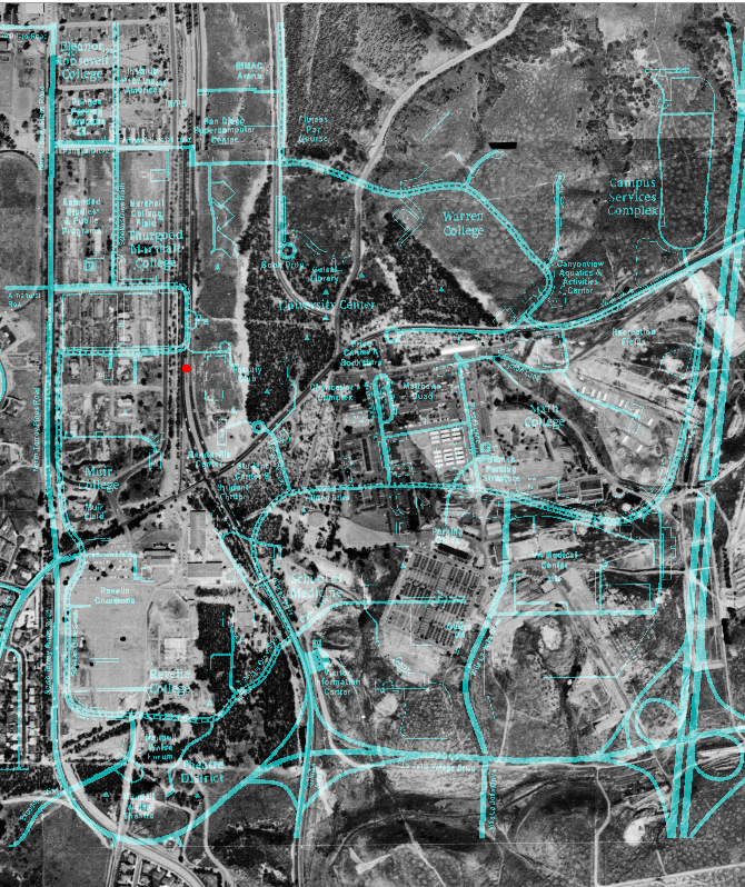
The aerial photo below was taken in 1964, and is overlaid with a modern map of the UCSD campus. Highway 101 is the main north/south road, with Miramar Road running roughly east/west. The red dot marks the location of the Rose monument.

To find the cache, take the lodge number on the plaque (AB) and the year at the bottom of the plaque (CDEF).
The cache is at:
N32 52. B C [D-2]
W117 14. E [A-1] [F+1]
(Another historical footnote: while this is the original boulder, it is not the original plaque! The plaque was stolen during construction at Muir College in 1969. It was never located, and a new plaque was constructed in 1971 from a photo of the original.)
When I-5 came through east campus in the late 1960s, it was the end of Highway 101. Local traffic was diverted to the west edge of campus (North Torrey Pines Road) and construction obliterated the remnants of the highway. But if you know where to look, some of its history still remains.
The final cache is a pill bottle with a magnet on the bottom. Some stealth may be necessary; it's probably best not to approach from below. There's a small prize for the FTF.
Parking may be difficult during the week; parking regulations on campus are enforced from 7am-11pm Monday-Friday. See parking.ucsd.edu for more information.