 |
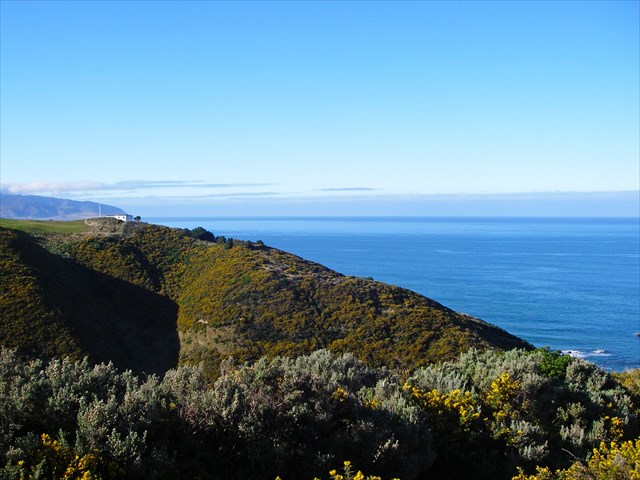
| Looking southeast, towards a small hill roughly the same elevation as the top of the elevator along with an unknown building. |
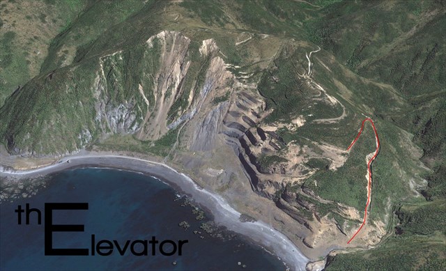
The Elevator
While researching other tracks in the Te Kopahou Reserve, we stumbled on a few unmarked routes to the east of the Red Rocks Track, closer to Owhiro Bay and the Quarry. This one in particular caught our attention – and is the namesake of this cache. The Elevator is a short route that ascends you to 125 metres AMSL in less than 0.4km of length, up the eastern side of the Owhiro Bay Quarry, and just to the west of the Haape Stream. It has a gradient that exceeds 55% at times, and consists mostly of loose scree. It is contained on both sides by walls which give the route a chute-like appearance. This track was probably used once by trucks or 4WD vehicles to ferry freight (namely rocks and building material) off the top parts of the quarry down to the coast below. A hiking stick is recommended, and it’s much easier to ascend the elevator than to descend!
 |
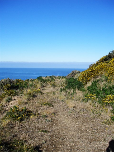 |
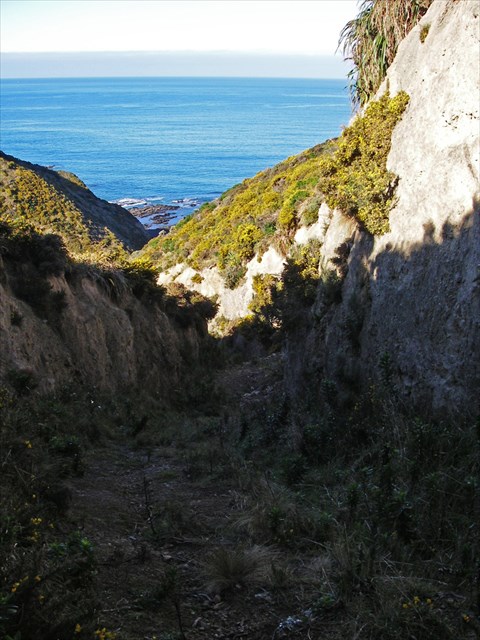
| Left: Looking down a portion of the elevator. Right: The views south after the track flattens out, past the elevator and cache. |
At the top of the elevator, the route takes a left hand turn back towards the sea, and coasts to a stop on a flat section of track, this is where the cache is. There are good views looking through the valley out to the sea, up whose side you’ve just climbed, and over to the southern suburbs of Wellington. From here on, you can walk up through the quarry and above it onto a ridge using a track called “Cliff Edge Effects” which eventually continues on and joins up with Red Rocks Track. The Owhiro Bay Quarry started operations in 1908 with the small scale removal of shingle and sand for use in construction sites around Wellington. In 1999, the Wellington Council purchased the quarry, and began a $500,000 rehabilitation project which involved shifting 300,000 cubic metres of soil and rock to recontour the site – extensive planting of native species, realignment of the coastal track, and the restoration of the Haape Stream.
Cache Details & Information
The cache is an easy find. A 1L black Sistema placed slightly off track, containing a logbook, logbag, geocaching notice, pencil, & FTF prize. Getting there is the difficult part. Park at the Owhiro Bay entrance to Red Rocks, and walk to the trailhead waypoint near Haape’s Stream. Then go up. It shouldn’t take you any longer than 20 minutes to go up or down, but allow for an hour return anyway.
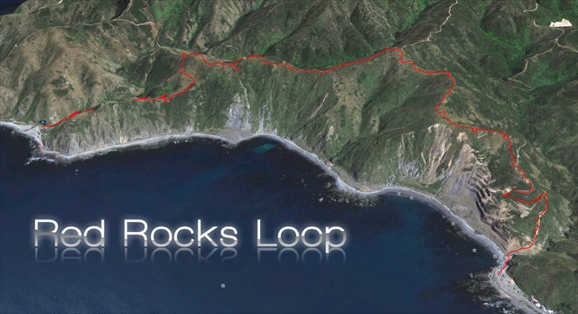
Alternatively, you could complete this as part of a 6.5 kilometre walk which takes you close to Sinclair Head, and allows you to pick up a few more caches along the way. We’ve called this the “Red Rocks Loop” – and it packs many views into a short distance and over a smaller elevation change. Please be aware that the 6.5 km is only in the one direction – it’s up to you whether you walk back to the carpark along the coast or go back the same way you came. It shouldn’t take much longer than 3 hours, including a few photo stops, cache stops and maybe a snack break. It may be worth bringing a hiking stick, some food and drink, and definitely don’t forget your camera. It may be a bit much to attempt to bike this one. All that aside, enjoy!