Ancien Camping municipal de Caen
Cette multi-cache va vous permettre de découvrir ou re-découvrir les bords de l'Orne et le lieu où était implanté le camping municipal de Caen. Ce camping proche de la ville dans un cadre de verdure très agréable, le tout au bord de l'Orne était très apprécié des campeurs. De nombreuses randonnées en canoé ou kayak partaient de Clécy, Pont d'Ouilly ou encore du Pont du Coudray à Amayé-sur-Orne et arrivaient au camping municipal. Au plus fort de son activité, ce dernier disposait de 130 emplacements. Malheureusement, les crues à répétition auront eu raison du camping et la ville de Caen décide de sa fermeture au tout début des années 2000.

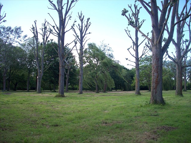
Depuis sa fermeture, le site a laissé place aux promeneurs, vététistes et autres coureurs à pied (j'en fais partie) qui profitent d'un lieu rendu à la nature. Il subsiste néanmoins quelques vestiges de ce fameux camping (fontaines à eau, réverbères ou encore embarcadère pour canoé-kayak).
En octobre 2007, les chemins ont été réaménagés pour offrir aux amoureux de la nature une balade de 3,2 km (5 km avec les chemins environnants). Aux trois entrées du sentier (sous le viaduc, à la salle des fêtes de Louvigny, à l'entrée du bourg de Louvigny coté Caen), une carte offre un aperçu du parcours. Des bancs (en plastique recyclé s'il vous plaît) ont germé ici et là. Une sympathique terrasse a été aménagée au bord de l'Orne. Et trois panneaux pédagogiques (l'un d'eux a disparu) vous apprennent, par exemple, que la lamproie, poisson à la vilaine allure de tube suceur, vient parfois hanter le fleuve.
BREF, UNE BONNE PAIRE DE CHAUSSURES ET/OU UN VELO AINSI QU'UN BON SENS DE L'OBSERVATION VOUS SUFFIRONT POUR VENIR A BOUT DE CETTE MULTI...
Au fil de l'eau, vous allez devoir découvrir des indices qui vous permettront de débusquer la cache finale. Histoire de ne pas vous perdre en route, n'oubliez pas ce principe. Il n'est quasiment pas nécessaire de sortir du sentier...
WP1 : N 49°10.204 W 00°22.018
En vous rendant au WP1, un numéro sur fond rouge vous donnera un ordre d'idée de la hauteur maximale que peut atteindre l'Orne lors de très grandes crues (Réponse A). Simplissime, n'est ce pas ? Continuez votre route vers le WP1.
Passé le plan, les choses sérieuses commençent. Vous voilà sur les rives de l'Orne, le second fleuve normand le plus important après la Seine. Ce fleuve prend sa source aux environs d'Aunou-sur-Orne, près de Sées (61) avant de rejoindre la mer de la Manche à Ouistreham. A ce propos, quelle est la longueur de ce fleuve ? (Réponse B). Et quelle est sa superficie de bassin ? (Réponse C).
Passez le petit pont. Sur votre droite, vous voici au coeur de l'ancien camping municipal. Laissez votre imagination de campeur faire le reste mais ne vous égarez pas trop car, un peu plus loin, un arbre devrait retenir votre attention. Combien de types d'animaux abrite cet arbre ? (Réponse D). Etonnant, non ? Pendant que vous y êtes, sur l'eau, des poteaux verts et blancs demeurent ici et là. Combien sont encore en bon état ? (Réponse E : E a disparu donc prenez E=3). Bien plus loin (environ 500m), un arbre, à l'arête verte, se distingue par la présence d'un nombre rose en son pied (Réponse F). Si votre quête se passe bien, vous devriez être proche de franchir un pont en bois qui enjambe l'Odon, une petite rivière qui se jette ici même dans l'Orne.

Vous arrivez à la croisée des chemins. Droite ou gauche ? Prenez la direction de Louvigny...
Quoi, les explications ne sont pas assez claires !!! Bon, ok, je m'incline enfin pas tout à fait car pour connaître la direction à suivre, vous devez résoudre cette petite énigme :
Si GEOCACHING = 4
- Louvigny Porte du XVIIème siècle = ?
- Louvigny Le planître = ?
Alors suivez 8.
Si toutefois, vous n'aviez pas l'esprit à résoudre cette énigme, laissez faire votre instinct et comptez environ 290 pas vers la droite ou la gauche. Une chose est sûre, si le choix s'avère payant vous devriez pouvoir noter le nombre d'animaux en photo que vous voyez devant vous (Réponse G) ainsi que la hauteur maximum que peuvent atteindre les plantes herbacées sur les berges (Réponse H). Sinon, recomptez vos pas de l'autre côté.

Poursuivez votre balade jusqu'à atteindre ce panneau en ayant pris soin auparavant de noter un dernier chiffre marron qui traîne en bordure d'un champ à l'angle (Réponse I). A la croisée des chemins, libre à vous de choisir la direction à suivre. Si, vous souhaitez un petit peu rallonger votre promenade, suivez la direction du planître (sîte classé le 20 août 1936 aux monuments historiques) avant de rejoindre le WP2, sinon suivez la direction de la porte (inscrite aux monuments historiques le 17 février 1928) jusqu'au WP2.
WP2 : N 49°09.497 W 00°23.040
Admirez cette porte du XVIIème siècle mais n'essayez pas de franchir la clôture. Un certain nombre de pierres est en train de vous tomber dessus. Combien ? (Réponse J).
Soufflez, votre quête aux indices est enfin terminée...
Les coordonnées finales de la cache sont les suivantes :
N 49° [ ((C / (E + 1)) + B + D) x A ] + 2 x H
W 00° [ ((C + F) - ((D + G + J) x A x H)) x I ] - H + E

#########################################################################
ENGLISH VERSION
This multi-cache will allow you to discover or rediscover the banks of the Orne and the place where was located the municipal campsite of Caen. This campsite close to the city in a pleasant green setting, the very edge of the Orne was very popular with campers. Many excursions by canoe or kayak went Clécy Bridge Ouilly or Pont du Coudray to Amayé-sur-Orne and arrived at the municipal campsite. At the height of its activity, it had 130 locations. Unfortunately, the floods have repeatedly been right from the campsite and the town of Caen decides its closure in the early 2000s.
Since its closure, the site has given way to walkers, bikers and other runners (myself included) who enjoy a place made to nature. There is still some remains of this famous camping (water fountains, street lamps or pier for canoeing).
In October 2007, the roads have been refurbished to offer nature lovers a walk of 3.2 km (5 km with surrounding roads). Three entrances to the trail (under the viaduct, at the village hall Louvigny, the market town of Caen Louvigny side), a map provides an overview of the course. Benches (recycled plastic please) have sprouted here and there. A pleasant terrace has been built on the banks of the Orne. And three educational panels (one of them is gone) you learn, for example, that the lamprey, fish the ugly look of tube nozzle, sometimes comes back to haunt the river.
BRIEF, A GOOD PAIR OF SHOES AND / OR A BIKE AND A SENSE OF OBSERVATION all you need to OVERCOMING OF THIS MULTI ...
Over water, you will need to uncover clues that will help flush out the final cache. History does not get lost en route, remember this principle. It is hardly necessary to leave the trail ...
WP1: N 49 ° W 00 ° 10,204 22,018
By going to WP1, a number on a red background will give you an idea of the maximum height that can reach the Orne during very large floods (Answer A) . Extremely simple, is not it? Keep up the road to WP1.
Passed the plan, the real fun begins. You are now on the banks of the Orne, the second largest river after the Norman Seine. This river originates in the vicinity of Aunou-sur-Orne, near Sees (61) before joining the sea of the Channel at Ouistreham. In this regard, what is the length of this river? (Answer B) . And what is its area of pond? (Answer C) .
Cross the small bridge. On your right, here you are at the heart of the old municipal campsite. Camper Let your imagination do the rest but do not stray too because a little further, a tree should hold your attention.How many types of animal shelters that tree? (Answer D) . Amazing, no? While you're there, on the water, poles green and white remain here and there. How many are still in good condition ? (Answer E : E disappeared so take E = 3) . Much further (about 500 meters), a tree with a green line is distinguished by the presence of a pink number in his foot (Answer F) . If your search is going well, you should be close to cross a wooden bridge that spans the Odon, a small river which flows right here on the Orne.
You arrive at a crossroads. Right or left? Take direction Louvigny ...
What, the explanations are not clear enough! Ok, I bow not last quite as for the direction to follow, you must solve this little riddle:
If GEOCACHING = 4
- Louvigny Porte du XVIIème siècle = ?
- Louvigny Le planître = ?
Then follow 8.
If however, you had no mind to solve this puzzle, let your instincts and take about 290 steps to the right or left. One thing is certain, if the choice pays off you should be able to record the number of animals in the picture you see before you (Answer G) and the maximum height that can reach grasses on the banks (Answer H) . Otherwise, your not count again on the other side.
Continue your walk until you reach this panel taking care to note before a final brown figure lying around the edge of a field at the corner (Answer I) . At the crossroads, you are free to choose the direction to follow. If you want a little lengthen your walk, follow the direction of planître (listed August 20, 1936 as a historical monument) before joining the WP2, otherwise follow the direction of the door (listed historical monuments February 17, 1928) to WP2.
WP2: N 49 ° W 00 ° 09,497 23,040
Marvel at the door of the seventeenth century but did not attempt to cross the fence. A number of stones is now fall on you. How? (Answer J) .
Blow, your quest is finally over for clues ...
The final coordinates of the cache are:
49 ° N [((C / (E + 1)) + B + D) x A] + 2 x H
00 ° W [((C + F) - ((D + G + J) x A x H)) x I] - H + E
