Abandoned Airfields - Alameda Airport Mystery Cache
Abandoned Airfields - Alameda Airport
-
Difficulty:
-

-
Terrain:
-

Size:  (micro)
Please note Use of geocaching.com services is subject to the terms and conditions
in our disclaimer.
THE CACHE IS NOT AT THE POSTED COORDINATES!
This is part of our Abandoned Airport Series.
This is a very simple mystery that can be solved with just the information on the cache page! We made this a puzzle so hopefully, you would take time to learn a bit of history about the old Airfields of the area.
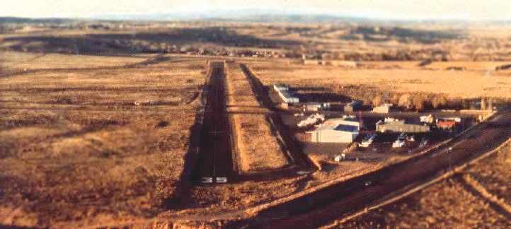
Alameda Airport was developed sometime between 1945 and 1955 and had two dirt runways at that time. By the early 60s the runways were paved and lengthened. The two runways went by the names 17/35 and 10/28. 17/35 was the longer of the two at 6080 ft after at least two lengthening events. Runway 10/28 ran 4315 ft generally East-West. They both had taxiways parallel to the runways.
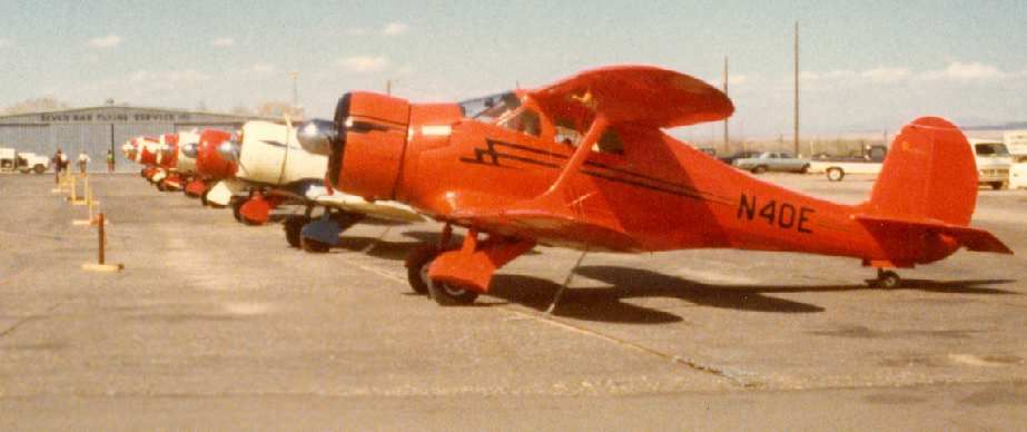
Seven Bar Flying Service was the anchor tenant for the airfield. in the 70s and early 80s. They eventually would move their operations to the Albuquerque International Airport. That was the end of Alameda Airport as it was sold to developers and would become the site of the Cottonwood Mall.
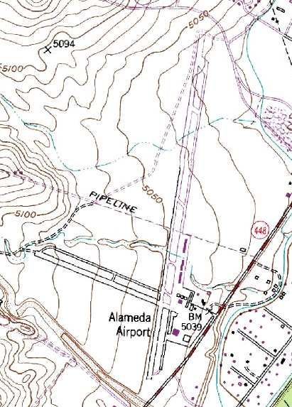
Interesting enough, as late as 1996, the USGS Topo Map still listed Alameda Airport and included its runways. At this time, much of the airfield had been covered by the mall and other developments.
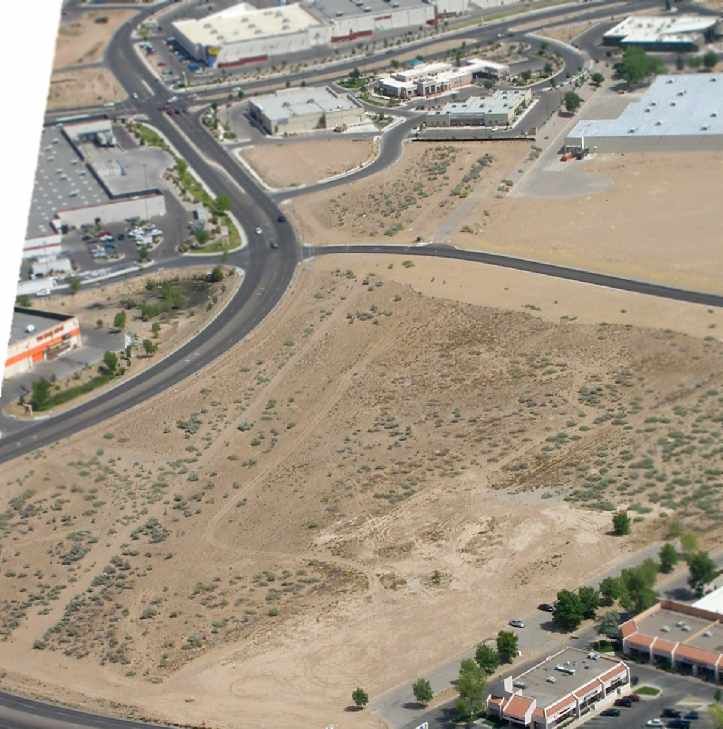
In 2003, not much remains of the airfield. A small piece of pavement which was once a taxiway for runway 17/35 can be seen and the dirt remnants of the remainder of the taxiway and part of the runway.
As you will notice when you are on site, there is still a bare strip of land that appears to be the remains of runway 17/35. If you look around the cache site, you will find sections of pavement the were once part of the runway. It is only visible for a short distance, and will no doubt be developed over sometime in the coming years.
The Cache itself is located at the following Coordinates:
N 35 12.02A
W 106 39.B0C
A = The last digit of the length of the shorter runway
B and C = The two digits of the second number in the longest runway
If you have any first hand knowledge of this airport, please share your story in your log!
Check out the others in the series:
Coronado - GC2VE99
Western Express/West Mesa - GC2VDJN
El Rancho - GC3PD97
Additional Hints
(Decrypt)
Haqre gur ehajnl