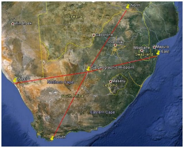
If you use the four extreme coordinates (i.e. the northern, southern, eastern and western most points as given below) of continental South Africa to calculate its geographical centre this is where you end up; approximately 830km from each of the four “corners” of the country.
A geographic midpoint, sometimes called a centre of gravity, centre of mass or centroid is the average coordinate for a set of points calculated on a spherical globe. Due to the irregular shape of Earth and distortions that occur when the Earth’s surface is projected onto a flat surface, this true centre might seem somewhat off when viewed on a flat map.
Happy caching!
References:
Geographic midpoint calculator, http://www.geomidpoint.com
Northern most point: S 22° 7.631' E 29° 39.387'
Southern most point: S 34° 50.016' E 20° 0.008'
Eastern most point: S 26° 51.495 E 32° 53.440’
Western most point: S 28° 37.801' E 16° 27.477'
Thank you to "Ons twee" for agreeing to help maintain this cache.