ALLEGHENY NATIONAL FOREST DISCOVERY SERIES
Each of the earthcaches in this series will take you along roads and trails
to discover the wonders that exist in and around the ANF.
Elk - Forest - McKean - Warren
This discovery series was developed as a heartfelt THANK YOU to all who completed the requirements as requested, and wrote positive logs worth the time to read. Complete 24 ECT caches. Send a list of logs (GL links) via message for verification of requirements. Arrange to meet at Cache Condo to pick up your trackable coin.

EARTHCACHE REQUIREMENTS
Each cacher must send his/her own answers BEFORE logging a find. Enjoy the journey (learning adventure) as well as the destination (smiley earned). Remember to take only pictures and leave only footprints. To get credit for this Earthcache, complete the following tasks:
NOTE: Answers via message -and- log signature picture are required to post a find for this cache.
An organism is any living thing - plants / animals / microbes. FYI viruses are not considered an organism.
1. MESSAGE …. Choose one of the trails that lead to/near a swampy area. Observe the soil for color/texture/porosity/etc. Also take note of the plants/animals in this area.
2. MESSAGE …. This area is a series of interconnecting wetlands. ... a. How are both areas you visited similar? ... b. How are both areas you visited different? ... c. Based on your observations, hypothesize why the entire area is not either swamps or ponds.
3. MESSAGE …. Using Google Earth, trace the flow of the interconnecting ponds. ... a. Give the elevation of the first and the last pond. ... b. Give the coordinates of the first and the last pond. ... c. Convert the coords to N 41° xx.xxx W 079° xx.xxx
4. MESSAGE …. Walk the trail from the posted coordinates until you reach N 41° 26.932 W 079° 04.129. Here you will find a sign. ... a. What organisms are pictured? ... b. Choose one organism and explain what was done to bring that organism back to this area.
5. LOG …. Post a picture anywhere along the trail. Post a picture of your body of water. These pictures are your log signature. No spoiler pics.
OPTIONAL - Please respect the time and effort involved in finding and creating this earthcache by adding A B C to your log.
A. Discover another body of water in/around the ANF, Give coordinates. Identify (river, stream, etc.). If found at a geocache/earthcache site, post picture with name of the cache and GC number instead of cooordinates.
B. JOURNEY OF THE MIND ... Science explains what we observe. Relate (in your own words) something you found interesting in the reading. This adds to your learning adventure and your log.
C. JOURNEY OF THE HEART ... Art shares our personal experience of what we see. Share something special you found on site, and why it is special to you ... prose / story / poem / picture. This is a memorable addition to your log and will make other hearts smile.
Journeys of Heart and Mind ...
Stories to Touch the Heart and Puzzles to Challenge the Mind / Rainbow Tree Story
THANK YOU LN for travelling and hiking with RT to complete this Earthcache Trail.

POROSITY
-Porosity is the ratio of the volume of small openings in soil or rock to its total volume, usually expressed as a percentage. It determines the capacity of soil or rock to hold water.
-For those who wish to do a quantiative analysis rather than just a qualitative observation, the following site gives a simple field method to measure soil porosity by counting the number of pores on a face of a clod of soil.
-See www.crcv.com.au
Vineyard activities 6: Measuring soil porosity
http://www.crcv.com.au/viticare/vitinotes/Viti-Notes/vineyard%20activity%20guides/Vineyard%20activities%2006%20Measuring%20soil%20porosity.pdf
SWAMPS
A swamp is a wetland that is forested. It is a low land that has more woody plants than a marsh and better drainage than a bog. Swamps have very fine sediments (silt and clay). The waters are usually stagnant with low levels of oxygen that leads to very high organic contents.
PONDS
Ponds are quiet, shallow bodies of water that allow enough sunlight to reach their bottom. Water temperature of ponds is fairly even from top to bottom and changes with the outside air temperature. There is little wave action in the water body, and the pond bottom is usually mud-covered. The amount of dissolved oxygen in the pond may vary greatly during a day.
BUZZARD SWAMP INFORMATION
Enjoy your visit to this wonderful area within the Allegheny National Forest.
GEOLOGY
The Buzzard Swamp Waterfowl Area No. 6 Dam is located in the Kantwha section of the Appalachian Plateaus physiographic province, an area characterized as a maturely dissected plateau of moderate to strong relief. Bedrock immediately underlying the dam site is made up of Pennsylvanian Age strata commonly assigned to the Pottsville Group. This unit consists predominantly of conglomerates and sandstones, with minor amounts of shale and coal. Rock strata in this area commonly exhibit low, open folds considered to be horizontal. Although no faulting is known to occur in the area, fractures in the form of jointing are common.
HYDROLOGY
The Buzzard Swamp Waterfowl Area No. 6 Dam drains a watershed area of 2.7 square miles and impounds a reservoir with a surface area of 66 acres at normal winter pool Elevation 1620. The flood discharge facilities for the dam consist of a 215-foot-wide, "grass-lined, trapezoidal emergency spillway channel located on the left abutment and a primary spillway structure located near the midpoint of the dam. The primary spillway structure is comprised of a stop-log weir which discharges into a ten-foot-wide concrete channel. The combined spillway capacity was estimated to be 5130 cfs with stop-logs in place and 5370 cfs with the stop-logs removed, based on the available freeboard relative to the low spot on the dam. The reservoir is normally regulated by the addition or removal of stop-logs at the primary spiilway weir. The spillway or stop-log crest is set at about Elevation 1620 during the winter season and is lowered to approximately Elevation 1618 for the summer season. Thus, the available freeboard relative to the low spot on the dam crest is approximately seven feet during the winter and abcut nine feet during the summer. Normal excess reservoir inflows are discharged over the crest of the primary spillway stop-logs. Larger reservoir inflows are discharged through the 225-footwide emergency spillway.
RECREATION
Buzzard Swamp is a 9.6 mile system of interconnecting trails which offers excellent opportunities to view wildlife, cross-country ski, mountain bike or go bass fishing. Fifteen man-made ponds were constructed in the early 1960's in partnership with the Pennsylvania Game Commission. Buzzard Swamp is within a special management area that emphasizes wildlife management and recreational opportunities. Buzzard Swamp offers some of the best wildlife viewing opportunities on the Forest. The area is an important link in the Atlantic flyway during the waterfowl migration. During spring migration, 20-25 species of waterfowl can be seen around the swamp. An observant hiker could see bear, deer, beaver, coyote, snapping turtles, turkey, osprey, and bald eagles. Don't forget your binoculars or spotting scope for great views of the native fauna. All of the ponds have small and large-mouth bass, perch, catfish, crappie, and bluegill. Boating is permitted on the ponds, but no motors are allowed. The nearest pond is 1 mile from the trailhead, and since no motorized vehicles are allowed within the swamp, boats must be carried.
RESOURCES
http://boulter.com/gps/
http://www.fs.usda.gov/Internet/FSE_DOCUMENTS/stelprdb5107545.pdf
http://www.dtic.mil/dtic/tr/fulltext/u2/a108946.pdf
http://www.visitusa.com/pennsylvania/hiking/buzzardswamptrail.htm
Pond ... Wetland ... Wetland Soil ... Geomorphology
WATER CACHES
All the water caches are a THANK YOU
to Earth Mother for her life-sustaining waters.
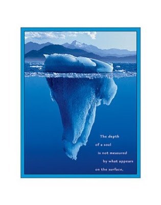
The depth of a soul is not measured by what appears on the surface.