The Cirques in Réunion are geological structures unique in the world: an incredible sinking of nature in only a few tens of thousands of years!
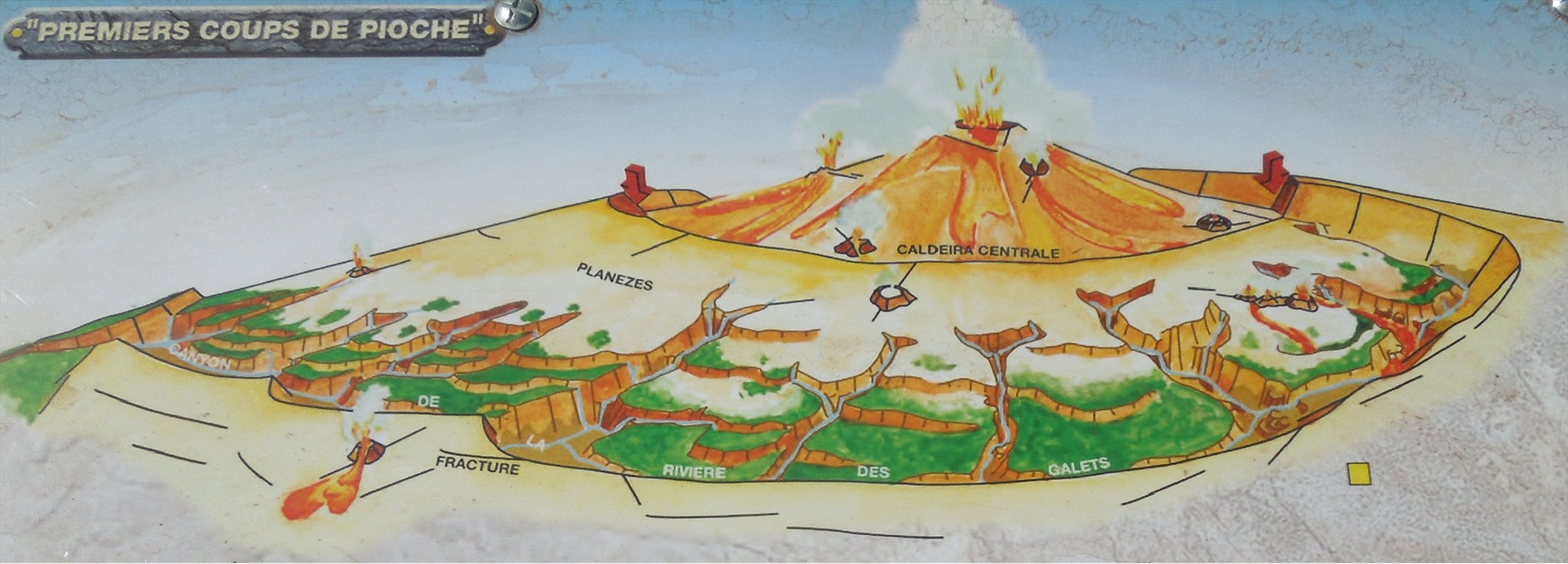
1. The start of this great geological formation
Around 100000 years ago the principal mountain, was an active volcano especially in the centre, collapsed into a Caldera. How was the caldera created? There are numerous scientific explanations, one is that the magma chamber emptied itself and later on collapsed to form the caldera. In the case of the Cirque de Mafate, it is more likely the effect of hydrothermal fluid flow through time that caused the creation of this spectacular caldera!
La Rivière des Galets, guided by large fractures, dug deep canyons from which large gully moved towards the sea in steep slope: erosion had just started!
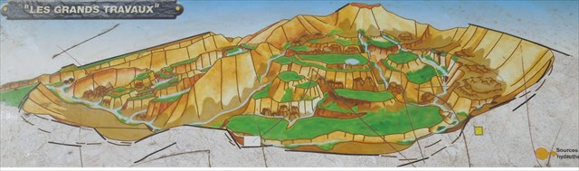
2. Major erosion work has started
A few tens of thousands of years later, the activity in the volcano started to decrease but it still maintained hydrothermal and fumérolienne activity.
Well exposed to the harsh tropical climate on the island, the volcanic underground structure started to weaken; large rock walls detached or slid from the caldera walls forming small isolated islet. A Cirque is born!
Semi-dry forest of colored wood developed on the more stable ground in the caldera.
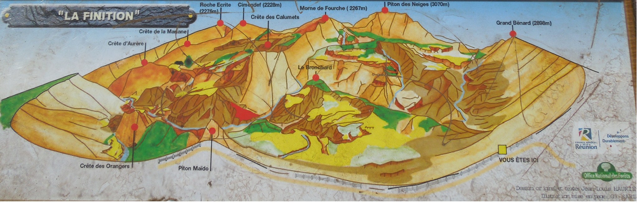
3. The final touch
Starting from the 19th century, human activity started to appear bringing on large land reclaiming thus increasing the effect of erosion.
Huge rainfalls and torrential floods washed the terrain increasing the erosion.
The forestry industry introduced new trees like the filaos to protect the area fragile to erosion.
In the start of the 20th century, the Bronchard landslide buried the thermal station in Mafate renown throughout the Indian Ocean for its sulfurous waters. In 1958, la Rivière des Galets was blocked by a landslide creating a large barrage, which rapidly broke loose. What will tomorrow bring, will the Piton des Neiges wake up and become active again? Who knows, an earthquake could change the current disposition of the Cirques?
The geological site will keep on living ...
Mafate is the Cirque that was last populated. The first inhabitants were black slaves that had fled and they were named "les Marrons". Mafate is actually named after one of these marrons. Then later on in the 19th century, the white man moved in along the river bed.
Le cirque de Mafate is only accessible by foot or by helicopter. The postman still delivers daily the mail by foot! It is now a dreamland for the trekking enthusiasts. Le cirque de Mafate is crisscrossed by 200km of trails.
When you enter Mafate by the riverbed of la rivière des Galets, you can discover the interior of Mafate in 2 or 3 days by foot. The villages are called "îlets", you can discover l'Ilet à malheur, l'Ilet à Bourse, la Roche Plate, Aurère, la Nouvelle and much more. You can also discover the beauty of Mafate through short walks of 2 to 3 hours bringing you to magnificent sceneries.
In order to log this cache as found, you will have to answer the following questions:
1. From the sign, please provide the erosion depth range of Cirque de Mafate
2. Provide the name of the landslide that generated the closure of the Mafate thermal station
3. What would consider the two biggest erosion threats that Cirque de Mafate is facing today?
Although not essential, a picture of yourself at Piton Maïdo with the Cirque de Mafate behind you would be appreciated.
Please be aware that in order to increase your odds of seeing the cirque de Mafate from Piton Maïdo, I advise you to visit the site early in the morning before the clouds start to cover the sky.