Blind Pass is a narrow water inlet which separates Sanibel and Captiva Islands. On both sides of Blind Pass, there are pay parking lots for your use. The coordinates will take you to the parking lot on the Captiva side of Blind Pass
Sanibel and Captiva are barrier islands. Barrier islands are long, narrow offshore deposits of sand that parallel the coastline. The islands are found on coastlines all over the world and basically are sand bars. The elevation of the highest point on the island is usually only about 10 feet above low tide. These islands buffer the coast from wave erosion. Barrier islands form where there are gently sloping coastlines with lots of sand available. Barrier islands are fragile, constantly changing ecosystems.
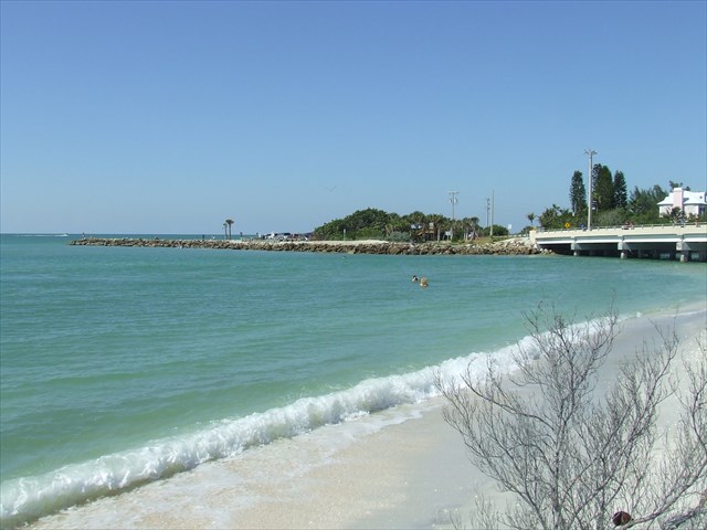
Often times these barrier islands are separated by narrow inlets. Passes between barrier islands are dynamic systems, opening and closing as tides and currents move sand from island to island.
This inlet at Blind Pass allows the water to flow from the Gulf of Mexico into Pine Island Sound with the changing tides. Gravitational attraction from the sun and moon are what cause a rising tide (flood tide = landward) and a falling tide (ebb tide = seaward). The transition between flood and ebb tide is known as slack tide. Tidal currents that are forced through the narrow Blind Pass inlet can be quite strong. The current in the pass has been measured as fast as 3.5 ft. per second. Swimming in the pass is not advised.
Blind Pass has opened and closed many times over the years due to the shifting sand and storms. It last closed in 2001. Since 2001 hurricanes and tropical storm winds and tides have been a very powerful force in placing even more sand in this location. When the pass is closed, Pine Island Sound cannot flush into the Gulf of Mexico, so water east of the bridge becomes murky and stagnant. As water quality declines, so do seagrass, fish, and invertebrate populations.
To restore the health of the waterway, the state, Lee County and the Captiva Erosion Prevention District spent millions to open the pass in 2009. The dredging was completed in August.
Since 2009, the process of sand deposition in the pass has continued and in the summer of 2012, dredging was again necessary to keep the pass open.
Please email the answers to the following questions to the cache owner. Please include the answer to the last question in your log as this answer will vary over time. Pictures of your visit are always appreciated.
- Record the date and time of your visit. Was it an ebb tide, flood tide or slack tide?
- There is a walkway on the bridge. From the walkway, drop a twig in the water where the current is moving the fastest. Estimate the speed of the current in feet per second.
- Are there any sandbars starting to fill in the pass? If there is a sandbar present, walk out on it. How far does the sandbar extend out into the pass southeast from GZ.
- The sandbars begin forming at the shoreline. Take a picture of the pass where it opens to the Gulf. Label the picture with the date and tide (high, low, slack). Post the picture online. This will give us a visible record of the shifting sands.