Cache urbaine, endroit passant. Ruse et discrétion requise !
Urban cache, be carefull not to be seen !
L'endroit est accessible par la promenade des remparts de la Citadelle, l'avenue St-Denis ou la terrasse Dufferin.
Accessible from The Terasse Dufferin, walk from the remparts of the Citadelle or St-Denis ave.
Le Glacis.
En jargon militaire, le glacis est un terme désignant à l'origine un terrain découvert,
généralement aménagé en pente douce à partir des éléments extérieurs d'un ouvrage fortifié.
Ce concept provenant d'ancienne forteresse européenne,il avait notamment pour fonction de n'offrir aucun abri à d'éventuels agresseurs de la place forte et de dégager le champ de vision de ses défenseurs. En plus cet aménagement protégeait la forteresse des tirs d'obus.
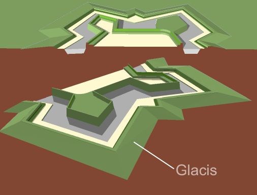 A Glacis.
In military engineering is an artificial slope of earth used in late European fortresses so constructed as to keep any potential assailant under the fire of the defenders until the last possible moment.
On natural, level ground, troops attacking any high work have a degree of shelter from its fire when close up to it; the glacis consists of a slope with a low grade inclined towards the top of the wall. This gave defenders a direct line of sight on to the assaulting force, allowing them to efficiently sweep the field with fire from the parapet.
Additionally, but secondarily, the bank of earth would shield the walls from being hit directly by cannon fire.
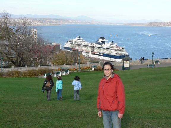
Une très belle vue d'ici.
A nice view from here.
Depuis ce site du Cap Diamant, on peut voir le pont de l'Ile d'Orléans, le site de la chute Montmorency, on voit Le Mont-St-Anne et Le Cap Tourmente.
Bien entendu, c'est un bel endroit pour jeter un oeil sur les bateaux de croisières.
Photo prise à l'automne 2006.
From this site of Cap Diamant, you can see the bridge to Ile d'Orléans, the site of Montmorecy falls. We can see Mt St-Anne and far away to Cap Tourmente.
It is surely a good spot to watch cruising boats visiting Québec. Picture taken fall 2006.