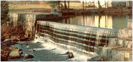
A weir dam is a small overflow-type dam that is used to raise the level of a river or stream. Weir dams have historically been used to create mill ponds but have also been used to control erosion. Water flows over the top of a weir. Since the weir is the portion where water is overflowing, a long weir allows a lot more water with a small increase in overflow depth. This is done in order to minimize fluctuation in the depth of the river upstream with changes in the flow rate of the river. Weir dams also give hydrologists and engineers a simple method of measuring the rate of flow over the weir and check oxygen levels of the water.
They can be used to reduce the flow rate of the water, which will reduce the effect of erosion. One of the first problems with dams is the erosion of surrounding land and banks. Dams will hold back the sediment load normally found in a river flow, depriving the downstream of this. In order to make up for the sediments that are trapped by the dam, the downstream water will start to erode its channels and banks. This lowering of the riverbed will threaten vegetation and river wildlife as well.
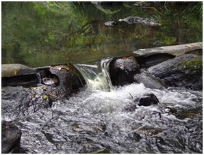
Up Stream on the river there is some erosion occuring. The Erosion Occuring Up stream is Called Bank Erosion. Bank Erosion is a very common form of water erosion. Over time, with flooding and the flow of water the banks Start to erode.
Weir Dams as used in stopping flooding have worked well at this location, but Down the River (Jenison, Grandville area) The flooding can be very bad. EX: Kent Trails . You know what I mean if your from the area:)
Sharp Crested Weir
A sharp-crested weir allows the water to fall cleanly away from the weir. Sharp crested weirs are typically 1/4" or thinner metal plates.

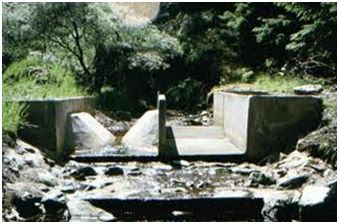
Broad Crested weir
A broad-crested weir is a flat-crested structure, with a long crest compared to the flow thickness.
Combination weir
a combination of 2 weirs. this allows for more accurate flow rate readings.
V - notch weir
The V-notch weir is a triangular channel section, used to measure small discharge values.The upper edge of the section is always above the water level.
Now that we know a bit about weirs here are some questions for you to answer...
1. What type of weir is this?
2. What is the approximate Length of the crest?(the part the water flows over)From one end to the other.
3. What is the approximate distance from the crest to the river bed?
4. Observe the river before the Weir dam and after. If there is any erosion, Does the erosion get better or worse after the dam? Explain your reasoning.
5. Observe the pool, Can you see any mineral deposits?
6. Take a picture of you and your GPS at the site(optional)
Email me the answers to 1 - 6 through my profile please!
Grand Rapids Fish ladder
The Sixth Street dam near downtown Grand Rapids prevents migratory fish such as salmon and steelhead from moving up and down the Grand River. However, on the west side of the river, a series of stair-step concrete pools called a fish ladder has been constructed to allow these fish to bypass the dam on their journey upstream toward Lansing. A specially designed viewing structure allows visitors to see fish as they pass by. Parking is available adjacent to the fish ladder and also nearby on the street.
I hope you enjoy this Earthcache I have put together and be sure to check out the other caches in the area!
