O.C.H. #13: The Trail Marker Tree Traditional Geocache
O.C.H. #13: The Trail Marker Tree
-
Difficulty:
-

-
Terrain:
-
Size:  (small)
Please note Use of geocaching.com services is subject to the terms and conditions
in our disclaimer.
This cache is part of a series of caches reflecting Oconto County History. Please respect the delicate nature of the surroundings, being careful not to damage vegetation and items that may be of historical significance. Reports of such nature will result in the archiving of these caches.
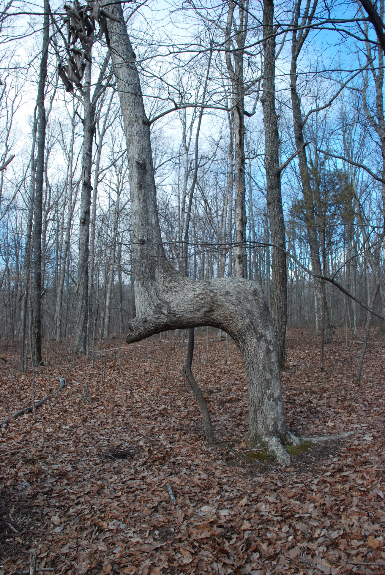 Native Americans used long lived tree species as trail signs. Saplings were tied down at right angles so that they would point in a specific direction. A surviving example, located on private property nearby, is centuries old and points east towards the Bay shore (or across the Bay?). County Highway S, originally surveyed along ancient Indian trails, was the first true wagon road and stage coach route built in Oconto County. Portions of this section of the Fort Howard to Menominee Road were abandoned in 1875 but can still be walked on in the Pensaukee Wildlife Area. Enjoy your walk through history. The container is small and camoed...bring a pencil.
The Geocache Notification Form has been submitted to the Wisconsin DNR. Geocaches placed on Wisconsin DNR managed lands require permission by means of a notification form. The DNR Notification form and land manager information can be obtained at: http://www.wi-geocaching.com/hiding Permission to place the cache was granted by John Huff, DNR property manager, on 4/16/2013.
Additional Hints
(Decrypt)
Ol n fgngryl byq zbanepu.