Bleach Green viaducts, Whiteabbey.
The information below comes from various sources.
Bleach Green is a railway junction located in Newtownabbey where the Belfast to Larne railway line diverges from the Belfast to Derry route. The Bleach Green Junction is the only burrowing junction in the whole of Ireland.
Usually referred to as “Bleach Green viaduct” there are three viaducts carrying the lines from Belfast to Ballymena/Londonderry and Larne Harbour across the Three Mile Water and Valentine’s Glen, to the north of Whiteabbey station.
When opened in 1848, the line to Ballymena used the Larne line as far as Greenisland (then called “Carrickfergus Junction”) where it left, by a trailing junction, to head towards Monkstown and Ballymena.
This indirect route resulted in longer journey times and time-consuming operations as locomotives ran round their trains. In 1931 work started on the construction of a loop line from Bleach Green to Monkstown, the effect of which was to create a shorter, direct, line from Belfast to Ballymena and Londonderry and eliminate the reversing at Greenisland.
A special train, on 17 January 1934, marked the formal opening of the loop line (of just under 1½ miles) and viaduct.
The project also involved the building of a new viaduct for the down Larne line and the creation of a burrowing junction (remotely controlled) where the down Larne line ran under the main line.
The main line viaduct, of reinforced concrete, is 630ft long, 70ft at its highest and has ten arches. It has a ruling gradient of 1:176½. The down Larne line viaduct (also reinforced concrete 400ft in length and 40ft in height. The original stone viaduct carrying the up Larne line (1848) remained in use.
For further reading see “The Northern Counties Railway” by JRL Currie, David & Charles (1974).
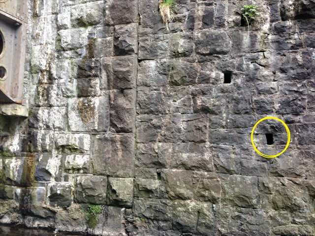
The cache is a small to medium tab-lock box located in a man-made drain hole in the embankment wall about 1.5 metres above the river. A stone has been placed to obscure the cache in the hole. Please be on the lookout for prying eyes as this walk is popular with walkers and dog owners. Feel free to take photographs.
Be aware of undesirable attention if you try to get this cache after dark. On such occasions I recommend you go with a group of people. You might want someone to take photos anyway!
A photo with the precise location is given as the walls and viaduct structures may make it difficult for the GPSrs to be accurate.