Logging Requirements:
- Visit both sets of cords and contrast the SIZE of the pebbles in the “gravel" and in the cliffs. You will need to contrast
- Which location has LARGER pebbles
- Which location has the highest concentration of volcanic (red) pebbles?
- Which site best demonstrates progradation?
- Based on above info: Were the rivers flowing faster earlier or later in the process?
Description:
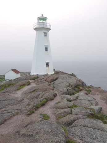
Cape Spear is considered one of the oft-quoted “furthest east points in North America,” and is the first place in North America to see the sun rise if one considers Greenland to be a part of Europe.
It is also home to some really neat geology that extends along the Avalon coast most easily visible seen near St. Johns here and at Signal Hill. The Cuckhold Formation is a prime example of PROGRADATION, the process of sediment settling out of solution (rivers) in “reverse” from finest sand to larger pebbles/cobbles.

Geology:
You can see that the pebbles at the two sets of coords vary in size. In fact, unlike most sedimentary layers the sediment is sorted from fine sand at the bottom to coarse pebbles and cobbles near the top. What caused this?
Avalon peninsula used to be part of another continent, scientifically called Gondwana. As Gondwana crashed against Laurentia blocks of earth were uplifted forming hills and basins. Over time, rivers quickly eroded these hills, brining loads of sediment from the north southward. Since Cape Spear was a basin at that time, it collected the sediments. The speed of the river current largely determined the size of the load that would drop out at this location. The faster the movement of the river (faster at the end because the glaciers were melting rapidly), the larger the pebbles/cobbles/sand, the faster the current!
References:
Hild, Martha Hickman., and Stephanie Porter. Geology of Newfoundland: Touring through Time at 48 Scenic Sites. Portugal Cove-St. Philip's, N.L.: Boulder Publications, 2012. Print.