FIN: Mustolanmäki on tunnettu näköalapaikka Suonenjoelta Karttulaan vievän tien varrella. Mäeltä aukeaa laajoja näkymiä Iisvedelle ja ympäröivään kumpuilevaan metsäiseen ja peltoiseen maisemaan. Mustolanmäki on tiettävästi Pohjois-Savon maantieverkoston korkein kohta.
Lyhytaikainen pysäköinti onnistunee kätkön läheisyydessä, mutta hieman kauempana on virallinen pysäköintilevike.
Kätkö: Kierrä lokivihko kanteen ennen purkin sulkemista. Laitathan purkin huomaamattomasti juuri siihen, mistä sen löysitkin, ettei se lähtisi seilaamaan.
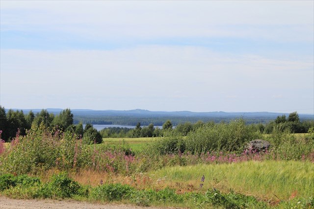
ENG: Mustolanmäki hill is a place with a scenic view along the road from Suonenjoki to Karttula. From the top of the hill there is a view over lake Iisvesi and the surrounding forests and fields. Mustolanmäki is supposedly the highest point of the road network of the Northern Savo-region.
You should be able to park temporarily nearby the cache, but an official parking space is a bit furher down the road.
The cache: Roll the logbook inside the lid before closing the container. Place the container exactly where you found it from in order to avoid it getting lost.