A natural arch is formed by the natural, selective removal of rock. The natural processes that lead to selective removal of rock from a rock exposure are almost exclusively processes of erosion. Erosion can selectively remove rock both macroscopically and microscopically. Both modes are effective, albeit on different time scales, because of the basic structure of virtually all types of rock.
Macroscopic erosion occurs when joints or fractures are first induced in this rock matrix through some (usually catastrophic) process, and then widened through a variety of other processes. This splits the rock into distinct macroscopic pieces that can then move relative to each other under the forces of gravity or water pressure.
Microscopic erosion occurs when certain processes dissolve the crystalline cement, thus destroying the rock matrix and allowing other processes to disperse the remaining loose grains.
Both types of erosion occur separately and in combination on all rock exposures. Only under very special circumstances will a natural arch form.
An important observation should be made to dispel what has been a persistent myth about natural arches. Every single process relevant to natural arch formation involves the action of water, gravity, temperature variation, or tectonic pressure on rock. Wind is not a significant agent in natural arch formation. Wind does act to disperse the loose grains that result from microscopic erosion. Further, sandstorms can scour or polish already existing arches. However, wind never creates them.
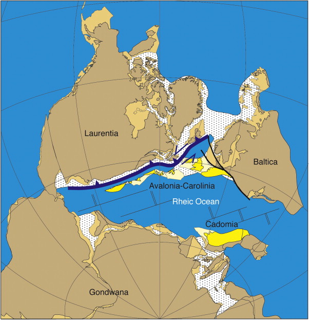
The rock in this area was laid down on the shores of the Rheic Ocean during the Devonian era (400 - 300 Million years ago) when the Earth's land masses were dominated by the continents of Euramerica and Gondwana. Near the equator, the plate of Euramerica and Gondwana were starting to meet, beginning the early stages of assembling Pangaea. This activity during a period known as the Variscan Orogeny (380 - 280 Million years ago) further raised the northern Appalachian Mountains and formed the Caledonian Mountains in Great Britain and Scandinavia.

You may log this earthcache immediately after visiting, but the answers to the questions below are required within a reasonable time frame.
1. Estimate the size (height & width) of the arch.
2. Explain how you think the arch was formed.
3. What evidence is there that this may once have been the shoreline, and why is it now several hundred feet below?
4. [Optional] Post a photograph of the arch with your log
 The most exciting way to learn about the Earth and its processes is to get into the outdoors and experience it first-hand. Visiting an Earthcache is a great outdoor activity the whole family can enjoy. An Earthcache is a special place that people can visit to learn about a unique geoscience feature or aspect of our Earth. Earthcaches include a set of educational notes and the details about where to find the location (latitude and longitude). Visitors to Earthcaches can see how our planet has been shaped by geological processes, how we manage the resources and how scientists gather evidence to learn about the Earth. To find out more click HERE.