"Before the Missouri River was wrestled into submission in the 20th century, it ranged freely between its bluffs across a floodplain as wide as 20 miles, carving new channels and abandoning old ones with whimsy. Fast-growing deciduous trees - willows, cottonwoods and elms - gathered in groves on the floodplain, some surviving a few years, others for decades, their tenure at the mercy of shifting channels and raging spring floods." (NGPS)
Carboniferous period

The Pennsylvanian is, in the ICS geologic timescale, the younger of two sub periods (or upper of two subsystems) of the Carboniferous Period. It lasted from roughly 323.2 ± 1.3 to 298.9 ± 0.8 Ma (million years ago).
The Mississippian is a sub period in the geologic timescale or a subsystem of the geologic record. It is the earliest/lowermost of two sub periods of the Carboniferous period lasting from roughly 358.9 ± 0.4 to 323.2 ± 0.4 million years ago.
Sedimentary
Sedimentary rocks are types of rock that are formed by the deposition of material at the Earth's surface and within bodies of water. Sedimentation is the collective name for processes that cause mineral and/or organic particles (detritus) to settle and accumulate or minerals to precipitate from a solution. Particles that form a sedimentary rock by accumulating are called sediment. Before being deposited, sediment was formed by weathering and erosion in a source area, and then transported to the place of deposition by water, wind, ice, mass movement or glaciers
Stratification
STRATIFICATION refers to the way sediment layers are stacked over each other.

CROSS-BEDDING is a feature that occurs at various scales, and is observed in conglomerates and sandstones. It reflects the transport of gravel and sand by currents that flow over the sediment surface (e.g. in a river channel).


RIPPLE MARKS are produced by flowing water or wave action

Side-view of current rippled sandstone (note coin for scale). The cross-beds or (more accurately) cross-laminae are inclined to the right, thus the water was flowing from left to right.
Karst topography
Karst topography is a geological formation shaped by the dissolution of a layer or layers of soluble bedrock usually carbonate rock such as limestone or dolomite. Subterranean drainage may limit surface water with few to no rivers or lakes. Many karst regions display distinctive surface features, with sinkholes being the most common. However, distinctive karst surface features may be completely absent where the soluble rock is mantled, such as by glacial debris or confined by one or more superimposed non-soluble rock strata. Some karst regions include thousands of caves, although evidence of caves large enough for human exploration is not a required characteristic of karst.
How caves form
Cave formation begins when rainwater absorbs carbon dioxide as it falls through the atmosphere. Rain water must have carbon dioxide to become acidic. It must be acidic to chemically react to the limestone bedrock. Rainwater is absorbed by the soil into the ground.
As rainwater comes through the soil it absorbs more carbon dioxide that is being produced by plants that are dead. This changes the ground water to a weaker form of carbonic acid (H2O + CO2 = H2CO3). As it travels down through the ground it comes to solid rock. When the rock is limestone or dolomite caves can form.
The water reacts chemically with limestone and slowly a larger and larger space will form. This happens because the rocks are made of calcium carbonate (CaCO3). This is what you call chemical erosion.
As the space becomes larger and larger the water can flow through. As it flows it erodes. Physical erosion washes away rock and sand. This is what makes a cave larger and forms an underground stream. Finally over hundreds of thousands of years or even millions of years the cave is formed.

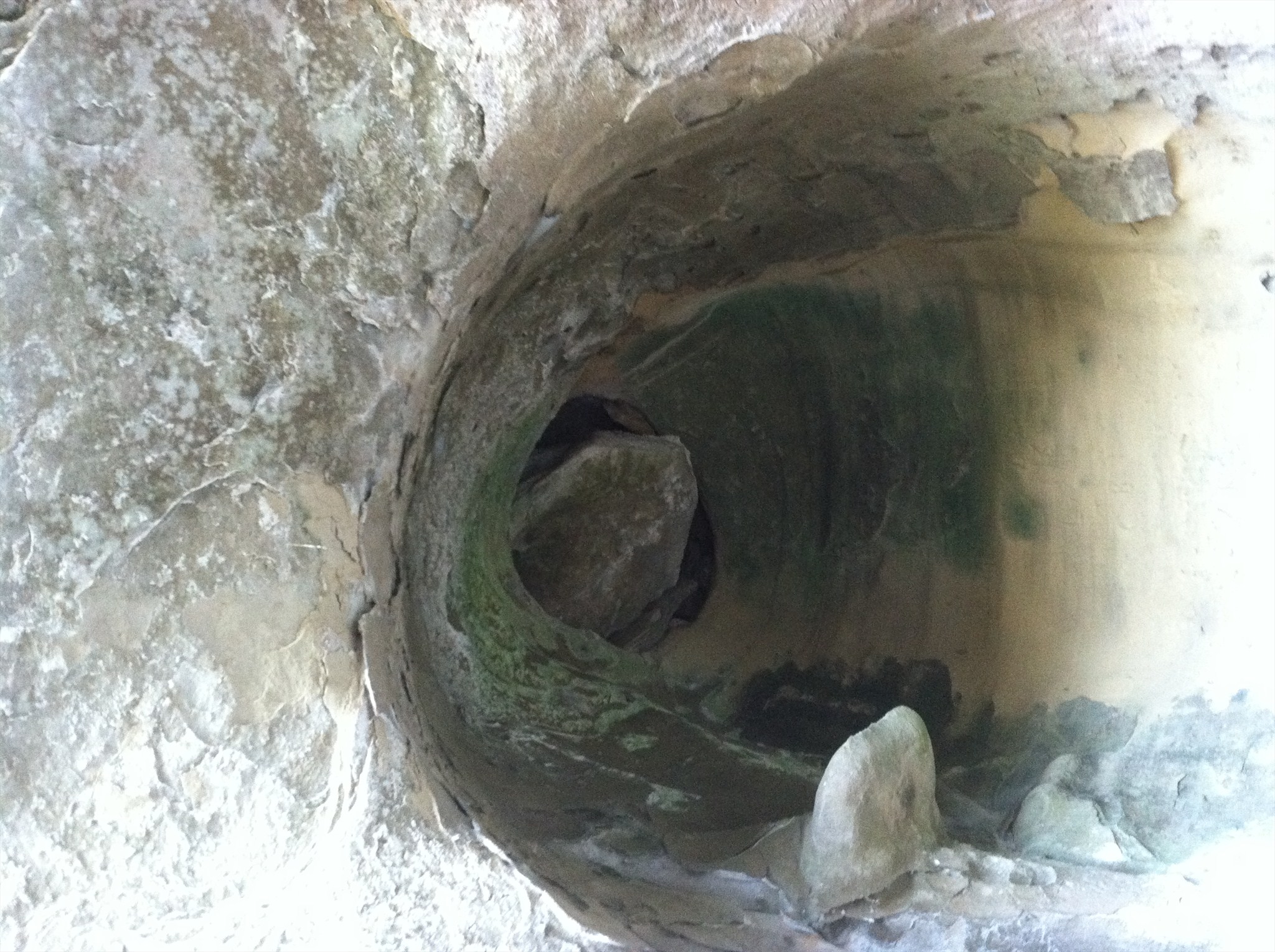
Sinkhole
A sinkhole. It is a natural depression in the Earth's surface caused by erosion. Water seeps into cracks in the bedrock and erodes away at it. Over time the cracks get bigger and bigger and soon a cave is formed. Size of the cave below is not important, just know that its down there. A sinkhole starts to become visible when the ground starts to sink lower than the surrounding ground. Sometimes this can happen in an instant and sometimes this can happen slowly over a long period of time.
**Logging requirements**
DO NOT POST ANSWERS IN YOUR LOG.
Send the following answers to me via email.
- GC4TTHM – Indian Cave
- What part of the carboniferous period was this cave estimated to have been formed?
- How was the cave created?
- Sandstone is soft enough to scratch how many petroglyphs are etched into the cave wall?
- The loess here measure anywhere from ___ to ___ feet deep?
- The loess-created bluffs are the result of __________?
When you walk up the stairs towards the cave you will come to a T. For simplicity left will be Left and right will be right.
- What type(s) of strata bedding are present here?
Go right to answer the following
- At the top right platform what karst topography feature do you see?
- As you look into the karst topography feature what is in it?
- Look at the cliff above the left platform how many possible cave openings do you see?
- Look at the cliff above the left platform what is the size of openings?
| I have earned GSA's highest level: |
 |
The above information was compiled from the following sources: