------------------------------*All Limited Edition Geocoins Have Been Awarded*------------------------------
This cache is placed as part of the
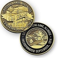
Crystal Lake 100-Years Geocoin Challenge created to celebrate Crystal Lake's centennial anniversary of incorporation (1914-2014). The Challenge will take you throughout the city where you will discover twelve (12) hidden caches and explore some Crystal Lake history along the way. Be one of the first 250 geocachers* to complete the Challenge and receive a limited edition trackable CL100Years Geocoin.
The Crystal Lake 100-Years Geocoin Challenge Passport contains instructions, a list of the geocaches, and designated areas for recording the code words you discover in each cache. You can print your Passport
HERE or pick one up in the specially marked box located just outside the front entrance to Crystal Lake City Hall at 100 W. Woodstock St., Crystal Lake, IL 60014.
Here are the 12 caches:
GC4XNGQ,
GC4Y2WH,
GC4XM0N,
GC4Y96C,
GC4XKNN,
GC4XK2V,
GC4ZFZM,
GC4XTYZ,
GC4XPNZ,
GC4ZAKQ,
GC4XPM5,
GC4XQQY
*limit one per registered geocaching account/household please
------------------------------code words are located on inside cover of logbooks------------------------------
The City of Crystal Lake traces its origins to two separate communities which were established in the 1800s following the arrival of the first European settlers in 1836. Those communities were generally known as Crystal Lake and Nunda.
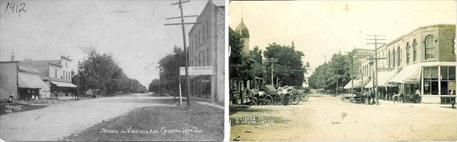
(L) Virginia St. east of Dole, circa 1910 and (R) Williams St., 1912_Images provided by Crystal Lake Historical Society
The Village of Crystal Lake was platted in 1840. Surveyors determined the boundaries to be Virginia Street to the north, Lake Avenue to the south, McHenry Avenue to the east, and Dole Avenue to the west. Its main business district was located on an old indian trail (Virginia St/Route 14 near today's McCormick Park) and included a stage coach stop and trading post near the corner of Pomeroy Avenue.
The Village of Nunda, first called Dearborn, was established in 1855 and later platted in 1868. Its boundaries included the area now generally bounded by Route 176 on the north, Crystal Lake Avenue on the south, Main Street on the east, and Walkup Avenue on the west (today's "Downtown Crystal Lake"). Its main business district was along Williams St. The street configuration of Crystal Lake's present downtown reflects the railroad's early influence. In 1856, the first train depot was established and a rail spur line (now Dole Avenue) was built to transport ice cut from the lake to Chicago and to bring visitors from Chicago to the area.
The Village of Nunda became North Crystal Lake in 1908. Consolidation of Crystal Lake and North Crystal Lake occurred on April 28, 1914. The City of Crystal Lake Charter was adopted on September 23, 1914.
- Compiled information from City of Crystal Lake & Crystal Lake Historical Society
Important Information:
Cache is hidden just off the commuter parking lot. Like many of the caches in the series, this one may require extreme stealth.