Overview
The southern areas of Perry County that border the Ohio River have always been rich in natural resources. From lush forests and wide waterways to rocky bluffs and underground treasures, it’s easy to see why early settlers were drawn to this area. In particular, some early settlers thought the area that is now the town of Cannelton held particular promise.
In 1850, the Honorable Hamilton Smith, President of the American Cannel Coal Company, published a book intended to market the area to potential investors. He noted that the hills of southern Perry County were “filled with strata of bituminous and cannel coal, building stone, fire and whetstone, [and] fire-clay or potters’ marie.”
Smith described the Cannelton area as having “natural advantages for manufacturing” that were “unsurpassed and perhaps unequalled.” In fact, he began his book with the following bold statements: “Within the last few years, the town of Cannelton, on the lower Ohio, has attracted much notice at home and abroad. Distinguished geologists, civil engineers, and manufacturers have pronounced it the most eligible site for a manufacturing city of any now known. Some have predicted that it will eventually be ‘the great manufacturing city of the world.’”
Although Cannelton failed to become “the great manufacturing city of the world,” it did thrive for a while on the industries that sprang up to mine its natural resources. Today, relics of these industries and the town they created can still be seen on a quick drive around Cannelton.
Sandstone
In his 1850 book, Smith wrote, “The sandstones of the hills are an excellent quality of building stone, composed of a great variety of brown, grey, and reddish brown sandstones, mostly free from mica, except some of the grey beds which contain it in very fine particles. The layers are easily quarried, and there are some magnificent quarries in the Cannelton hill, that have been opened to obtain the stone for the erection of the Cannelton Cotton Mill.
The posted coordinates will lead you to a sign board that explains some of the history of the Cannelton Cotton Mill. After reading the sign board, make your way to the Cotton Mill waypoint to examine the sandstone more closely to answer the questions below.
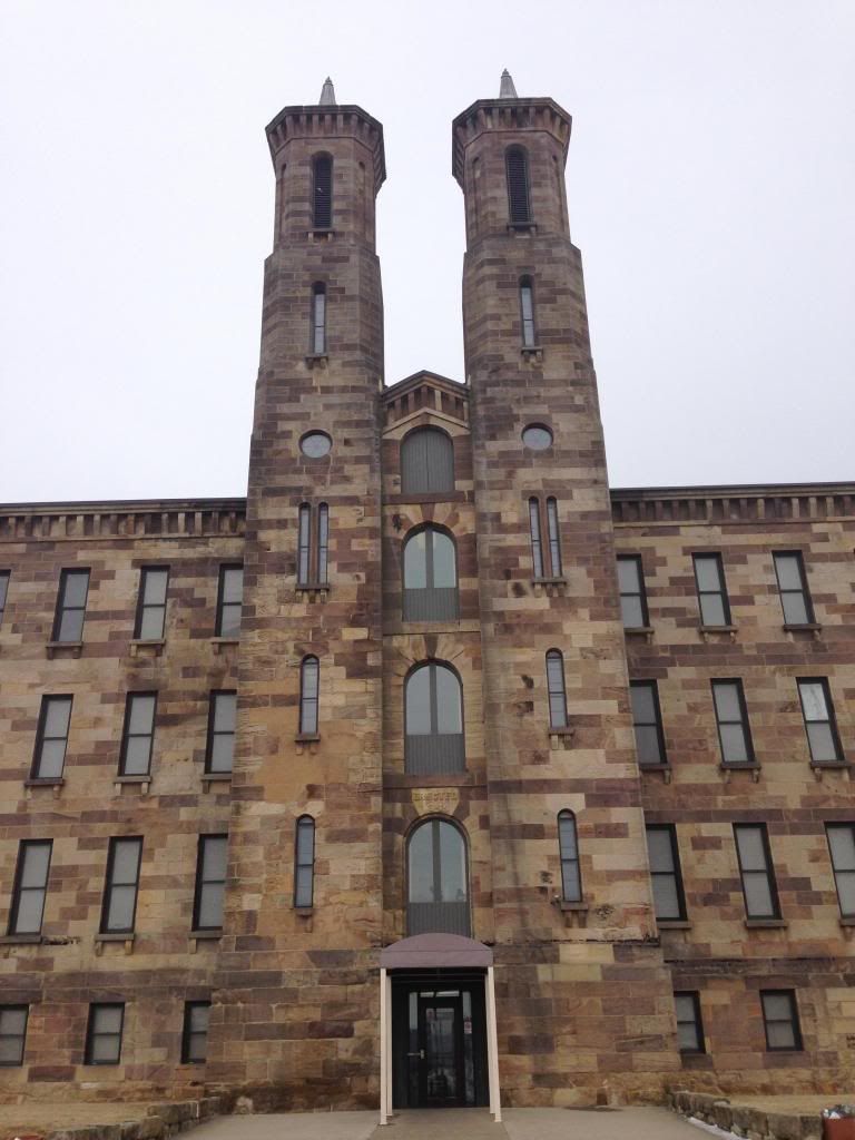
The bluffs overlooking the Ohio River throughout southern Perry County abound with sandstones. In 1836, Seth Hunt opened a business on the hillside above Cannelton to mine coal and sandstone. It was his quarry that was used to mine sandstone to build the Cannelton Cotton Mill in 1849.
Workers harvested large slabs of sandstone by boring holes into the stone and driving wet hickory pegs into them. The pegs expanded overnight and sheared off the slabs of stone that the stonecutters then shaped with chisels and mallets. At first, the sandstone taken from the quarry is soft and easy to work, but after exposure to the air, it hardens and becomes more durable and resilient.
The Cannelton Cotton Mill was once the largest mill west of the Appalachians and also the largest factory in Indiana for many years. It operated as a cotton mill for over 100 years until its closing in 1954. It has been on the National Register of Historic Places since 1976 and on the National Historic Landmark list since 1991.
The Cannelton Sandstone is part of the Raccoon Creek Group of the Pennsylvanian System of the Mansfied Formation. The Mansfield Formation includes all the rocks between the base of the Pennsylvanian System and the base of the Lower Block Coal Member, which includes much shale and thin beds of coal, clay, and limestone.
From 1849-1861, Hunt’s quarry was not actively used by his company. During this time, Cannelton residents used the quarry to cut stone for many other buildings around town, including the beautiful St. Michael’s Church located at the corner of Main and Eighth Streets. Be sure to visit the St. Michael’s waypoint to see the church and answer the questions below.
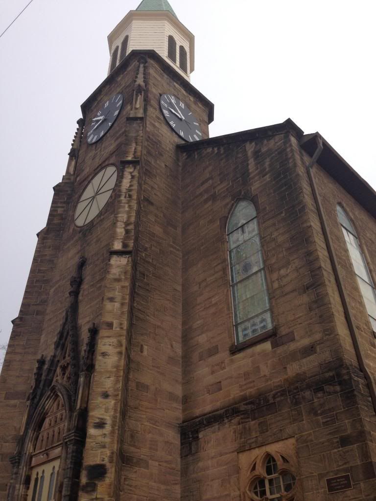
St. Michael's Church was built of native sandstone in 1858. It features a 156-foot high spire and a bell tower containing four bells. It also has a large clock that chimes every half hour. From the ornate arch over the doorway to the subtle etchings that embellish each block, the stonework of St. Michael’s Church is stunningly beautiful. Built by old world masters, the church stands as an exemplar of early Indiana stonework.
To Log This EarthCache
OPTIONAL: Take a photo of yourself with your GPSr somewhere in the vicinity of the posted coordinates or at one of the other waypoints. While not required, we always enjoy seeing photos of our fellow cachers!
To demonstrate the educational value of your visit, please email me the answers to the following questions: (click on the El Pollo Loco Gang link at the top of the cache page to reach our profile, where you will see a link to Send message)
1. Describe the texture of the sandstone blocks that make up the exterior walls of the Cannelton Cotton Mill. How do the shapes and sizes of the sandstone blocks vary from its base to the main walls of the building?
2. Compare the colors of the sandstone blocks used to build the Cannelton Cotton Mill with those used to build St. Michael’s Church. Do you see any differences? What are the similarities?
3. Find another building in Cannelton that was built of native sandstone. There are many examples to choose from. In fact, when you’re at the St. Michael’s waypoint, just look down the hill for a couple of examples. Take a picture, post coordinates, and/or describe the example of sandstone construction you found.
This EarthCache brought to you by:
El Pollo Loco Gang