One Compass, Orienteering map and Results list is provided at Start/Finnish location (see Multicache coordinates).
PLEASE RETURN AFTER USE!
Parking is on a given Waypoint, about 300m from the Start.
The terrain can be tricky at times. Use caution when conditions are wet and slippery, especially if you are trying to achieve a fast time.
The entire round trip from the Parking Waypoint to the cache and back is over 2km.
In the true spirit of orienteering, please post in Results log at Start/Finnish position the number of minutes it took you to complete the course and find the final cache if possible.
Please use only Compass and Orienteering map - don't project Control Points to GPS coordinates - this is not Orienteering spirit - thus we use GPS tracking for Analysis.
I. INTRODUCTION
Orienteering is a competitive running sport. The participants use a detailed topographic map and magnetic compass to traverse variable terrain and visit control points (CPs) that are plotted on the map. Competitors start at staggered intervals and are individually timed as they perform all the navigation skills required to complete the course. The quickest completion time wins the competition. Geocaching and orienteering share some common methods and goals so it's not surprising that the two activities are sometimes combined, especially by geocachers. Both activities challenge the mind and the body and provide the excitement of a treasure hunt. The ability to solve problems and make smart decisions is more important than speed or endurance. 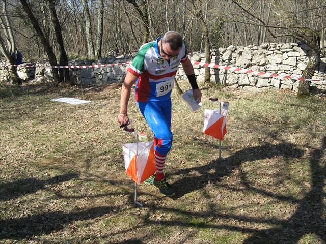
II. THE COURSE
In orienteering competitions, the course consists of a series of numbered control points and may be as long as 10 km. Each control point has a large orange and white marker and a distinctive punch that is used to mark the scorecard. 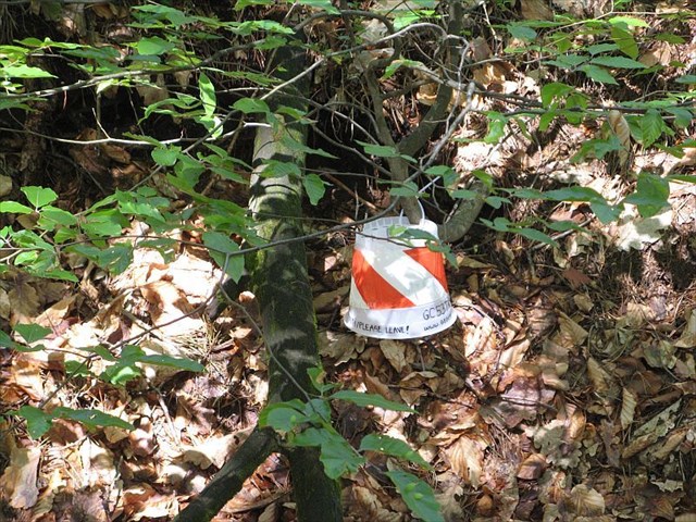
In contrast, this course is roughly 1km long (direct distance between CP). The CPs are landmarks that are easy to find and identify. At each CP you'll record specific information (a letter with a number) and use it to locate the final geocache.
III. THE CONTROL POINTS
The control points (CPs) are labeled 1 thru 5. On your mark. Get set. GO!
IV. THE CACHE
The cache is a lock&lock box. Please be careful to close the container completely.
V. NOTES
Orienteering uses magnetic, rather than true, compass bearings. In our part of the world, however, the difference is less than 1/2° and is not significant for this geocache. Note your start and finish times, then record how many minutes it took you to complete the Course.
REMARK: Due to removal of the logs caused by the sleet, the vegetation on the map is not accurate.
Specifications for orienteering maps (for reading map)
Specifications for control descriptions (for decrypting hint in map)
International Orienteering Federation (for more informations)
Slovenian Orienteering Federation (for more informations)