The glaciations that occurred during the last glacial period covered many areas, mainly in the Northern Hemisphere. They are known as Devensian in Britain. They all have different names, depending on their geographic distributions.
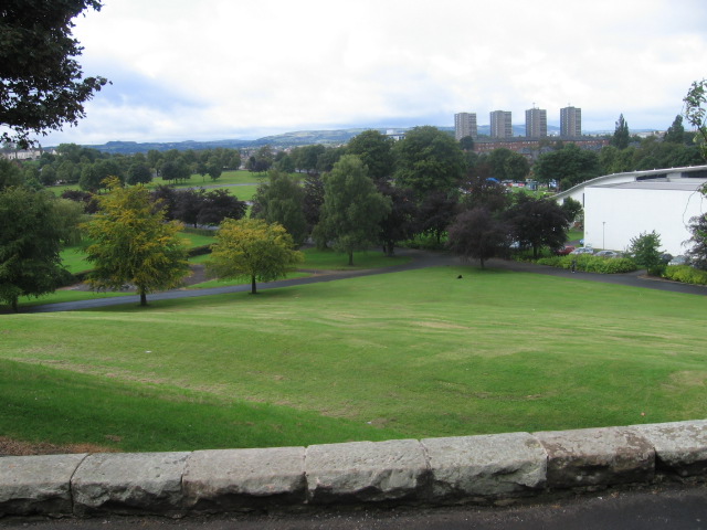
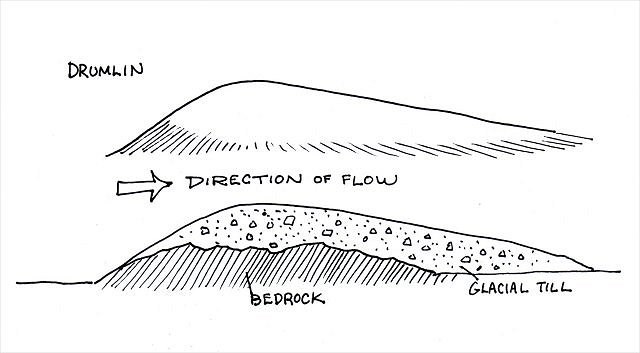
The park is centred on a drumlin that forms a smooth, elongate hill and is flanked by flat ground. The drumlin is formed of glacial till (unsorted glacial sediment) deposited and moulded by Late Devensian glaciers that occupied the Clyde Valley between 30 – 16 thousand years. Drumlins form at the base or bottom of the glacier. As the ice advanced, it moved rocks, gravel and sand and created tear-shaped raised ridges running roughly parallel to the path of the glacial flow. Drumlins are generally found in broad lowland regions. Although they come in a variety of shapes, the glacier side is always higher and steeper, while the lee side is much smoother and tapers gently in the direction of ice movement.
The flat ground surrounding this drumlin is underlain by a thin deposit of raised glaciomarine clay (deep-ocean sediment) laid down during a period of higher sea level. At this time the drumlin would have been an island in the then flooded Clyde estuary. Although most drumlins are composed of till, they can vary greatly in their composition. Some contain significant amounts of gravels, whereas others are made up of rock underlying the surface till (rock drumlins).
TO LOG THIS EARTHCACHE YOU MUST EMAIL THE CO THE ANSWERS TO THE FOLLOWING QUESTIONS. ANY LOGS ENTERED WITHOUT AN EMAIL BEING RECEIVED WITHIN 4 WEEKS WILL BE DELETED. If you would like a reply, please remember to tick the ‘send email address’ box before sending.
- At the coordinates, look north towards the drumlin. What direction do you think the glacier was travelling? West to East or East to West.
- Explain the reason for your answer.
- Using your GPS, calculate an approximate length of the drumlin. To do this, go to the 1938 Empire Exhibition Monument at the top of the steps on the west side, then see how far you are from the marked waypoint near the ski centre.
- Using your GPS, provide the height of the drumlin at the monument (which is not at the drumlin’s highest point).
- Please attach a photo to your log of you, your dog, gps, thumb or something personal to prove you were here. Please do not show any spoilers in your photo.
June 2019 the logging tasks for EC were updated. COs can now insist on a photo as proof of visit.
Thanks to Glasgow City Council for permission.
WELL DONE FINLAY AND HIS DRUDGE ON ANOTHER FTF.
| We have earned GSA's highest level: |
 |