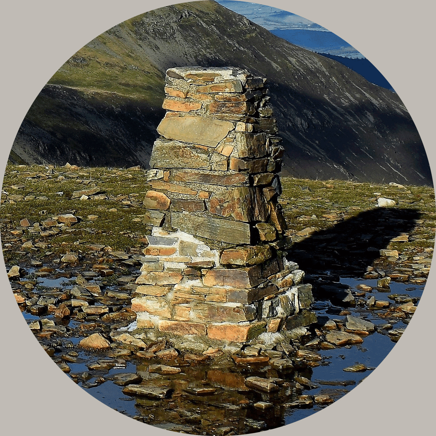
Cairn Table rises to a height of 594m (or 1949'), 3 miles (5 km) southeast of Muirkirk on the Lanarkshire/ Ayrshire border. It is the source of the Duneaton Water. The hill is easily identified from a fair distance away owing to the prominent cairn from which its name derives. On a clear day, Arran, Ben Lomond and the Galloway Hills are all visible. Though sometimes you'll be lucky to see the trig from the cairn...
The striking cairn is a modern war memorial, built to commemorate local victims of the 1914-19 war, but it was built with materials taken from already existing prehistoric cairns on the summit. Summit stones were also used to make millstones, hence the name Grindstone Rig immediately to the south. Unfinished millstones can still be found scattered around the top. Narrowly failing to reach the 2000' mark, Cairn Table features on several hill lists - it is a Marilyn, with a very significant drop of 321m to the nearest col, a HuMP, a Yeaman and a Dewey Donald.
The 10km route is marked with red dots on the noticeboard in the Walkers Car Park at Kames. Follow the white poles which mark the early stages onto a track which leads over The Steel and straight up the slopes of Cairn Table. An easy north-westerly descent leads by Sanquhar Brig and a Land Rover track back to the start, which makes for a better walk than just straight-up-and-down.
In June 2009, the record time in the annual Cairn Table Hill race was slashed from 33.48mins to 31.08mins by Tom Owens from Shettleston Harriers. Do not attempt to emulate this! It took me 53mins to the top on the day I set the cache, but the weather was benign, I was moving pretty briskly & I know the terrain, so allow for a good hour or more each way.
About Ye Ole Survey Monuments
|
 |
Ye Ole Survey Monument (YOSM) is a captivating series of caches that pays homage to the remarkable legacy of OutForTheHunt's YSM series (GC45CC).
YOSM caches are strategically positioned at or near Trig Points. These triangulation stations have played a pivotal role as surveying landmarks, contributing to the mapping of expansive territories.
Some of these points, bearing historical significance, might now be situated on private land or have vanished with time. As a result, the caches are artfully placed in close proximity, reverently acknowledging the historical importance of these survey monuments.
|
More information, bookmarks and statistics can be found at the YOSM Website
If anybody would like to expand the Ye Ole Survey Monuments Series, please do.
I would ask that you request a number for your cache first at www.yosm.org.uk
so we can keep track of the numbers and names to avoid duplication.