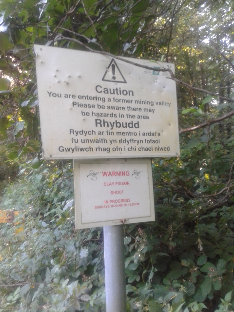
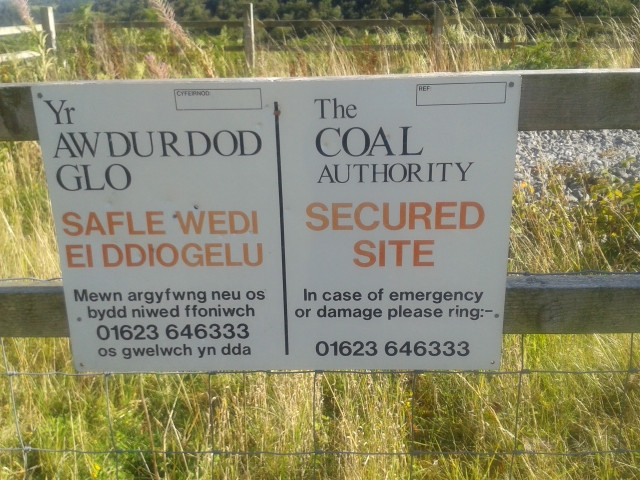
WARNINGS
- Mining - "You are entering a former mining valley. Please be aware there may be hazards in the area". This is a former active mining region and so care must be taken as many of the artifacts of this areas past are still present. There are many signs around the area warning as such, though many of these are so old as to now be blank.
- The Coal Authority Secured Site - These are small areas fenced off for various reasons and should not be entered for any reason.
- Clay Pigeon Shooting - Sundays 10:30am to 13:00 pm. At the lower end of the valley near the Graig Ddu brickworks clay pigeon shoots regularly take place and so that cache should be avoided at these times.


History
The South Wales Valleys and specifically Cwn Nant Ddu are said to posses some of the most beautiful place names in Wales, for example: Cwmffrwdoer= valley of the cold, fast flowing stream, Pentrepiod = the village of the magpies, Pontnewynydd = the bridge of the starving man, whilst LLanerch in Welsh means clearing. This was also once a very industrialised area, home to multiple collieries and pits, working numerous coal seams, as well as a brickworks and many miles of sprawling tracks of the GWR railway starting from Branches Fork at the bottom of the valley by the Bridgend pub and working up. Not much is left of the once booming industry, except a few derelict buildings, piles of rubble and fenced off pit heads and other areas too dangerous to enter.

Map of Pits and Collieries, South Western Division Map - Credit: The Coalmining History Resource Centre - http://www.cmhrc.co.uk/images/gcmg_map23.gif
This cache is placed at the location of one of the pit heads. Blaenserchan Colliery's first shaft was sunk in 1890 by Partidge & Jones Ltd. As at this stage the colliery had only one shaft, known as the upshaft. Blaenserchan continued with a single shaft, and after 6 years employed 436 men, but it would soon have to expand. The upshaft would eventually reach a depth of 362 yards almost a decade later in 1899, before a second, downshaft was sunk in 1913 and opened 2 years later. The new shaft allowed the mine to not only expand production, but also allowed the mine to control the air in the pits, whereas it was previously controlled by the Llanerch site. Pithead baths were added in 1934. The remains of the baths are visible on the road around the head of the valley, beyond the LLanerch site. All that is left now is a large slab of concrete and a few piles of rubble. The former shafts are sealed off with a brick wall encircling them. If you read the names on the bricks you will see many local names, further evidence of the industrial past of this region. If you continue on around the second shaft is located on your right, opposit a loose stone path leading down into the valley and washery.
The cache itself is a 35mm film cannister that should be an easy find. You do not have to climb over the wall to find the cache.