Going Back in Time
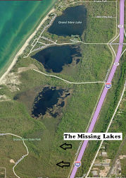
10,000 years ago, Earth's most recent ice age began to release its grip on the world. Glaciers receded north, revealing the land we now know as the State of Michigan and leaving behind a huge volume of freshwater that we now know as Lake Michigan. During this glacial recession, large sand dunes and five smaller lakes were created along the southeast shore of Lake Michigan. The wonderful dunes are the more famous geologic formation, but the Grand Mere Lakes are also quite unique, disappearing in a way that few lakes do.
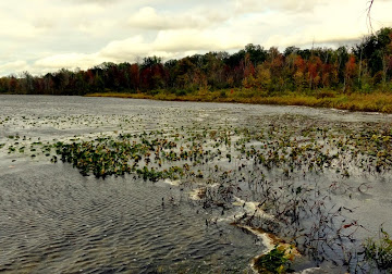
The Grand Mere Lakes have no permanent inlet stream sources; they are connected to the Lake Michigan water table. However, their position behind the sand dunes separates them from Lake Michigan and exposes them to aeolian (wind-carried) sand and sediment deposits. These sediments fill the lakes from direct windfall and from deposits left upon the lake ice during winter.
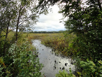
Baldtop, the largest dune in Grand Mere State Park, contributes to the sedimentary deposits of South Lake. The sedimentary deposits create mud and soil for vegetative growth. They also form a stratigraphic log of climate cycles.
Over the years, the two southernmost lakes filled to become the present-day tamarak swamp, leaving only the three remaining Grand Mere Lakes - North, Middle, and South.
What Am I Looking For?
This Earthcache is one of simple observations. Be sure to note your observations at each of the stages in order to answer the questions and receive credit for this find.
The stages are very close to each other, have parking spaces nearby and easy access via flat terrain on grass, gravel road, or pavement.
Taking a look at an internet satellite view of the area is very helpful in understanding the structure of the Grand Mere Lakes, but is not likely to help answer the questions.
How Do I Get Credit For This Earthcache?
In order to receive credit for the cache, answer the following questions and email them to the address on my profile.
Feel free to log your find immediately after you send me the answers to my questions.
You do NOT need a reply from me. I'll know if you were honest. :-)
However - if you log the cache without sending me your answers ... I will be forced to make your entry disappear ... just like the two southernmost Grand Mere Lakes!
1. When standing at the point that juts out into North Lake, what is the primary composition of the soil at the edge of the lake?
a) Pebbles
b) Sand
c) Mud
2. When comparing the surface condition of Middle Lake to that of North Lake, Middle Lake has _____________ vegetation growth than North Lake.
a) More
b) Less
c) About the same
3. Based upon what you can discern from the amount of sediment deposits in the Grand Mere Lakes, which one of the three lakes is most likely to have the oldest sedimentary record?
a) North Lake
b) Middle Lake
c) South Lake
4. Approximately how wide is the waterway that connects Middle Lake to South Lake?
