The Ordovician & Silurian Periods
The Ordovician Period is the second of six periods in the Palaeozoic Era, which occurred between 485.4–443.8 million years ago. The Ordovician Period occurred after the Cambrian period, during which the rock formations at Howth and Bray were formed. The Silurian Period occurred between the Ordovician and the Devonian Periods.
The Ordovician volcano that existed at Lambay during the period was similar to the modern day volcanoes in the ‘Ring of Fire’ around the Pacific Ocean. Lambay Island is an extinct volcano which was active during the Ordovician Period. Volcanic activity on Lambay during this Period caused the eruption of andesitic lavas. This activity was accompanied by instability and numerous submarine debris flows, which include black slates.
Following these events limestone reefs developed around the volcanic island, again with instability as the sediments are often slumped and disturbed. A rich fauna thrived in these limestones, and are now preserved as fossils in the rocks. At the end of the Ordovician Period, the sea level dramatically dropped as a result of a global glaciation event and the limestones were exposed, and a karstic doline (sinkhole) formed which is now visible in the cliffs, infilled with younger sediment. A series of unfossiliferous sandstones were deposited on top of part of the limestones during the Silurian Period. The more recent events seen in the record of the rocks include karstification resulting in two caves, and glaciation which levelled off the top of the cliffs.
Sedimentary Rocks appearing at Portrane
Limestone is a sedimentary rock composed mainly of calcium carbonate (CaCO3) in the form of a mineral called calcite. Because of impurities, limestone can exhibit various different colours. The limestone at Portrane was formed from sediments consisting of an accumulation of shell, coral, algal and fecal debris in shallow marine waters following volcanic activity in the area. Limestone is formed in layers, called bedding planes, which are very evident at Portrane.
Sandstone is composed primarily of sand-sized minerals or rock grains. The most common colours of sandstone are tan, brown, yellow, red, grey, pink, white and black.
Mudstone is a fine-grained sedimentary rock originally constituted of clay or mud. It is usually black or dark grey-brown in colour. Mudstone is formed when very fine-grained clay particles are deposited in water.
Igneous Rocks appearing at Portrane
Andesite is a type of intermediate volcanic rock, formed at convergent plate margins. It is named after the Andes Mountain and is composed of 60% silica. This type of rock forms from magma that cools rapidly at or near the surface. Due to this relatively rapid cooling, andesite has an aphanitic texture, meaning that the individual grains are small enough that they can barely be seen by the naked eye. Andesite is primarily grey in colour.
The Cache
To log the earthcache, please email me through my profile, your answers to the following questions:
1. Describe the colours of the rocks found at your feet at the published coordinates. Based on the colour formations, can you speculate what rocks are present here?
2. Facing out to sea at the published coordinates, you will see a large rock to your left, near the cliff face. Estimate the height of this rock.
3. What type of rock is andesite? Sedimentary, igneous or metamorphic?
Feel free to log your find straight away once you have sent the answers. If there is any issue, I will contact you.
The Terrain
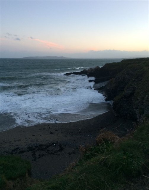
The published coordinates offer you the best view of the rock types, although if the conditions are rough, you might decide to stay up on the main path and draw your conclusions from there.
Photos of the area are welcome but not a requirement (without giving away any of the answers  )
)
***** Congrats to the swerve for FTF *****
Happy Earthcaching!