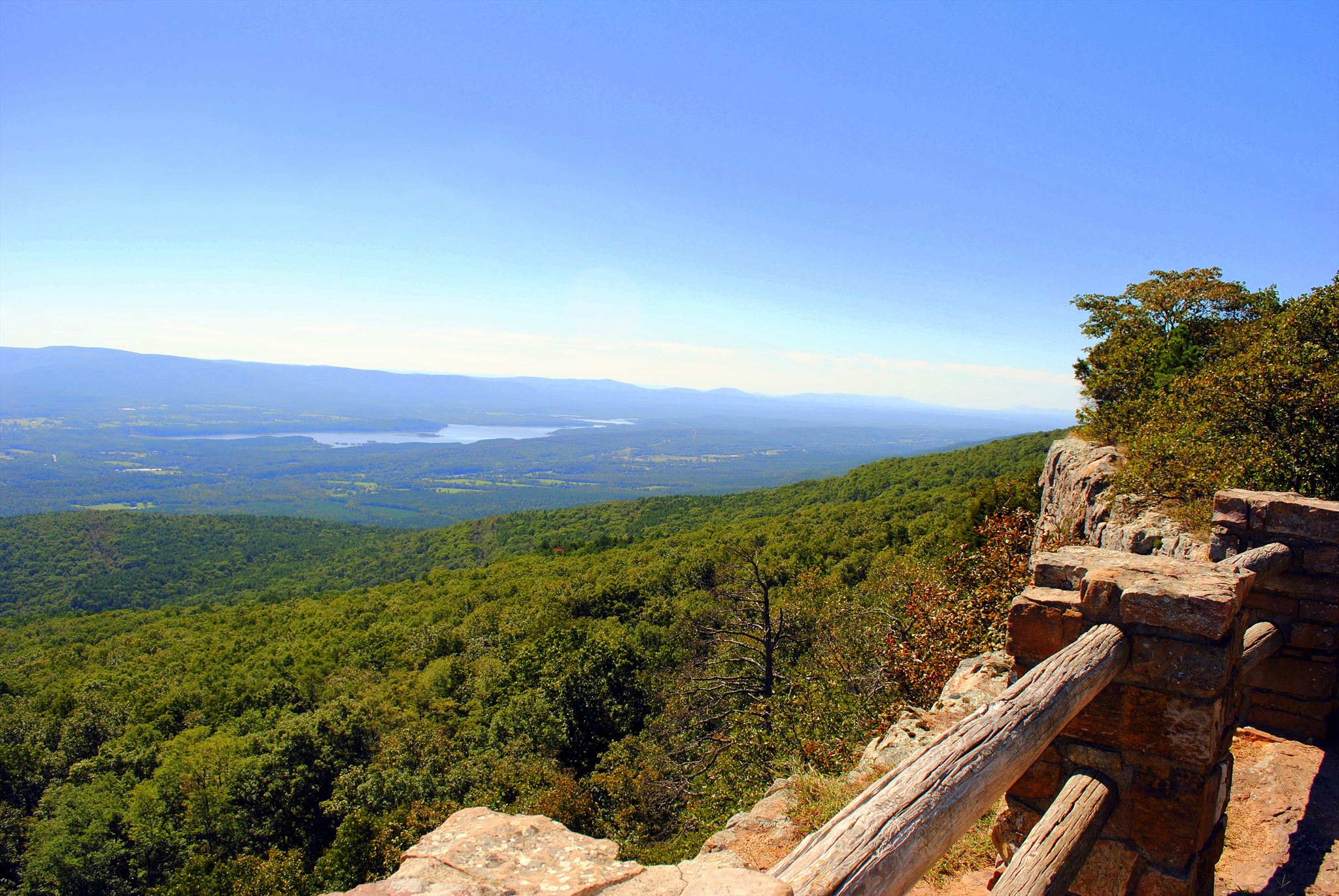
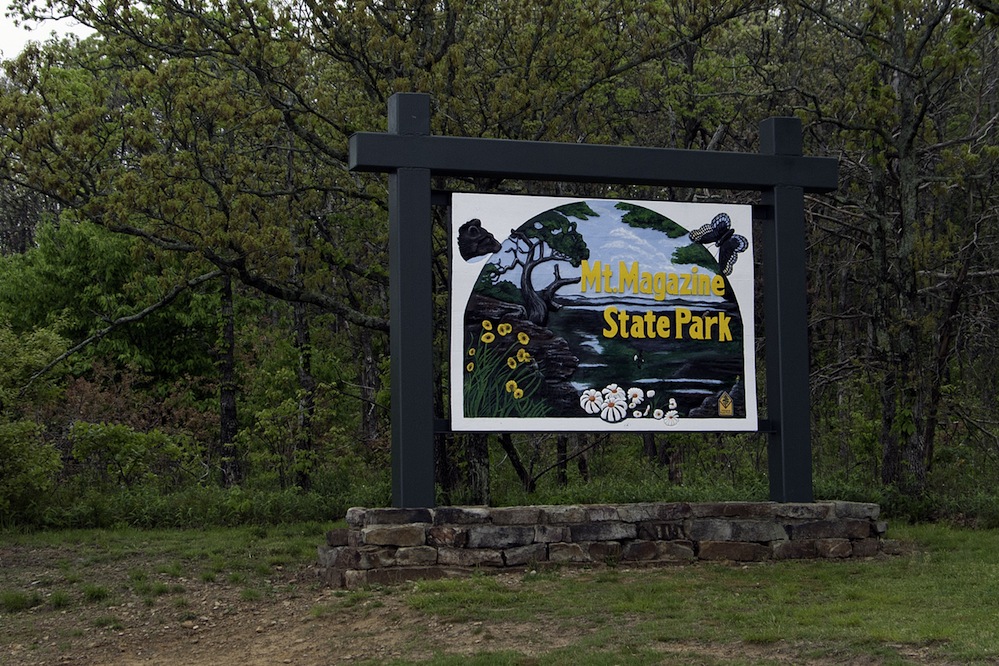
Welcome to Mount Magazine State Park, here you will see incredible views of valley’s, rugged hills and massive cliffs.
To ensure you enjoy your state park experience, be aware of the natural world. There are some areas which are potentially hazardous to all visitors. Since it is impractical to post signs at all danger points, use caution when approaching such areas as cliffs, caves, heavily wooded areas, swamps, streams, and lakes. Adults are responsible for children in their care. If unsure about possible hazards, check at the visitor center.
Local geology:
A Physiographic Region is a region of which all parts are similar in geologic structure and climate and which has consequently had a unified geomorphic history; a region whose patterns of relief features or landforms differs significantly from that of adjacent regions. The Ouachita Mountains are a physiographic section of the larger Ouachita province (which includes both the Ouachita Mountains and the Arkansas Valley), which in turn is part of the larger Interior Highlands physiographic division. The Ouachita Mountains form one of the few major mountainous regions between the Rocky Mountains and the Appalachian Mountains. The highest peak in the Ouachitas is Mount Magazine in west-central Arkansas. Unlike most other mountain ranges in the United States, the Ouachitas run east and west rather than north and south. Also, the Ouachitas are distinctive in that volcanism, metamorphism, and intrusions are notably absent throughout most of the system. The Ouachitas tend to be clustered into distinct sub-ranges separated by relatively broad valleys. The Ouachita Mountain Region consists of a series of sharp ridges, mostly east-west trending and often buckled and distorted, separated by narrow to broad valleys. Surface rocks from this region are mostly shales, sandstone, novaculite, chert and minor limestone. Mount Magazine is a flat-topped plateau with a sandstone cap rimmed by precipitous rock cliffs.
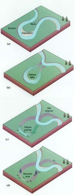
Meander
A meander, in general, is a bend in a twisting watercourse or river. A meander is formed when the moving water in a stream erodes the outer banks and widens its valley and the inner part of the river has less energy and deposits what it is carrying. A stream of any volume may assume a meandering course, alternately eroding sediments from the outside of a bend and depositing them on the inside. The result is a snaking pattern as the stream meanders back and forth. When a meander gets cut off from the main stream, an oxbow lake is formed.
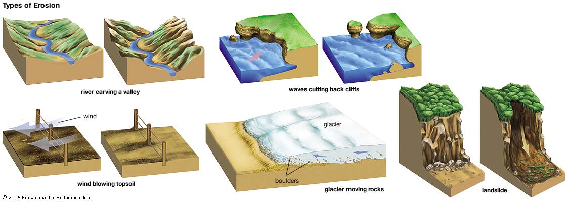
What is Erosion?
Erosion is the process by which soil and rock are removed from the Earth's surface by natural processes such as wind or water flow, and then transported and deposited in other locations.
Types of Erosion:
Splash Erosion: Small soil particles are detached and sent airborne through the impact of raindrops on soil.
Sheet Erosion: Raindrops break apart the soil structure and it's moved down-slope by water that flows overland as a sheet rather than definitive channels. This occurs frequently during cloud bursts.
Rill Erosion: This process develops small, short-lived, concentrated flow paths. These paths create a sediment source and delivery system for hill-slope erosion. Areas where precipitation rates exceed soil infiltration rates are more prone to this type of erosion.
Gully Erosion: Water flows in narrow channels during or directly following heavy rains or melting snow. The gullies can erode to considerable depths.
Valley or Stream Erosion: Continual water flow alongside land (along a linear feature) creates this type of erosion. It extends downward, deepening a valley, and head-ward, extending the valley into the hillside. This occurs most frequently in times of flooding.
Bank Erosion: Over time, banks of rivers and streams are naturally worn down.
Freezing and thawing: Cold weather causes water trapped in tiny rock cracks to freeze and expand, breaking the rock into several pieces.
Wind erosion is a major geomorphological force, especially in arid and semi-arid regions. Wind erosion is of two primary varieties: deflation, where the wind picks up and carries away loose particles; and abrasion, where surfaces are worn down as they are struck by airborne particles carried by wind.
Mass movement is the downward and outward movement of rock and sediments on a sloped surface, mainly due to the force of gravity. Mass movement is an important part of the erosional process, and is often the first stage in the breakdown and transport of weathered materials in mountainous areas. It moves material from higher elevations to lower elevations where other eroding agents such as streams and glaciers can then pick up the material and move it to even lower elevations. Mass-movement processes are always occurring continuously on all slopes; some mass-movement processes act very slowly; others occur very suddenly, often with disastrous results.
Source: (water)
**Logging requirements**
DO NOT POST ANSWERS IN YOUR LOG.
Send the following answers to me via email.
- The text "GC5FP9X Mount Magazine Overlook" on the first line
- Looking out over the valley what erosional force is carving away here?
- How many times do you see the river head almost directly south?
- How many meanders do you see from this view point?
- See the waypoint “object 1 & 2” what are these and what do they do?
| I have earned GSA's highest level: |
     |