When you look closely at the Mansfield formation along the strike of the rock in west central Indiana, you will notice that it demonstrates that facies change is a notable feature. The rock varies from chert and quartz pebble conglomerate (usually near the base) to fine-grained sandstone, siltstone, and shale. The coarser sediments including the sandstones were probably originally laid down on a plain sloping gently to the southwest. Broad channels carried reworked older sediments (mostly of upper and middle Mississippian age) in variable currents to resting places in and near the channels. Inter-channel areas were covered with finer silty sediments. The channel sediments were later cemented with iron oxides and compacted to form cross-bedded sandstones. The cross beds indicate water action and the direction of flow.

The coarser-grained channel facies have resisted post Pennsylvanian weathering. These ancient channel fills now stand out as picturesquely eroded cliff-makers.
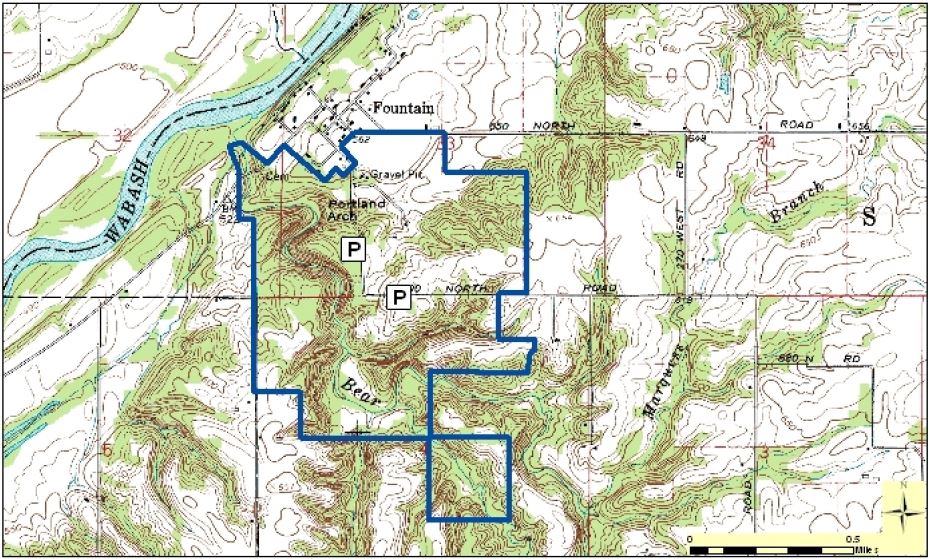
A trail leads to Bear Creek Valley, which is a rocky canyon eroded in the Mansfield formation. The high vertical walls show cross-bedding and pebble layers. This was done by strong scouring currents in the streams that flowed in this area during the Pennsylvanian period. The trail will lead to the Portland (original town name for Fountain) Arch that has eroded through the thin layer of sandstone. Another example of erosion in the area is seen at Devil's Tea Table.
Arches are rare, but a few have developed by unusual stream erosion along joints in cross-bedded facies. Portland Arch in Fountain County is such an example. A small but spectacular arch in Parke County was destroyed by quarrying about 1955. Other cave-like openings will probably be arches in the geological future.
To log this earthcache, please send answers to the following questions to my account:
1. What color is the sandstone at the Portland Arch?
2. Look at the layers of sandstone. Do they seem to be the same size?
3. Using the above graphic as an example, which direction do you think the water flowed to form the crossbedding layers?
4. Post a picture of yourself (face not required) or a personal item at the coordinates.