Mackinac County - Letters From Home Letterbox Hybrid
LettersFromHome: The postmaster has determined these letters are no longer deliverable. They have been returned to sender.
Mackinac County - Letters From Home
-
Difficulty:
-

-
Terrain:
-

Size:  (regular)
Related Web Page
Please note Use of geocaching.com services is subject to the terms and conditions
in our disclaimer.
Parking for the caches in the Letters From Home series can be found at N43 02.850 W85 48.512 (Marne), N43 07.578 W85 52.886 (Conklin), and N43 11.031 W85 56.816 (Ravenna).
| Cache is not located at the coordinates listed above. See below for further details |
|
|
| LETTERS FROM HOME |
MACKINAC COUNTY |
|
|
 |
 |
|
|
|
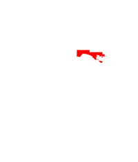
Mackinac County is a county located in the Upper Peninsula of the U.S. state of Michigan. As of the 2010 census, the population was 11,113. The county seat is St. Ignace. Formerly known as Michilimackinac County, in 1818 it was organized as one of the first counties of the Michigan Territory, as it had long been a center of French and British colonial fur trading, a Catholic church and Protestant mission, and associated settlement.
The county's name is believed to be shortened from the French term "Michilimackinac," which referred to the Straits of Mackinac area as well as the French settlement at the tip of the lower peninsula.
|
|
|
|
Michilimackinac County was created on October 26, 1818, by proclamation of territorial governor Lewis Cass. The county originally encompassed the Lower Peninsula of Michigan north of Macomb County and almost the entire present Upper Peninsula. As later counties were settled and organized, they were divided from this territory.
At the time of founding, the county seat was the community of Michilimackinac Island on Michilimackinac Island, later known as Mackinac Island, Michigan. This has been an important center for fur trading before the 1830s, when European demand declined. The county was organized in 1849 as Mackinac County. In 1882 the county seat was moved from Mackinac Island to St. Ignace, Michigan, which had been founded as a French Jesuit mission village during the colonial years.
|
|
|
To find the geocache, you must follow these instructions:
1.Read through the description of Mackinac County. Set the yeard the county was created to ABCD. Set the year the county seat was moved to EFGH. Set the day of the month the county was created to JK.
2. Add A+C+F and set this new number to L.
3. Add G+E and set this new number to M. .
4.Travel at a bearing of 289.7 degrees for (LEKM) feet.
5. You will find what you are looking for in a six trunked tree up the hill.
|
|
|
In each geocache container you will find a stamp. Use this stamp to complete your Map of MI (related webpage above)
|
|
|
|
| Remember to bring your own ink pad. No ink pads will be placed in any of the geocache containers in this series. |
|
|
|
| For more on Mackinac County visit https://en.wikipedia.org/wiki/Mackinac_County,_Michigan |
|
|
For those that might not have tools to project waypoints geolifeline.com may be of some use to you.
There are 83 caches in this series. That is a lot to maintain so feel free to help by bringing along a spare bag and maybe a towel to dry out anything that gets moisture in it.
Please keep the containers hidden from muggles. Thanks for playing.
|
Additional Hints
(Decrypt)
fvk gehax gerr hc gur uvyy