To log your find, please read through the information below and submit your answers to the questions that follow.
The Malmesbury Group of rocks are the oldest in Cape Town. Originally deposited as (mostly) marine sediment some 540-560 million years ago, the Malmesbury Group is well-documented in other Earthcaches in the Cape Town area. The figure below (after Compton, 2004) illustrates the possible tectonic setting during deposition of the Malmesbury Group.
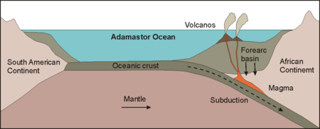
At the time of deposition, the west coast of the African Continent was a subduction zone. Subduction is the process that takes place at convergent plate boundaries where one tectonic plate moves under another tectonic plate and sinks into the mantle as the plates converge. Above subduction zones, volcanoes exist in long chains called volcanic arcs. Japan and the Mariana Islands of the Pacific are examples of present day volcanic arcs.
The depositional environment of the Malmesbury Group was therefore one in which volcanoes were active. The evidence for this is a layer of volcanic rock named the Bloubergstrand Member of the Malmesbury Group, which can be observed at this Earthcache location.
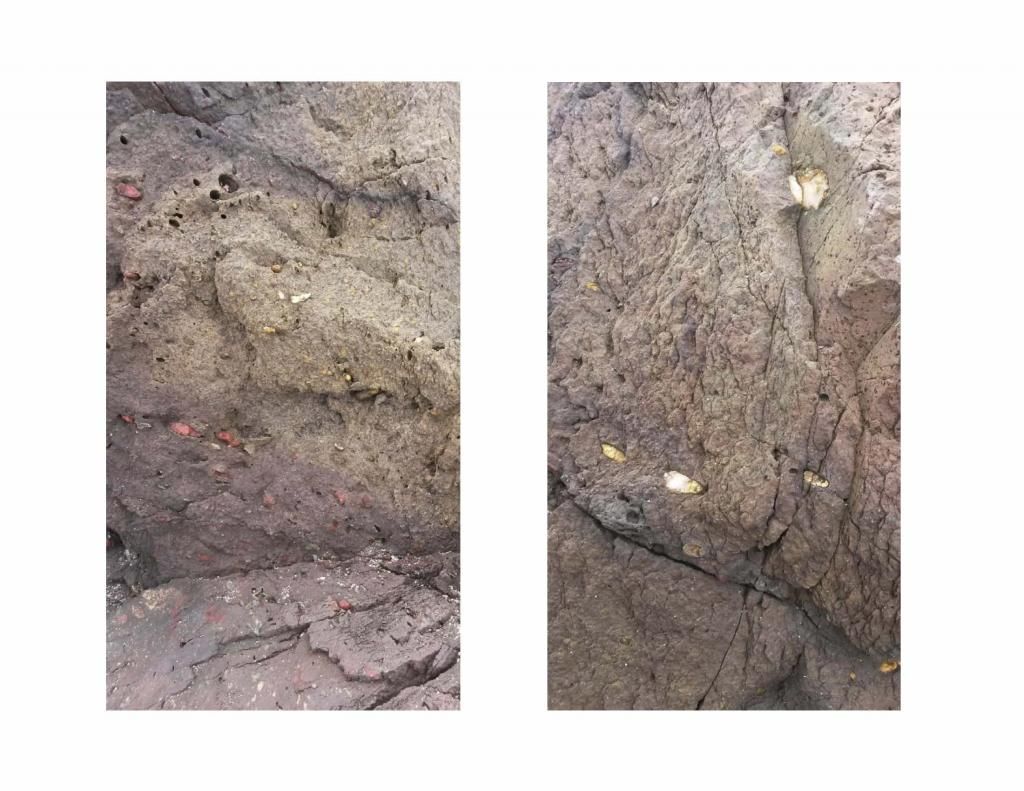
At the listed co-ordinates is an outcrop of fresh (relatively unweathered) volcanic rock. Basalt is a very common volcanic rock with low silica content while rhyolite is a volcanic rock with high silica content. The rock here is most probably more rhyolitic but does have portions that resemble basalt. The lavas of different volcanoes, when cooled and hardened, differ much in their appearance and composition. If a rhyolite lava-stream cools quickly, it can quickly freeze into a black glassy substance called obsidian. When filled with bubbles of gas, the same lava may form the spongy appearing pumice. Allowed to cool slowly, it forms a light-colored, uniformly solid rock called rhyolite. Note the abundant small cavities in the rock at the listed co-ordinates, which are called vesicles (see photo below). They are formed when volatiles are trapped in the molten lava. The contents of the vesicles have mostly been eroded or washed out here. Other common physical features of volcanic rock are the presence of clasts of other rock types picked up by the flowing lava, which are called xenoliths and larger crystals randomly within the rock mass called phenocrysts.

At Waypoint 2, the volcanic rock is much more weathered. But even though the colour is different and the rock is noticeably weaker and more friable, some of the physical features can still be seen.
At Waypoint 3 the rock exposed is typical of the Malmesbury Group sediments that have subsequently been metamorphosed to phyllite or greywacke. Notice the fine grain size and thin laminations (bedding). Laminations generally do not exist in modern sediment, because organisms burrowing through it generally remove all traces of them. The Malmesbury laminations are preserved because organisms capable of destroying them had not yet evolved on Earth. The laminations and strata of the Malmesbury Group are also not horizontal as would be expected but are steeply inclined. This is because since these rocks were formed, they have been folded tightly such that the rock layers are now almost vertical.
At Waypoint 4 volcanic rock is again exposed. Like at Waypoint 2, it is quite weathered and discoloured (brown to red to maroon) but giveaway features are present. Note the vesicles and phenocrysts in the rock as shown in the photographs below.
REFERENCE: John S. Compton (2004) The Rocks & Mountains of Cape Town
Now, to claim your find: Simply email the answers to these questions to the cache owner for verification. You are welcome to log your find before submitting your answers, but logs not accompanied by the answers within a reasonable period of time will be deleted.
1. What is the group name of the oldest rocks in Cape Town?
2. What is the name of the volcanic member of this group?
3. Using your observations, and in your own words, describe at least two differences between the rock exposed at Waypoint 4 and that exposed at Waypoint 3.
4. Finally, just to prove you were there, near Waypoint 4 you will find a memorial to a person that drowned here in 1911. What is that persons name?
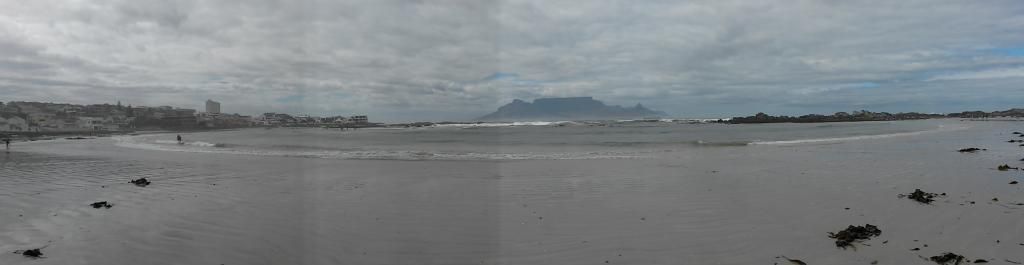
The views of Table Mountain from this spot are iconic. It would be great if you could post a picture of yourself at the location together with your log, but this is optional.