The cache is not located at the above coordinates
All caches are placed on trails that require a hike, mountain bike or horse to get to and are off limit to motorized vehicles.
The trails have varying degrees of terrain and demarcation. The caches should help with trail location in lesser used areas.
A lot of the caches are within BC Parks White Lake Grasslands Protect area. They are all easy to find small containers hanging in trees near the trails to minimize any environmental impact on the land. Please stay on the trails and respect this sensitive area. Good Caching!!!
The cache is located at: N 49 15.29A, W 119 33.18B,
A = last digit in HWY 9_ . B = First digit of the year (Ma) at the end of the Paleozoic age.
McIntyre Bluff
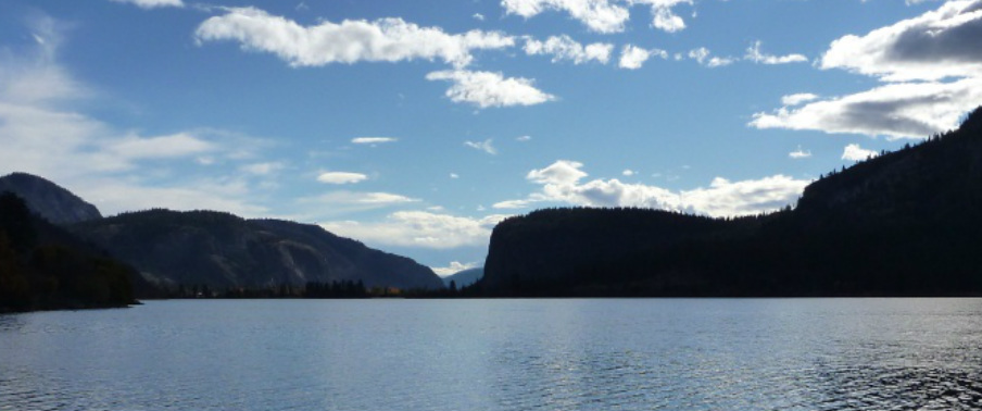
The silhouette of McIntyre Bluff viewed from Vaseaux Lake. (Photo: T. Redding)
McIntyre Bluff is an approximately 300 metre tall cliff between Vaseaux Lake and Oliver. The bluff is composed of granitic gneiss (metamorphosed granite) and
migmatite (a mixture of igneous and metamorphic rock) with veins of quartz and feldspar. The rock is of the Okanagan Metamorphic Complex and is of Paleozoic (543 - 251 Ma) and Mesozoic (251 - 63 Ma) age. It is thought that the cliff was carved over the course of repeated glaciations.
McIntyre Bluff is located at the narrowest part of the Canadian portion of the Okanagan Valley. It is hypothesized that this was the location for the ice dam that resulted in the formation of glacial lake Penticton and the silt bluffs that occur along the valley sides to the north.
References
Brown, S, Gibson, D and Thorkelson, D. 2010. Geology of the southern Okanagan Valley shear zone. Unpublished field trip guide.
http://gac.esd.mun.ca/sgtd/page3/page40/assets/ctg2010.pdf
Cannings, R. 2009. Roadside Nature Tours through the Okanagan. Greystone Books. p. 79
Roed, MA and Fulton, RJ (eds.) 2011. Okanagan Geology South. Okanagan Geology Committee. p. 99-100 [
the bluff is also featured in the cover painting]
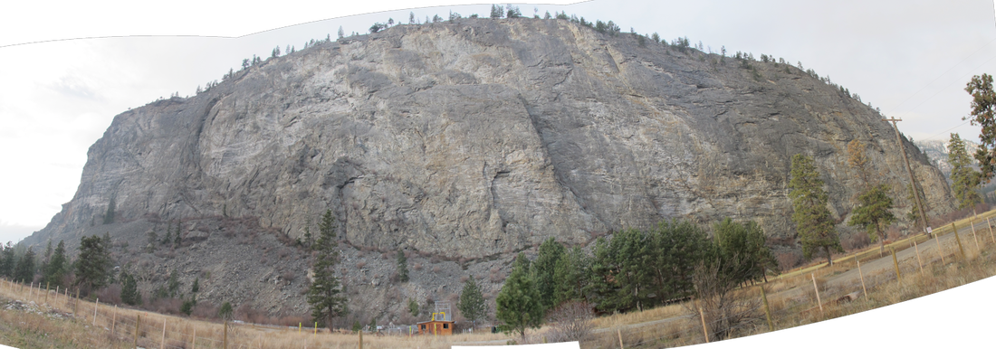
Panorama of McIntyre Bluff from Highway 97 at McIntyre Dam. (Photo: T. Redding)
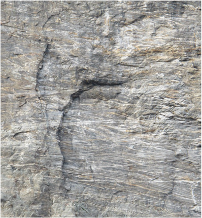
Granitic gneiss with quartz veins. Veins crossing each other is indicative of multiple periods of injection of geothermal fluids. (Photo: T. Redding)