This cache is winter (snow) friendly!
Port Huron, MI is the easternmost city of Michigan's glove. Point Edward, ON is a village that sits opposite from Port Huron and which lies adjacent to the larger city, Sarnia. Between these two towns is the beginning of the St. Clair River.
The St. Clair River can be considered a strait. A strait is a narrow strip of water that connects two larger bodies of water. In this case, Lake Huron and Lake St. Clair.
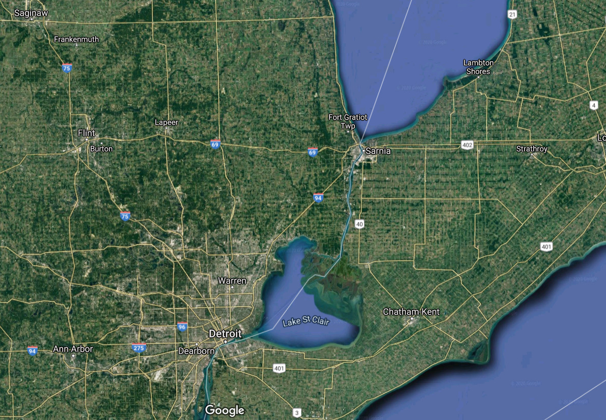
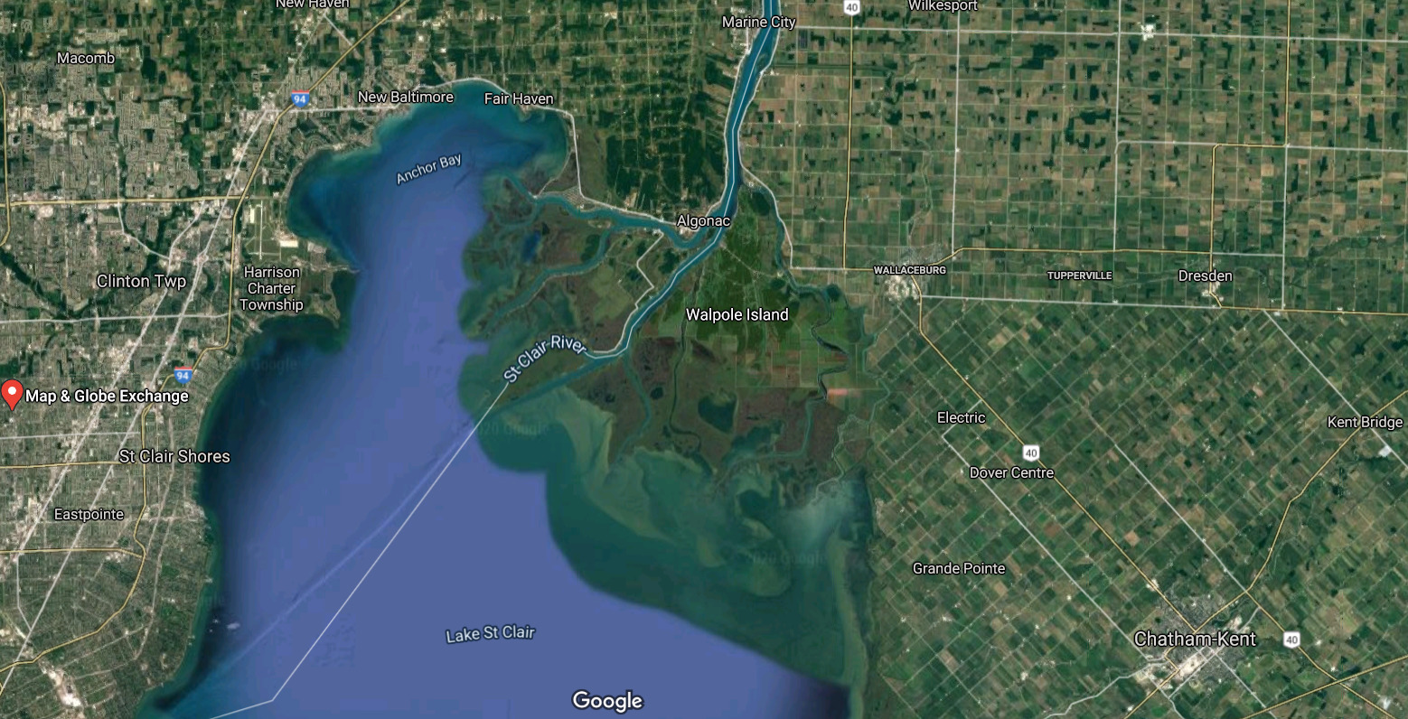
The St. Clair River flows from Lake Huron south for 40 miles to Lake St. Clair. A delta forms at the Lake St. Clair end. A delta is a landform at the mouth (or end) of the river created from the deposition of sediment.
At the inlet of the St. Clair River, all of Lake Huron flows into a slender river. The current here, understandably, is extremely strong.
Let's calculate how fast the water is moving at this point and compare it to the other end.
First, estimate how far Point Edward is from where you are standing. Don't worry, you don't have to be perfect! Just a general guess. Example: 100 feet (not close, just an example).
Second, go to this website. [Edit: Changed hyperlink June 20, 2022 to reflect newer site and mobile friendly.] This is the United States Geological Survey (USGS) website that draws data from gage stations.
Third, the first graph you see should be Streamflow in ft^3/s [cubic feet per second]. You can move your mouse or use your finger to find the closest date and time to when you were present. This is the Discharge. It represents how much water is moving into the river every second. Note this value.
Fourth, scrolling down under the heading "Select Data to Graph," click the Mean water velocity for discharge computation, feet per second (ft/sec). This will bring up a new graph. Again, find the closest day and time when you were present. This is how fast the water is flowing and is your Velocity. Note the velocity.
Fifth, calculate your own discharge (volume of water flowing past you) at this point.
The calculation: (estimation of length in feet from Port Huron to Point Edward ) x (stream velocity in feet per second - this is the velocity found in #2b) x (45 feet = the approximate depth of water here) = discharge (volume of water in cubic feet that passes this point every second)
Make sure your units are all the same! If you use meters to estimate distance, converting to feet will be easier since the USGS website gives units in feet per second.
Now for the logging tasks:
1. Post a photo in your log [OPTIONAL]
2. Email me the values of your estimated distance, stream velocity from the USGS website, and your calculated discharge.
3. How does your calculated discharge compare to the USGS website's discharge? Why do you think it is different or similar?
4. Critical thinking! At the delta of the St. Clair river (N 42° 37.011 W 082° 31.333), the depth of the water is 35 feet and the distance across is 4,110 feet. What do you think the stream velocity is here? You need discharge to complete the same calculations as #2 - thinking about what discharge represents (the amount of water flowing into the river), what might this value be at the delta, where water is flowing out of the river?