The Devil's Elbow Traditional Cache
-
Difficulty:
-

-
Terrain:
-

Size:  (micro)
Please note Use of geocaching.com services is subject to the terms and conditions
in our disclaimer.
This cache is placed at a corner on the Glenedra Road, between Draperstown and Feeny. This corner can be very dodgy to negotiate in the Winter, due to the local geography, the route of the road and add in some cold climatic conditions, hence its well deserved name, The Devil's Elbow.
The cache is a sample bottle containing only a log. Please ensure that it is fitted snuggly back into its hiding place so that it won't fall out and float away. BYOP!
During the week previous to the placement of the cache, a few days of heavy snowfall at this altitude resulted in a vehicle leaving the road at this corner and it then had to be slyped out from the river below.
Under the Devil's Elbow flows a tributary of The Glenedra River, running down from Altbritain Forest. The B40 goes over a bridge at this point, but the bridge is not visible from the road.
In order to see Altbritainbeg Bridge you need to park up and head down in. The downstream side of the road WAS the best for access, BUT I would NOW suggest approach from UPSTREAM....if so then don't forget to take a look at the downstream side of this bridge.
Any recent precipitation
will decide your rate of hesitation,
but if you have the gear,
you should display no fear
and trepidation should disappear.
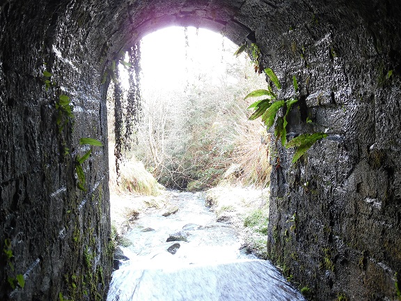
Downstream view.
Additional Hints
(Decrypt)
Sbegl srrg va naq svir srrg hc, gur 'NGZ' jvyy tvir lbh fbzr pnpur!