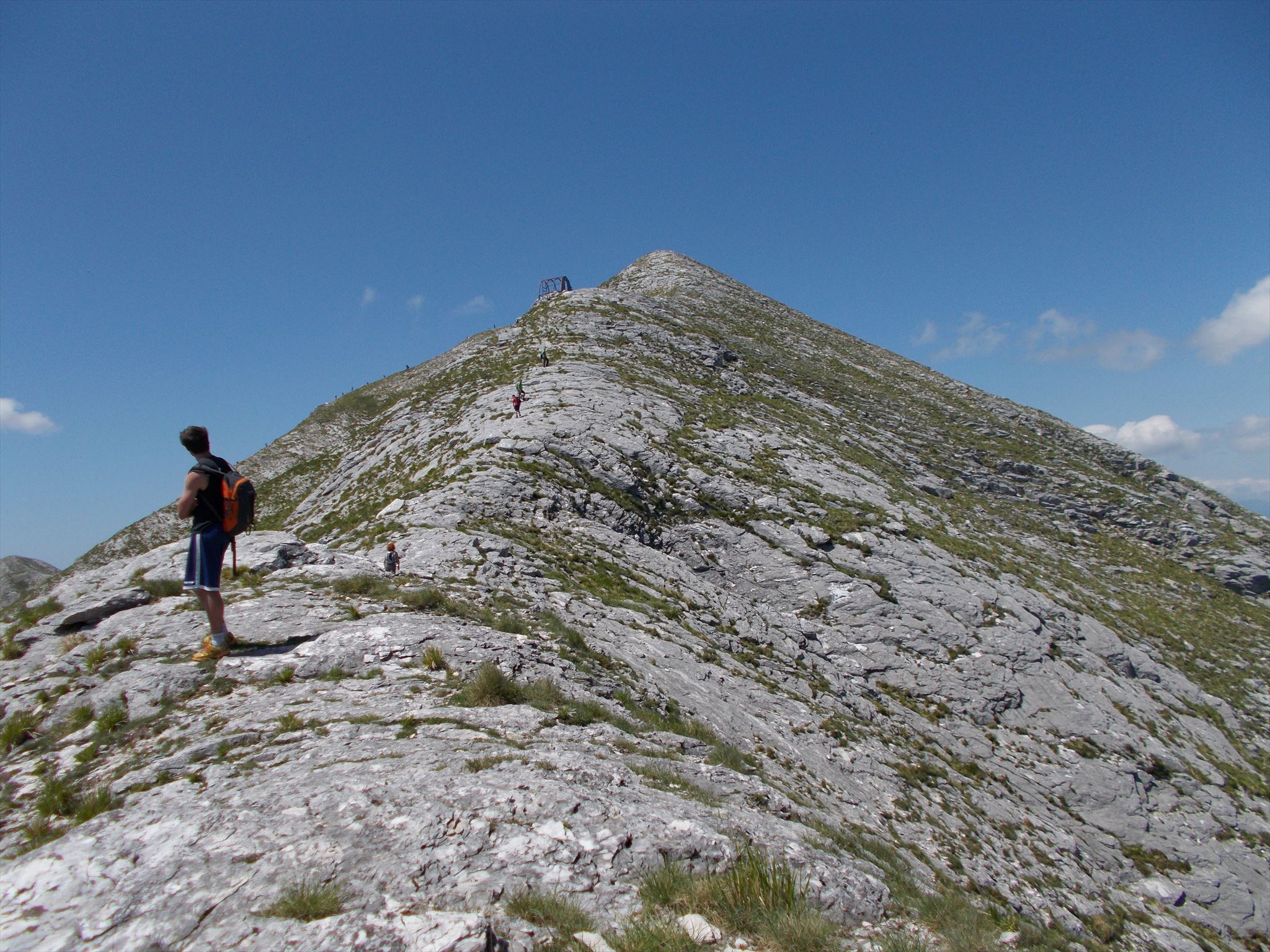
Il Monte Corchia è alto 1677 metri e si trova nel comune di Stazzema. È conosciuta come la montagna vuota dato che al suo interno è contenuto il più esteso complesso ipogeo d'Italia, in parte visitabile nella parte denominata Antro del Corchia. Un'altra caratteristica notevole è la presenza di cave di marmo: la Cava dei Tavolini, sul versante sud-ovest, e la cava del Retro-Corchia, sul versante nord. A est della vetta si trovano i resti del bivacco Lusa-Lanzoni, costruito nel 1978 per gli speleologi e incendiato nel 1994. Dalla vetta si gode un panorama spettacolare verso il Fiocca, il Sumbra, l’Altissimo, il Freddone, le Panie, oltre alla costa della Versilia. In vetta c'è una piccola croce con annesso libro di vetta (che non è la cache).
L'accesso principale è dal rifugio Dal Freo, seguendo la cresta sud-est, per sentiero non numerato ma ben segnalato. È possibile accedere anche dal Passo di Croce per la cava dei Tavolini o per il canale del Pirosetto, o da Fociomboli per le cave del Retro-Corchia. Per i più avventurosi, si può accedere attraverso la lizza dei Tavolini direttamente da Levigliani; questo percorso presenta passaggi un po' esposti con tratti di arrampicata di grado I e tratti dove la traccia non è evidente.
La cache è situata sulla cresta pochi metri a ovest della cima, nascosta sotto un masso. È un contenitore tipo lock-n-lock con logbook, matita, e qualcosa da scambiare.
Mount Corchia (elevation 1677 metres) is situated in the municipality of Stazzema. It is known as the empty mountain since inside it there is the most extensive cave system in Italy, partly open to the general public in the part known as Antro del Corchia. Another peculiarity is the presence of marble quarries: Cava dei Tavolini, on the south-west side, and Retro-Corchia, on the north side. To the East of the summit there are the ruins of bivacco Lusa-Lanzoni, built in 1978 for speleologists and burnt in 1994. From the summit there are great views toward Mts. Fiocca, Sumbra, Altissimo, Freddone, Panie, and the Versilia coast. A small cross marks the summit, with annexed logbook (not the cache).
The main access is from rifugio Dal Freo, following the south-east ridge, through an unnumbered but well-marked path. The summit can also be reached from Passo di Croce through the Tavolini quarry or through the Pirosetto, or from Fociomboli through Retro-Corchia. If you're really adventurous, there is the former route used to bring down marble blocks (lizza dei Tavolini), starting in Levigliani; this trail has some bits with high exposition, grade I climbs, and in places the track is non-existing.
The cache is hidden a few metres west of the summit, on the ridge. It's hidden under a rock. It's a lock-n-lock container with logbook, pencil, and something for interchange.