Traduction / Translation


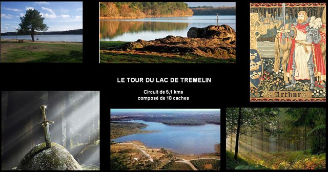
Le « lac de Trémelin » est un superbe étang de près de 45 ha au milieu d'un domaine boisé.
Le plan d’eau et le domaine forestier forment un site naturel de 220 ha à la richesse écologique exceptionnelle. Deux Zones Naturelles d’Intérêt Écologique, Floristique et Faunistique (ZNIEFF) y ont été inventoriées.
La pierre du Roi

Dans la légendaire forêt de Brocéliande, ce rocher qui se découpe sur la lande ne manque pas d’intriguer. la couleur pourpre de la roche place celle-ci dans la formation ordovicienne de Pont-Réan et sa granulométrie en fait une siltite gréseuse.

L’ensemble est disposé en couches superposées.
Très longtemps après le dépôt réalisé en milieu marin, l’ensemble a été porté en profondeur et comprimé dans la chaîne hercynienne ; en réponse aux contraintes horizontales les couches ont été déformées, se sont inclinées et est alors apparu un clivage proche de la verticale.
La siltite rouge est devenue schiste rouge, roche faiblement métamorphique.
Ce rocher illustre parfaitement deux phénomènes géologiques dissociés dans le temps : le phénomène sédimentaire avec dépôt en couches horizontales superposées (stratification)

et le phénomène tectonique avec apparition des plans de schistosité. Sur cet affleurement, les siltites étants proches du grès, la schistosité y est grossière, son aspect amygdaloïde étant dû à l’hétérogénéité du sédiment à l’échelle centimétrique

Pour valider cette Earth cache , vous devez répondre aux questions suivantes :
1°-Quel est le nom donné au clivage proche de la verticalite du schiste.
2°-Composition chimique du schiste rouge.
3°-Les longueurs A et B

Loguez cette cache "Found it" et envoyez-moi vos propositions de réponses soit via mon profil, soit via la messagerie geocaching.com (Message Center), et je vous contacterai en cas de problème.".
Une petit photo de vous avec votre GPS sera apprécié.
translation in English
The stone of the King Arthur
In the legende of Brocéliande forest, the rock that stands out on the moor is no shortage of intrigue. the purple color
of the rock places it in the ordovician training Pont-Réan and its grain size is in a sandstone siltstone.
The assembly is disposed in superimposed layers.
Long after the filing made in the marine environment, the whole was increased in depth and compressed in the Hercynian chain; in response to horizontal stresses the layers were distorted, were inclined and then appeared a near-vertical cleavage.
The red siltstone turned red shale, low metamorphic rock.
This rock perfectly illustrates two geological phenomena separated in time: the sedimentary deposition phenomenon superimposed horizontal layers (stratification)
and tectonic phenomenon appearance of cleavage planes. On this outcrop, the beings closest siltstones sandstone, schistosity is rough, appearance amygdaloïde being due to the heterogeneity of the sediment at the centimeter scale.
To validate this Earth cache, you must answer the following questions:
1 -What is the name given to cleavage close to the verticality of shale.
2. Chemical -Composition red shale.
3. -The lengths A and B
To validate this cache "Found it " ,please send me your answers by my geocaching address or by the message center geocaching.com
A small photo of you with your GPS will be appreciated.