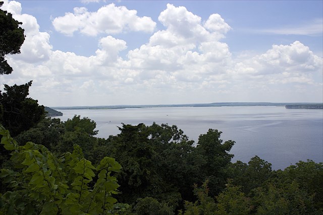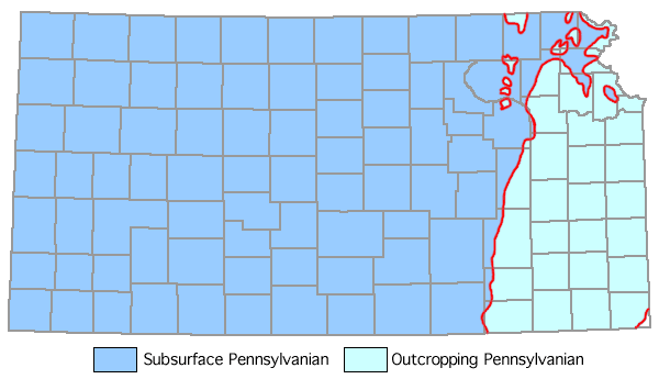
A dam can serve more than one purpose and this location is a good example providing flood control, water supply, recreation, and habitat for fish and wildlife. Recreation and habitat for fish is probably pretty obvious from the picture above. The need for a water supply in this area has a geologic basis as you can see in the picture below.

The aquifers in Montgomery county are much deeper than in neighboring counties to the east (which makes drilling more expensive and difficult). The aquifers are covered by a thick layer of Pennsylvanian era rock which is the surface layer throughout this part of eastern Kansas:

The main purpose at this location is flood control and Elk City Lake is managed by the U.S. Army Corps of Engineers (Tulsa District). According to their pertinent facts: "Construction began in February 1962 and the project was completed for full flood control operation in March 1966." In order to contain a large volume of water the dam must be built in an area where water naturally flows during a flood that is also capable of containing a large volume of water. When most people think of Kansas they probably think "flatter than a pancake" and not someplace where a dam or reservoir could be constructed. And that is exactly what makes this area unique. Over time the streams and rivers in this area have eroded through those Pennsylvanian layers of shale, limestone and sandstone to form large escarpments. When shales weather they forms clay or mud which is generally abundant throughout the state. You are standing near the edge of a 200 foot cliff (in Kansas!). On the other side of the dam you can see the top of the other cliff which forms a (now flooded) valley. The dam is 100 feet tall if that helps you visualize this area before 1966.
GZ is located at the top of Table Mound which is locally called a mound because of how it stands out from the other local geologic features. It has been eroded on both the east and the west by the Elk River which heads north from the reservoir but pulls a U-turn to head south and east to joint the Verdigris River. If you inspect the map at GZ you will be able to identify the uncontrolled spillway. This spillway is located in the middle of another local geologic feature known as a saddle (which is a depression in an anticline). A dike had to be built along the saddle to increase the reservoir's capacity to contain flood waters but the saddle also serves as the natural location for the uncontrolled spillway which protects the dam from overtopping.
There are a few main dam designs. An arch dam consists of a vertical or nearly vertical wall that is curved to direct the force from the water in the reservoir into the canyon walls. This design does not require as much mass and thus the bedrock does not need to be as strong. This dam is best suited to a narrow canyon with steep side walls composed of sound rock. The second type is called an embankment dam and works best in a wide relatively shallow valley. Since it can often be constructed from locally available soils and/or rock it may be more economical, especially if an impermeable clay is locally available to construct the core. The third type is a gravity dam which uses the mass of the dam to prevent rotation around the toe (downstream lower edge). This design requires the strongest bedrock foundation since all of the weight is directed into the earth by gravity. Lastly, an arch-gravity dam requires solid rock in the canyon walls and a relatively solid bedrock foundation.
To log this cache, e-mail me the answers to the following questions (please do not post answers online):
1. Which type of dam was used to create Elk City Lake?
2. What geologic features made that the best dam design for this location?
3 & 4. These requirements are temporarily disabled because the informational part of the informational sign is currently missing.
5. (optional) Include a picture of yourself with the reservoir, dam, stilling basin or just about anything in the area other than the informational sign at GZ.
Be sure to visit a great cache just a short hike down the Table Mound Trail (map) and check out "Hikin' Table Mound"-(GCRY9K). The 2.75 mile (one way) trail drops from the scenic outlook down to Elk City State Park (entry fee required for the state park).
Bibliography:
1. http://quarriesandbeyond.org/states/ks/ks-ind_quad_1906_2.html
2. https://en.wikipedia.org/wiki/Elk_City_Lake
3. http://www.swt-wc.usace.army.mil/ELKC.lakepage.html
4. http://www.swt.usace.army.mil/Locations/TulsaDistrictLakes/Kansas/ElkCityLake/PertinentData.aspx
5. http://www.publications.usace.army.mil/Portals/76/Publications/EngineerManuals/EM_1110-2-2300.pdf
6. http://www.fema.gov/media-library-data/20130726-1813-25045-0568/fema_filter_manual_links.pdf
Placed by an
