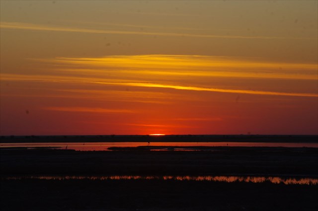
Makgadikgadi Pan
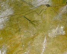
Below and right of the "broomstick" Okavango Delta, the Pans are clearly visible in this satellite photograph.
The Makgadikgadi Pan, a salt pan situated in the middle of the dry savannah of north-eastern Botswana, is one of the largest salt flats in the world. The pan is all that remains of the formerly enormous Lake Makgadikgadi, which once covered an area larger than Switzerland, but dried up several thousand years ago.
Location and description
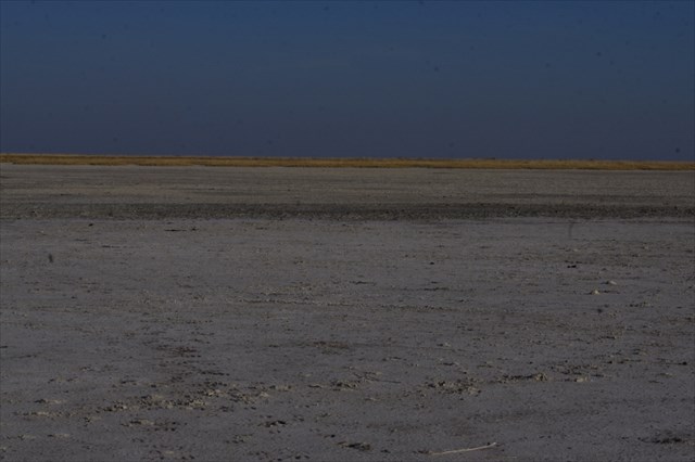
Lying southeast of the Okavango Delta and surrounded by the Kalahari Desert, Makgadikgadi is technically not a single pan but many pans with sandy desert in between, the largest being the Sua (Sowa), Nwetwe and Nxai Pans. The largest individual pan is about (4,921.0 km2,rarely has much water, and is generally claimed to be the world's largest salt pan.
A dry salty clay crust most of the year, the pans are seasonally covered with water and grass, and are then a refuge for birds and animals in this very arid part of the world. The climate is hot and dry but with regular annual rains. For much of the year, most of this desolate area remains waterless and extremely arid; and large mammals are thus absent. But during and following years of good rain, the two largest pans – Sowa to the east and Ntwetwe to the west – flood, attracting wildlife – zebra and wildebeest on the grassy plains – and most spectacularly flamingos at Sowa and Nata Sanctuary. Flamingo numbers can run into the tens – and sometimes – hundreds of thousands and the spectacle can be completely overwhelming.
The main water source is the Nata River, called Amanzanyama in Zimbabwe, where it rises at Sandown about 59.5 km from Bulawayo. In times of sustained rainfall the water in the pans is supplemented by other seasonal river flows –besides the Nata,other seasonal rivers are the Tutume, Semowane and Mosetse Rivers in the east, and in years of exceptional rains, the Okavango via the Boteti River in the west. During this time, the pans can be transformed into a powder blue lake, the waters gently lapping the shorelines, and flowing over the pebble beaches – a clear indication of the gigantic, prehistoric lake the Makgadikgadi once was. This gave rise to many of the locals calling the pans "The Botswana Sea" !
Research suggests that the Makgadikgadi is a relic of what was once one of the biggest inland lakes Africa has ever had. These salt pans cover 16,057.9 km2 in the Kalahari Basin and form the bed of the ancient Lake Makgadikgadi, which evaporated many millennia ago. Archaeological recovery in the Makgadikgadi has revealed the presence of prehistoric man through abundant finds of stone tools; some of these tools have been dated sufficiently early to establish their origin as earlier than the era of Homo sapiens.
Geology
As the ancestral Lake Makgadikgadi shrank, it left distinct shorelines, which are most evident in the southwestern part of the basin. As the lake shrank numerous smaller lakes formed with progressively smaller shorelines.
The geology of the area consists of granite basement, flanked by the Karoo rocks, within the Kalahari Sand. The geologic processes behind the formation of the basin are not well understood. It is conjectured that there was a gentle down-warping of the crust, with accompanying mild tectonics and associated faulting; however, no significant plate boundary faults have been identified. But it is believed that geologic uplift around 800,000 years ago blocked all outflow of waters , forming a gigantic prehistoric lake at Makgadikgadi. Subsequently tectonic uplift in the extreme north of Botswana diverted the Zambezi and greatly restricted inflow to the Makgadikgadi area. Over thousands of years the saline waters evaporated leaving the pans as we experience them today.
This makes the area the largest salt pans in the world covering an area of over 30 000 km2 and one of the former largest inland sea in the world.
The large pans Sua and Nwetwe are composed of saline clays and efflorescence varying between 50 to 100 metres deep. Fluctuation in groundwater levels during interpluvials has led to hardpan (paedogenic) formation of calcretes and silcretes with resulting low permeability. The dry pan surfaces have halite and trona (NaCO3 + NaHCO + 2H20) crusts. The annual rainfall over the area of the Makgadikgadi pans averages 500mm. The highly saline water table is quite near the surface for such a semi-arid region, resulting from the fact that these pans are actually the termini of a large endorheic basin. The major geologic tectonic activity that led to diversion of major inflowing rivers subsequently resulting in drying up of what used to be the greatest inland lake to the largest salt pan in the world.
The Makgadikadi Pans are presently strictly a seasonal wetland with the Okavango alluvial fan to the north receiving the residual flow from historic drainages; however the summer wet season finds the Boteti and Nata rivers delivering copious flows here, producing a miracle of emergence of vegetation and wildlife amid the Kalahari Desert.
Kubu Island and Kukome Island are igneous rock "islands" in the salt flat of Sua pan. Kubu Island lies in the southwestern quadrant of Sua Pan, contains a number of baobab trees, and is protected as a national monument.
Salts - Sodium Chloride & Sodium Carbonate
SODIUM (Na) is the chief anion, with carbonate, bicarbonate, chloride and sulphate the principal cations. Magnesium and calcium have largely precipitated out. The dry pan surfaces have halite and trona (NaCO3 + NaHCO + 2H20) crusts. Phosphorus is abundant, but nitrate is the limiting soluble nutrient. The pH levels typically range from 8.5 to 10.1, while total dissolved solids range from 30 grams per litre in the south to less than one gram per litre in the north.
It most commonly occurs as a crystalline heptahydrate, which readily effloresces to form a white powder, the monohydrate. Pure sodium carbonate is a white, odourless powder that is hygroscopic (absorbs moisture from the air), has an alkaline taste, and forms a strongly alkaline water solution. Sodium carbonate (Na2CO3) can be extracted from the ashes of many plants growing in sodium-rich soils. Because the ashes of these sodium-rich plants were noticeably different from ashes of timber (used to create potash), they became known as "soda ash". It is synthetically produced in large quantities from salt (sodium chloride) and limestone by a method known as the Solvay process.
Together with Soda Ash (Sodium carbonate) there are large deposits of Salt (Sodium Chloride – NaCl), and this too is now being mined under strict superviswion in area of the Makgadikgadi pans.
SODA ASH -The manufacture of glass is one of the most important uses of sodium carbonate. Sodium carbonate acts as a flux for silica, lowering the melting point of the mixture to something achievable without special materials.
It is also a common additive in swimming pools used to neutralize the corrosive effects of chlorine and raise the pH.
The most common usage is as a water softener in laundering: it competes with the magnesium and calcium ions in hard water and prevents them from bonding with the detergent being used. Sodium carbonate can also be used to remove grease, oil and wine stains.
SODIUM CHLORIDE – commonly known as Table Salt, used as a flavourant and preserving medium.
Flora
The pans themselves are salty desert whose only plant life is a thin layer of blue-green algae. However the fringes of the pan are salt marshes and further out these are circled by grassland and then shrubby savannah. There are many prominent baobab trees found in the area that function as local landmarks. One of them, named after James Chapman, served as an unofficial post office for 19th-century explorers.
Fauna
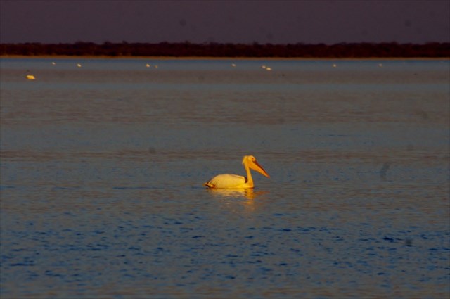
Very little wildlife can exist here during the harsh dry season of strong hot winds and only salt water, but following rains the pan becomes an important habitat for migrating animals including wildebeest and one of Africa's biggest zebra populations, and the large predators that prey on them. The wet season also brings migratory birds such as ducks, geese and great white pelicans. The pan is home of one of only two breeding populations of greater flamingos in southern Africa, and only on the Soa pan, which is part of the Makgadikgadi pans. The other breeding population is at Etosha, in the Northern part of Namibia. The only birds here in the dry season are ostriches, chestnut-banded plover (Charadrius pallidus) and Kittlitz's plover (Charadrius pecuarius). The grasslands on the fringes of the pan are home to reptiles such as tortoises, rock monitor (Varanus albigularis), snakes and lizards including the endemic Makgadikgadi spiny agama (Agama hispida makgadikgadiensis).
Threats and Preservation
The salt pans are very inhospitable and human intervention has been minimal so they remain fairly undisturbed, although land surrounding the pans is used for grazing and some areas have been fenced off, preventing the migration of wildlife. Modern commercial operations to extract salt and soda ash began on Sua Pan in 1991, and there are also plans to divert water from the Nata River for irrigation, which would cause severe damage to the salt pan ecosystem. Another threat is the use of quad bikes and off-road vehicles by tourists, which disturbs breeding colonies of flamingos. Illegal hunting in the national parks is a persistent problem. There are some protected areas within the Makgadikgadi and Nxai Pan National Park. The Makgadikgadi Pans Game Reserve is the scene of large migrations of zebra and wildebeest from the Boteti River across to Nwetwe Pan, while the Nata Sanctuary in Sua Pan is a place to see birdlife and antelopes. In Nxai Pan you can still see the baobabs painted by 19th century British artist Thomas Baines.
PLEASE NOTE THIS CACHE HAS A TERRIAN RATING OF 4, DUE TO THE NEED FOR 4X4 OR ALL WHEEL DRIVE WITH GOOD GROUND CLEARANCE TO REACH GZ. Especially in rainy seasons!
Please see log from team carkla who were the FTF. As water levels in the pan might vary, and you might not be able to get to GZ, a pic of yourself as close as you can safely get to GZ will suffice. It will be interesting if you cannot get to GZ to log how far away you were when you logged the find. All the questions are answerable from any point along the track that runs along the river course in NATA and will be acceptable if correct. That is if you physically cannot get to GZ. Just a note when we published the cache, - GZ was over 120 meters from the edge of the water in the pan. Locals told us the water had never in their lifetime been higher - WELL NOW THEY CAN CLAIM A NEW WATER LEVEL !
TO LOG THIS CACHE :=
Log your find and then email your answers to the following questions to ourselves. Logs without attempt of answers will be deleted.
1. The Nata river runs through the Nata Bird Sanctuary. The track to the pans runs alongside the river for some way before the banks of the river flatten to enter into the pan.What do you estimate the maximum river depth to be before it overflows its banks? The river is quite consistent in depth throughout the entire sanctuary.
2. In the vicinity of GZ, describe the general grain size and colour of the earth. ( For example : stony, shale, fine dust, mixture of grain size, very rocky, flat bedrock etc etc. Colour – white, pink, brown or whatever) ?
3. Describe the vegetation in the vicinity of GZ (if any)? Does the vegetation have any special or unique characteristics? Would this vegetation thrive if transplanted elsewhere, and state reasons for your answer?
4.. When the pans are filled with water, the locals have a specific name for these pans. What is this name?
5. Optional – log a photograph of yourself and/or your GPS in the vicinity of GZ
Creation of this cache
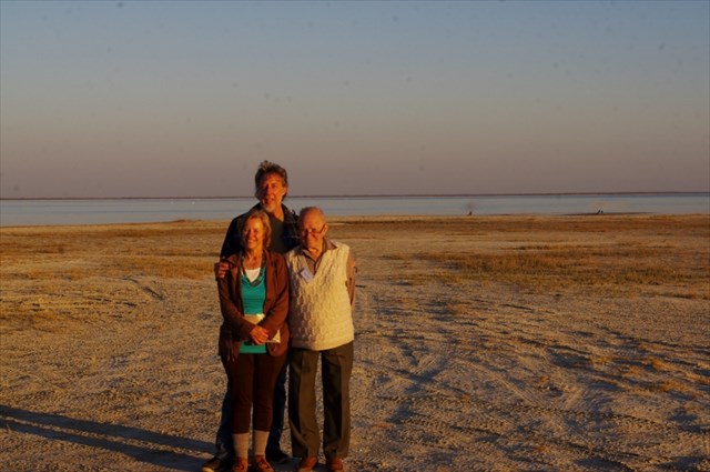
At the time of publication of this cache the main pans had a substantial amount of water in them. Apparently the pans were filled with water when heavy rains and floods occurred in the rainy season of 2013. This gave rise to the pans being nicknamed the "Botswana Sea". The locals state that it will take another 2 years before the water evaporates totally– that is if there is no further heavy rainfall or flooding during this period.
