History
Beginning between 21,000 and 22,000 years ago, late Wisconsin glaciers appear to have been active in or near Marion County almost continuously for the next several thousand years, producing three major depositional sequences of somewhat different character. (T1, T2, and T3)
T1
The initial ice sheet produced a robust till sheet (T1) which can be traced in the subsurface throughout the county, along with large outwash fans in and adjacent to the White River valley. This till sheet, and its associated outwash, overlie the pre-Wisconsin surface at most places in the county.
In general, all the till deposited by late Wisconsin ice sheets has a loam texture of sand and silt, and one part clay. Local textural variations are fairly common, however. This is particularly true near the base of the T1 sequence where the till is commonly more silty or sandy at places where the glacier overrode and incorporated silt and clay from older interglacial silt units, or sand and gravel from its own outwash.The T1 till sheet and its associated outwash are generally buried by younger deposits at most places, but they are well exposed in numerous bluffs along major streams.
T2
The ice sheet appears to have withdrawn briefly to the north, before readvancing and again covering the entire county. This T2 event also produced a relatively widespread till sheet that is somewhat less robust and more irregular than the previous one, and typically has a larger number of sand and gravel bodies associated with it.
The T2 event also produced two end moraines and associated outwash fans with markedly greater local relief and a rolling to hummocky character. These ridges flank the White River in the southern part of the county and appear to be related to the opening of a major reentrant in the ice sheet where the glacial White River disgorged.
Glenns Valley

The rolling, hummocky topography of the Greenwood moraine on display at Glenns Valley Park. This end moraine was constructed where the margin of the T2 ice became stationary for an extended period of time and the sediment delivered by the glacier accumulated in a ridge.
Prominent among these are the tall ridges in the Glenns Valley area, which stand as much as 150 ft above the floor of the adjacent White River valley. They are part of a feature known as the Greenwood Moraine, most of which lies just south of the county line in northern Johnson County, but is nevertheless one of the most conspicuous topographic features in and adjacent to the county.
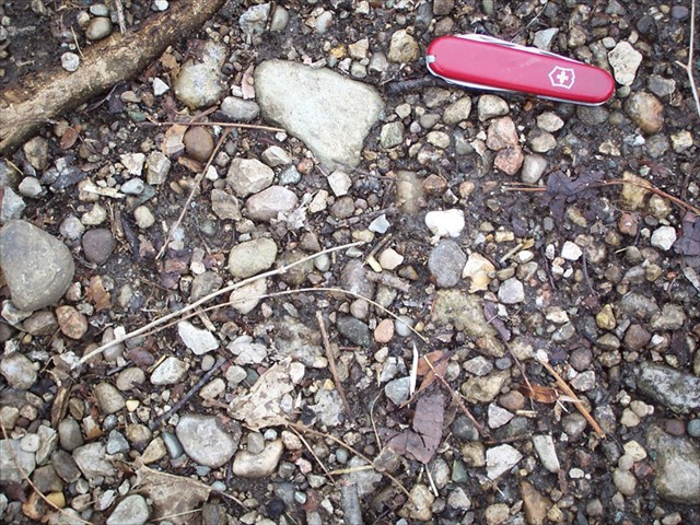
In the Glenns Valley area, the moraine has a gravelly surface, producing a well drained landscape that is somewhat dry compared to T2 till plains and supports oak-hickory forests. The summit of the ridge, just west of Bluff Road, is underlain by some 250 ft of sand and gravel, which extends to bedrock. The abundance of gray Paleozoic carbonate pebbles in the photo is evident. Photos by A. H. Fleming.
The ridges at Glenns Valley are composed chiefly of sand and gravel, and their up-ice (northeast) sides are capped by a thin veneer of T2 till.

They represent the heads of one or more large, coalescing ice-contact fans formed along this part of the moraine, and were evidently deposited where one or more major meltwater conduits exited the glacier. The body of the fan(s) formerly occupied what is now the modern valley of the White River, but was subsequently eroded away by massive meltwater discharges during later events. The meltwater erosion left only a few small, streamlined mounds of sand and gravel projecting above the central floor of the valley, along with the isolated ridges near Glenns Valley to mark the heads of the fan(s). Interestingly, the river channel in this immediate area follows an unusually circuitous route that appears to have a vaguely radial symmetry about the ridges at Glenns Valley. This pattern strongly suggests that the river channel migrated to the west side of the sluiceway along the toe of the growing fan during T2 time, and has largely remained there ever since.
Please send the answers to my profile to these questions:
1. What type of moraine is the Glenns Valley Moraine? (hint: it's in the text)
2. What is the elevation change from the parking lot to the reference point?
3. What was the general direction of travel of the melting glacier?
4. What is the general make up of this moraine (is it rocky, sandy, mixture?) as seen at the reference point?
5. Post a picture of yourself (face not required) or a personal item at the moraine.