Welcome to
Jessie Gap - EarthCache
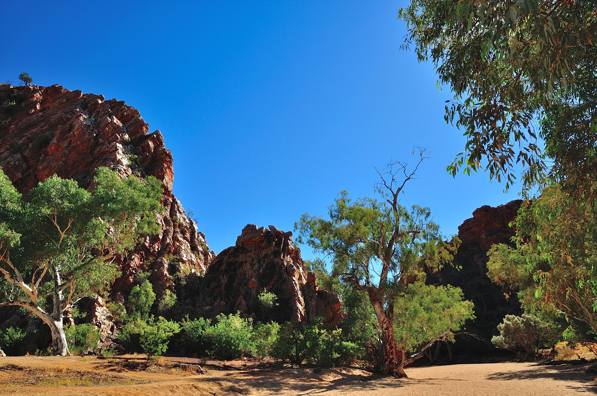
The Jessie Gap, or Atherrke in the Arrernte language, is a small water gap in the MacDonnell Ranges of Central Australia and was an important sacred site for the Eastern Arrernte Aboriginal people. It contains interesting Aboriginal paintings and is part of the story line of the Three Caterpillars; Yeperenye, Ntyarlke and Utnerrengatye which are ancestral beings for the Alice Springs area.

The main range which takes in most of the Park is described as being up to 200 metres high, steeply dipping, very thickly embedded hard rocks (quartzite, sandstone and conglomerate), moderately hard rocks (dolomite, limestone and shale) and soft rocks (shale and siltstone)
The area of Jessie Gap (as well as Emily Gap )is dominated by the Heavitree Range which comprises of steeply southward dipping Heavitree Quartzite.
Jessie Creek has widened two north-south vertical joint planes through this Heavitree Quartzite to form Jessie Gap. Minor quartz veining and shiny striated fault surfaces suggest that faulting may have affected the quartzite during the Alice Springs Orogeny when the attitude of the quartzite was changed from horizontal to a very steep dip southwards. Heat developed when blocks under pressure slid against one other to form a shiny veneer of melted silica on striated slip surfaces. Quartz-filled tear and tension joints can be seen on the water-polished sandstone near river level in the Gap. Ripple marked bedding planes can be seen on the Heavitree Quartzite to the west of the entrance of Jessie Gap.
 Questions to log this EarthCache
Q1 Standing between the gap, how would you best describe the overall shape of the western edge/side of the gap?
Q2 What is the texture of the rocks at the sandbed level?
Q3 What is your estimate in metres the narrowest part of "The Gap" is?
Hope you enjoyed this EarthCache & please feel free to upload a photo too 
Please send your answers to __ __ through Message Center or through email.
Please feel free to log this cache once you've completed the EarthCache requirements while waiting for a response to your answers.
You will need to send me your answers to verify your find for this EarthCache and will most likely hear from me within 24 hours or if in the unlikely event, a correction or more detail is needed

