The Giza Plateau in Egypt

Giza is located only a few kilometers south of Cairo, several hundred meters from the last houses in the southernmost part of the city proper, where a limestone cliff rises abruptly from the other side of a sandy desert plateau. The ancient Egyptians called this place imentet, "The West" or kher neter, "the necropolis".
Of Giza According to a treatise on the geology of the pyramid plateau, it is part of the Middle Eocene Mokattam Formation, which dips slightly southeast, comprising limestone and dolomites. To the south, the Mokattam and dolomitic limestones are overlain by the marly limestone and sandy marls of the Upper Eocene Maadi Formation. To the north and east, the Mokattam Formation is characterized by two steep escarpments about 30 meters (92 feet) high. It continues to the Great Sphinx ditch, which must at one time have formed a high peak. From there, the stonemasons cut the core blocks for the Great Pyramid.
Eocene and Mokattam Formation
The Eocene Epoch, lasting from 56 to 33.9 million years ago, is a major division of the geologic timescale and the second epoch of the Paleogene Period in the Cenozoic Era. The Eocene spans the time from the end of the Palaeocene Epoch to the beginning of the Oligocene Epoch. The start of the Eocene is marked by a brief period in which the concentration of the carbon isotope Carbone-13 in the atmosphere was exceptionally low in comparison with the more common isotope Carbone-12. The end is set at a major extinction event called the Grande Coupure (the "Great Break" in continuity) or the Eocene–Oligocene extinction event, which may be related to the impact of one or more large bolides in Siberia and in what is now Chesapeake Bay. As with other geologic periods, the strata that define the start and end of the epoch are well identified, though their exact dates are slightly uncertain.
The name Eocene comes from the Greek ἠώς (eos, dawn) and καινός (kainos, new) and refers to the "dawn" of modern ('new') fauna that appeared during the epoch.
Climate
The Eocene Epoch contained a wide variety of different climate conditions that includes the warmest climate in the Cenozoic Era and ends in an icehouse climate. The evolution of the Eocene climate began with warming after the end of the Palaeocene-Eocene Thermal Maximum (PETM) at 56 million years ago to a maximum during the Eocene Optimum at around 49 million years ago. During this period of time, little to no ice was present on Earth with a smaller difference in temperature from the equator to the poles. Following the maximum was a descent into an icehouse climate from the Eocene Optimum to the Eocene-Oligocene transition at 34 million years ago. During this decrease ice began to reappear at the poles, and the Eocene-Oligocene transition is the period of time where the Antarctic ice sheet began to rapidly expand.
Mokattam Formation
The Arabic name "Mokattam", which means "cut off" or "broken off", refers to how the low range of hills is divided into three sections. The highest segment is a low mountain landform called Moqattam Mountain. In the past the low mountain range was an important ancient Egyptian quarry site for limestone, used in the construction of temples and pyramids.
Mokattam cliffs constitute a chain of hills forming a continuous scarp that extend from Cairo southwards for about 200 kilometers separating the Nile valley from the eastern desert. This formations which belong to Middle and Upper Eocene is a succession of sedimentary carbonates and less abundant argillaceous rocks. They were classified into two distinct rock units which differ in lithology and color. Workers (1883) originally referred to these beds as “Mokattam Stuff“ and subdivided them into a lower (Unter) an Upper (Ober) Mokattam. At that time both units were considered to be of Middle Eocene age. However, subsequent work demonstrated that the Lower Mokattam (now designated as Mokattam formation) is of Middle and Upper Eocene age, whereas the Upper (now designated as Maadi formation) is of Upper Eocene age.
Upper unit (Maadi formation) is made up of a series of easily identified well-developed brownish beds of fissured limestone, marl and shale. The underlying unit (Mokattam formation) is made up of white to gray massive limestone. The latter formation is more resistant than Maadi formation and as a result a step or erosion surface separates the two.
According to Maadi formation include the following (from top to bottom):
1. Medium to strong yellowish white dolomitic limestone becoming sandy towards the base, some fissures & caverns, traces of gypsum pockets) - (6 m average thickness).
2. Alternating yellowish sandy and grayish shale beds with minor intercalation of marls & salts, some fissures & caverns - (40 m average thickness).
3. Fissured and cavernous weak to medium yellowish brown limestone, some marl and gypsum pockets - (20 m average thickness).
4. Alternating yellowish sandy and grayish shale beds with minor intercalation of marls & salts, some fissures & caverns - (10 m average thickness).
The underlying Mokattam formation consists of four members: the Giushi member; the upper building stone member; the Gizehensis member and the Lower building stone member. The top member of Mokattam formation ( Giushi ) is a thinly bedded white limestone 60 m thick. Upon the plateau of this member lies the largest part of the new – development of Mokattam city. At the site of Cairo both units ( Maadi and Mokattam formations ) have a cumulative thickness of about 166 meters.

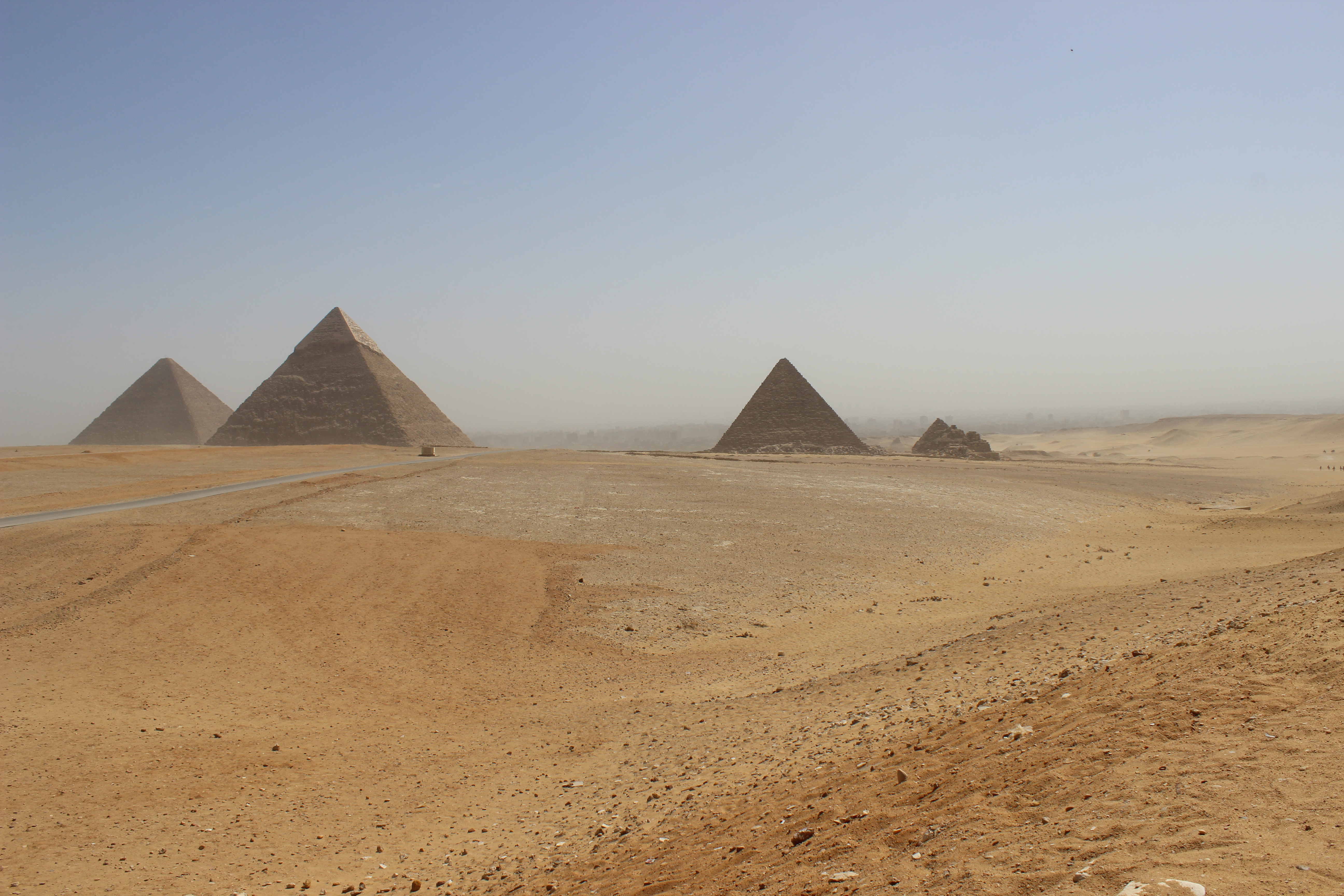
Side View of Giza (source: touregypt.net)
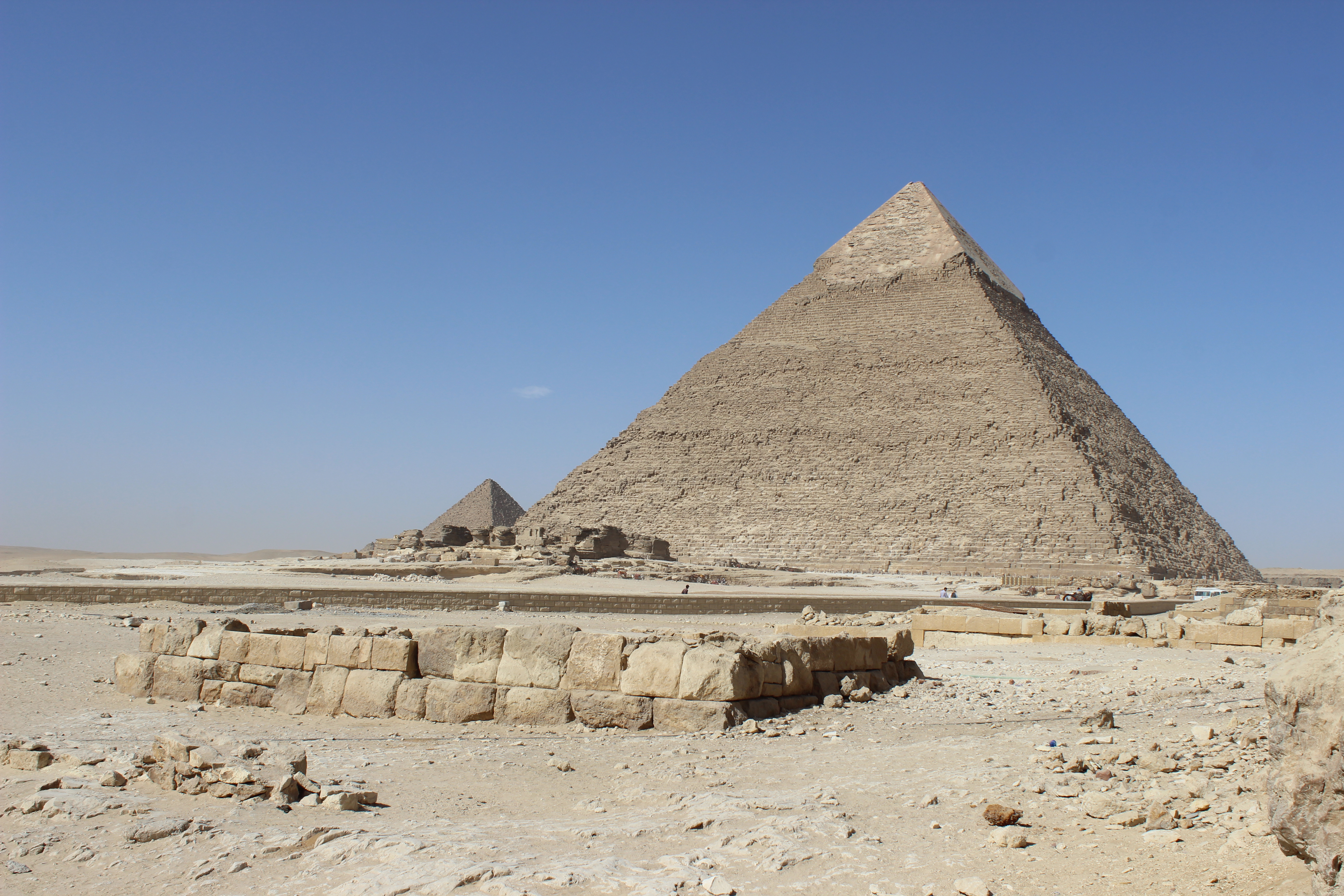
Another view of Giza
The limestone blocks and the fossils of Giza
More than 7 million limestone blocks with an average weight of 2.5 tons are installed in the three great pyramids. Over the blocks there are the brilliant white limestone slabs the pyramids were originally covered with.
This white trim was used in medieval times as a quarry and used to build houses in Cairo. Only at the top of the Khafre Pyramid, there are remnants of this panel. Inside the grave chambers of the Egyptian pharaohs were clad in red granite and weighted with up to 60-tonne granite blocks.
The limestone blocks that form the core, and thus the mass of the building blocks, mostly come from the immediate vicinity of the pyramids. It involves fossil rich calcareous sediments, which is currently the Eocene (Lutetian) have been deposited in the sea of Tethys before about 45 million years ago. In these sediment layers later the nearby Nile has dug deep and laid the limestone banks of these free marine sediments. This is where the builder of the Pharaohs have created their quarries for the pyramids.
Fossil Protozoa: The true "architect" of the pyramids.
Upon closer examination of the calcareous rocks pyramid shows that it masse lentil and coin-shaped fossils occur. It involves the fossilized shells of single-celled housing, known as foraminifera that can reach a size of up to 10 cm. These foraminifera were the most common inhabitants of the Eocene shallow seas from which build up large sections of sedimentary rocks of Mokattam formation at Giza. Because of their shape and their coins mass occurrence they were called since ancient nummulites (= coins stones). It is estimated today that the mass housing fossilized foraminifera these account for 60 percent or more of the individual pyramid rocks of Giza. The unicellular foraminifera are thus the "true architects" of the pyramids.
(Source: touregypt.net, Al-Azhar University Cairo)

Log conditions:
At the listing coordinates you have an overview to the Giza plateau and to the Great Pyramids. Answer the following question:
1. Describe the area in terms of the Mokattam formation. Which area is visible and at what level you are (top, middle or bottom)?
2. The Mokattam formation dates from the Eocene. From which sub-series of the Eocene is it (Upper Eocene, Middle Eocene or Lower Eocene) and from which chronostratigraphic stage it is (call the sub-series, the stage and the time interval)?
3. What is the soil structure here and why is this characteristic for the Mokattam formation?
4. Take a picture of the Giza plateau, your GPS and the Pyramids in the background and insert it within your log.
Go to the waypoint N29° 58.680 E31° 8.035. The museum. Answer the following question (optional, if you don't want to pay for the museum):
5. What great exhibit can be seen here? (optional, if you don't want to pay for the museum).
6. From what century is it? (optional, if you don't want to pay for the museum)
Go to the waypoint N29° 58.753 E31° 8.128. Fossils. Answer the following question:
7. Look for the large sandstone blocks of the pyramid and on the ground. Find a fossil fossilization. What is the shape of these fossils? Measure the length of three different fossils and then calculate the average value.
8. Take a picture of one of the fossils and your GPS and insert it within your log.
Send the answers of the questions to Fam.Weiss with your GC-name in the subject-line. We contact you if something is wrong.
Attention – Please note!
Please don´'t write the answers into your internet-log at GC!
Log entries without answering the questions will be deleted by us directly without any further enquiry!
Attention: To fulfill the log condition you have to send a reply mail with the answers for the questions per Geocaching account! A "multiple answer mail" for several Geocaching accounts therefore only fulfills the log condition for the respective sender! The logs of the other accounts are deleted without comment!