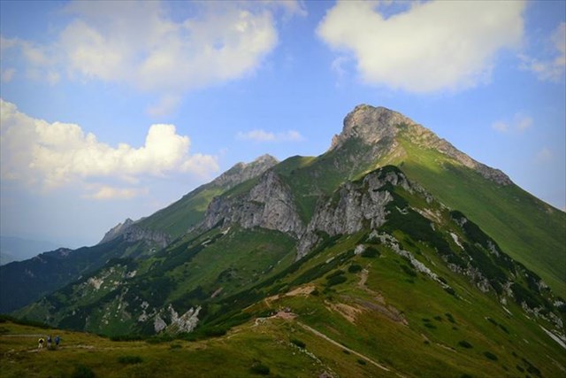
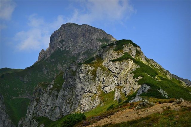
Široké sedlo (1 825,5 m n. m.)

V minulosti bola Širokému sedlu venovaná tradička, ale zlomyselnosť niektorých ľudí sa postarala, že došlo k jej archivácii. Tak sme sa s Natálkou rozhodli, že tomuto prekrásnemu miestu venujeme Earthcache, nech tu nezostane prázdne políčko v geopuzzle Tatry. Veď aké by boli Tatry, keby im chýbala ich najvýchodnejšia časť - hrebeň unikátnych Belianskych Tatier?
V minulosti bolo v Belianskych Tatrách otvorených viacero turistických chodníkov, ale z dôvodu ochrany prírody boli všetky chodníky vedúce cez hlavný hrebeň uzavreté v roku 1978. Po čase potom došlo k sprístupneniu náučného chodníka z Monkovej doliny do Kopského sedla (1993). Pri vstupe do Monkovej doliny môžu pracovníci Tatranského Národného Parku (TANAP) vyberať vstupné, ale nie je to pravidlom. V celých Belianskych Tatrách platí najvyšší, piaty stupeň ochrany, preto je prísne zakázané opustiť značený chodník, trhať rastliny, rušiť zver, odhadzovať odpadky a akokoľvek inak poškodzovať okolitú prírodu. V tejto oblasti tiež platí zimná uzávera turistických chodníkov od 1.11. do 15.6., ktorá platí aj pre tento náučný chodník.
Pozor! Od 15.júna 2022 boli zmenené podmienky logovania tejto EarthCache vzhľadom na poškodené tabule náučného chodníka a ponechal som len tie, ktoré je možné vygoogliť a od tohto dátumu je povinná fotografia zo Širokého sedla.
Pre úspešné zalogovanie je potrebné zaslať odpovede na nasledujúce otázky:
1. Aká bola hrúbka ľadovca z posledného zaľadnenia v Monkovej doline?
2. Z akého obdobia pochádzajú zvrásnené vrstvy vápenca na vrchu Opálenica, ktorý sa vypína na ľavej strane doliny?
3. Vysvetlite vlastnými slovami, aký je rozdiel medzi horninami Vysokých a Belianskych Tatier?
Poslednou podmienkou logovania je zaslanie aspoň jednej fotky zo Širokého sedla. Samozrejme, rešpektujeme súkromie a na fotke nemusí byť vidieť vašu tvár, ale v tom prípade požadujem fotku s vaším osobným predmetom, SWG, alebo môžete použiť papier, na ktorom je napísaný váš geocachingový nick.
Po návšteve miesta sa môžete zalogovať, nezabudnite nahrať požadovanú fotku a do 24 hodín budem očakávať email s odpoveďami na otázky. Ak sa tak nestane, log bez upozornenia zmažem. V prípade zaslania nesprávnych odpovedí vás budem spätne kontaktovať.


There was a cache in the past dedicated to Siroke sedlo/Wide col but the viciousness of some people led to its archivation. So we (me and Natalka) decided to dedicate this Earthcache to the same place and therefore a field in Tatras geopuzzle will not be left empty. Can you even imagine Tatras without its easternmost part - the ridge of unique Belianske Tatras?
In the past, there was open a number of hiking paths in Belianske Tatras but due to environmental reasons all of them leading through the main ridge were closed in 1978. Just one nature educational trail from Monkova dolina/Monkova valley to Kopske sedlo/Kopske col was later (1993) open for public. The workers of Tatras National Park (TANAP) can collect entrance fee when you enter Monkova dolina but they do not do so on regular basis. There is the highest degree of preservation in all Belianske Tatry and it is strictly forbidden to leave marked hiking path, pluck the plants, disturb the animals, leave litter behind and damage the nature any other way. There is also winter closure of Tatras hiking paths from 1-st of November to 15-th of June which also includes this nature trail.
Attention! From 15th of June 2022 have been changed conditions for logging this EarthCache due to damaged information boards of this nature trail and I left just those you are able to google and from this date the picture from Široké sedlo is also mandatory.
For valid log you need to send the answers to the following questions:
1. What was the thickness of the glacier in Monkova dolina during the last ice age?
2. During what period were formed the wrinkled layers of limestone on Opalenica peak, which is on the left side of the valley?
3. Explain in your own words the main difference between the rock of High Tatras and Belianske Tatras.
The last condition for logging is uploading at least one picture from Siroke sedlo. We respect your privacy and your face does not have to be on the picture but in such a case I require the picture with your personal item, or XWG, or you can use just simple piece of paper with your geocaching nickname on it.
After visiting this place you can log this Earthcache, do not forget to upload required picture and I will expect the email with the answers within 24 hours after your log. If it does not happen, I will delete your log without notice. In the case of incorrect answers I will contact you back.
