SI PREGA DI NON PUBBLICARE FOTO DI GZ, DEL CONTENITORE, DEL LOGBOOK, DI "VISTA DALLA CACHE". UNA FOTO PANORAMICA E' MOLTO MEGLIO! LASCIATE CHE QUELLI CHE VERRANNO POSSANO DIVERTIRSI NELLA RICERCA COME VOI!
PLEASE DO NOT LOG PICTURES OF GZ, THE BOX, THE LOGBOOK, "VIEW FROM THE CACHE". A PANORAMIC PHOTO IS WAY OUT BETTER! LET THE GEOCACHERS WHO'LL COME AFTER YOU TO ENJOY THE CACHE IN THE SAME WAY!
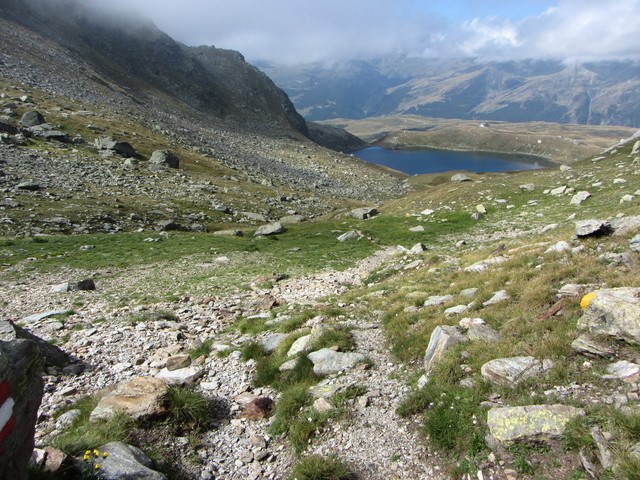 Lake Emet seen from Pass da Niemet
A beautiful walk leading from road "SS36" in the Italian territory to the valley of Niemet, in the Swiss territory.
Along the way you meet the lake Emet, the Bertacchi hut and another traditional cache. To get to Pass da Niemet (2294m.) it takes 1h30' to 2h.
From there you can keep going down the valley Niemet and in less than 3 hours to arrive to Innerferrera. Hence the bus Autopostale takes you to Andeer, where you can take another bus to reach Splügen; from there you can take an Italian bus that takes you to the parking place where you left the car (at the Montespluga dam) making this way a ring trip in the middle of the Alps.
As you reach a quite high elevation don't forget to use the proper clothes!
The cache is located near a big rock, just after the ruins of a Word War I construction. Please take a look to the spoiler pictures because the coordinates could be a little bit "out".
